
12 September 2008
The location of the Cairo landslide
Posted by Dave Petley
Thanks to posters over at the EgyptSearch forum, and in particular poster AntonD who finally identified the place, I can finally identify what I think is the location of the Cairo landslide. The point is at: 30 degrees 2.728 minutes N, 31 degrees 17.261 minutes E. This is the Google Earth image of this point:
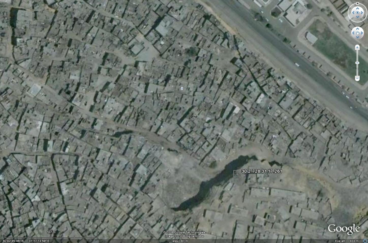
The cliff from which the failure occurred is clear, as are the houses below. According to various people there has been considerable development in this area since the image was collected.
Helpfully, the following image is online of the cliff before the failure. The image is on a Panoramio site belonging to Hazem Mamdouh: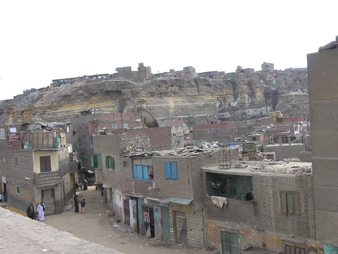 It appears to me that this image was taken from on top of the railway embankment. Compare that with this image, taken from Ghafari’s Picassa site, of the aftermath:
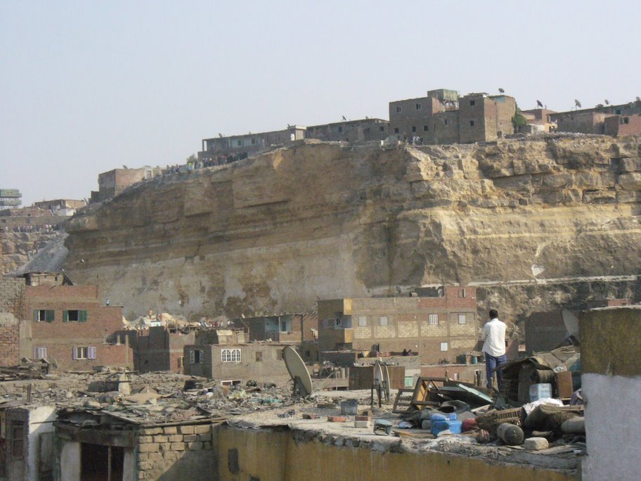
 I will try to post an analysis of the two images by Sunday.
In the meantime, there is a good analysis of the background to the landslide here. The official death toll is now 62, whilst the recovery operation looks increasingly difficult due to the size of the boulders.
The death toll in the Shaanxi tailings dam disaster is now listed as 151 people, with more victims to be recovered.
 Dave Petley is the Vice-Chancellor of the University of Hull in the United Kingdom. His blog provides commentary and analysis of landslide events occurring worldwide, including the landslides themselves, latest research, and conferences and meetings.
Thanks for posting this great blog entry Dave. I think your site is great, and as an urban planner who works in Muqattam in Cairo have benefited from your latest post greatly. One correction — I believe the coordinates are 30° 2’43.27″N and 31°17’13.73″E; I think you have a type showing the Longitude as 21 degrees? I hope I am referencing the right spot; since I am in Germany I will email my friends in Muqattam and try to get verification. Keep up the great work, and if you get a chance to read my post on what I think is Cairo’s “hidden agenda” to use this tragedy to bolster plans to move the poor out of Manshiyat Nasser so they can gentrify it, let me know what you think! Sincerely,T.H. CulhaneSolar CITIES
Dear T.H.,Thanks – you are quite right. We have now corrected the error. Thanks very much for pointing this out.Best wishes,Dave and Adam