
16 December 2007
La Honda landslide
Posted by Dave Petley
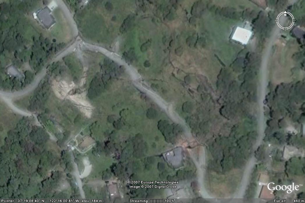
A dat off from the American Geophysical Union meeting saw my colleague Nick Rosser and I take a trip over to La Honda in the Santa Cruz mountains to take a look at the La Honda landslide. The Google Earth image (shwon on the right), though not perfect, shows the damage quite well. Not in particular the offsets on the road and upslope (on the right) the tension cracks that run across the slope. This landslide has already resulted in the destruction of about nine homes.
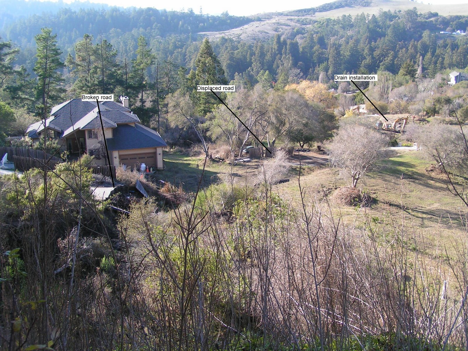
Our visit on Thursday occurred as works are underway, seemingly to construct some drains to reduce the pore pressures. This work seems essential as the degree of damage on the ground is now high. The image below shows the level of damage, looking down onto the road from the top of the backscarp. Note the broken road on the left – I have tried to label the key features. The displaced section is in the stand of trees in the centre of the image – maybe 15-20 m downslope.
 Click on the image for an enlarged view
Installing drains seems prudent, and one can only hope that it proves to be successful. Stabilising such an active slide is undoubtedly a real challenge.
 Dave Petley is the Vice-Chancellor of the University of Hull in the United Kingdom. His blog provides commentary and analysis of landslide events occurring worldwide, including the landslides themselves, latest research, and conferences and meetings.
Congratulations! Always interesting and current. Also enjoy your occasional diversions into landslides in history and art.