
19 December 2018
Researcher finds a cheap way to identify invasive coconuts from space
Posted by Lauren Lipuma
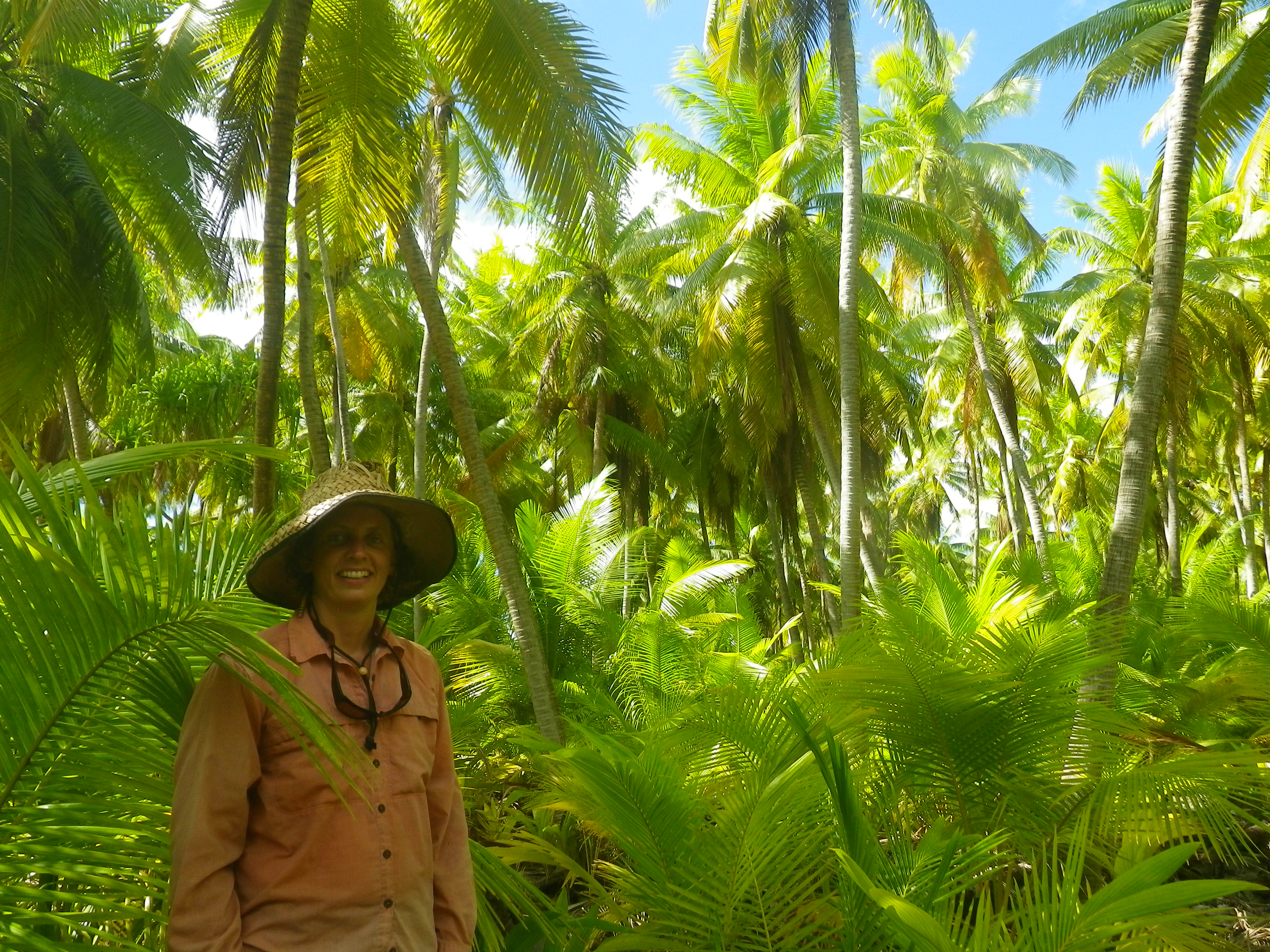
In the island of Orona in Kiribati, Engels stands in front of an area that used to be a coconut plantation. In the right conditions, coconuts can take over and become monocultures. “Everything in this part of the forest is coconut (except me… lol),” Engels said. “It was pretty scary to collect data there because if the wind blows hard giant coconuts come raining down without warning. I really wanted a hard hat!”
Credit: Mary Engels.
By Devi Lockwood
Conservation scientists can use free satellite imagery to track invasive plant species on remote Pacific islands, according to new research.
Mary Engels, a PhD student at the University of Idaho, has found a way to use freely available imagery from NASA’s Landsat satellites to identify coconut trees in Pacific Islands, rather than using costly images from private satellite companies. Engels presented her findings last week at the 2018 American Geophysical Union Fall Meeting in Washington, D.C.
Images from private satellite sensors like QuickBird have a much higher resolution than Landsat images but are expensive, so conservation scientists don’t often use them. But Engels has found a way to use lower-resolution Landsat imagery to properly identify invasive coconut palms from space. Engels hopes her research can be used to direct conservation efforts in the Central Pacific Ocean in a low-cost way.
“One of the hopes here is that we can use this analysis to quickly map where coconut is on those islands to try to understand the impact over time,” Engels said.
Coconut palms, while considered icons of tropical islands, are invasive to coral atolls and can harm island ecosystems by pushing out native tree species that attract seabirds and retain island soil.
Imagery from sensors like QuickBird has a high resolution of 0.65 meters (2 feet) per pixel. Conventionally, such high-resolution imagery has been necessary to determine where specific plant species grow in remote areas. The problem: QuickBird is costly and difficult to access. Freely available Landsat imagery from NASA, however, has only a moderate resolution of 30 meters (98 feet) per pixel.
Engels wanted to see if she could use Landsat imagery to identify coconut palms on Palmyra, a coral atoll that is part of the Pacific Remote Islands Marine National Monument. Palmyra is uninhabited, except for a research station co-managed by the Nature Conservancy and U.S. Fish and Wildlife.
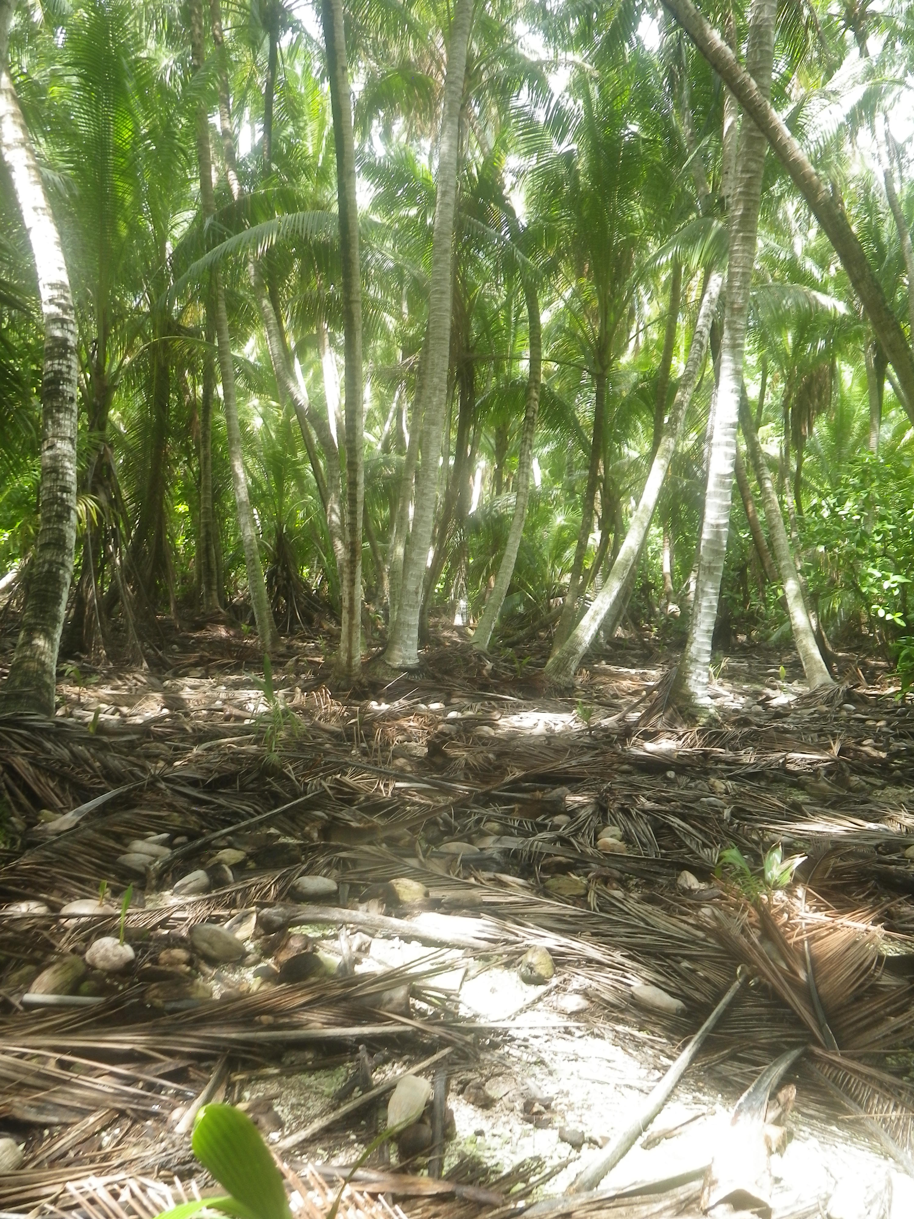
In the Nikumaroro atoll in Kiribati, native dominated forests and coconut dominated forests develop different soils.
Credit: Mary Engels.
At its widest, the island is about 11 kilometers (7 miles) long. When you zoom in on Palmyra in Landsat, you see blocks of colors: a painter’s palette of blues, browns, and greens.
In order to decipher these squares of color, Engels applied a two-step progress. First she started with high-resolution images from QuickBird. In these images, she classified various pixels as “pure” stands of vegetation. She sorted the pixels into categories: coconut trees, native species, or open land like paths and stretches of sand.
Once she figured out which pixels were entirely one type of plant, Engels superimposed that data over the moderate resolution imagery from Landsat. Then she used Multiple Endmember Spectral Mixing Analysis (MESMA) to unmix the pixels. MESMA determines the likely composition of each pixel; it is a technique for estimating what percentage or each pixel is covered by one of many known things.
“I build a reference library from those pure pixels so that my reference library can say, oh, I need a reference for what sand looks like? Here. This pixel, this is a sand pixel. This? This is a coconut pixel. This one, this is a native pixel,” Engels said.
She found that the pixel reference library could identify stands of coconut palms and native trees on the island. This means that the library can be used in the future without having to buy new QuickBird images.
The ultimate goal is to use moderate resolution imagery to figure out where certain species of plants are located––to decipher the painter’s palette of colored blocks into its component parts. From a pixelated image, Engels can tell where there are high concentrations of native and invasive plants.
In the future, Engels plans to apply her research to Kiribati, an island nation along the equator. This situation is more complex: people live there and harvest copra: fruit of the coconut palm, used to extract oil.
Devi Lockwood is a science writing graduate student at MIT. Follow her on twitter at @devi_lockwood.