
1 June 2016
Slowing of landslides reflects California’s drying climate
Posted by Lauren Lipuma
By Jim Barlow
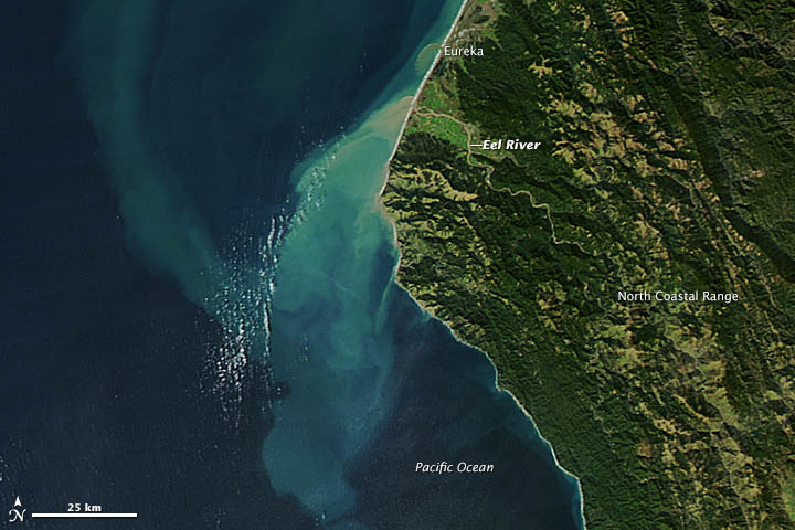
A satellite view of the Eel River in northern California. New research shows landslides in the Eel River Basin have been flowing slower than normal due to the recent California drought.
Credit: NASA.
Data from on-the-ground measurements, aerial photography, satellite imagery and satellite-radar imaging have unveiled an unexpected geological consequence of northern California’s ongoing drought.
Initially, scientists were perplexed by new satellite data that indicated trees and rocks atop 98 slow-moving landslides in northern California’s Eel River Basin were flowing slower than rates seen between 1944 and the turn of the century. Many of the formations, they could see, had barely moved in the last three years.
“We realized that this slowing down of the landslides was a massive signature of California’s drought,” said Joshua Roering, a professor in the Department of Geological Sciences at the University of Oregon and co-author of the study. “Finding this was an accident. We didn’t set out to connect our research to climate. We discovered this by being frustrated by the data.”
The research, led by Roering’s postdoctoral researcher Georgie L. Bennett, was published today in Geophysical Research Letters, a journal of the American Geophysical Union. The findings, Bennett said, are important to scientists monitoring landslides worldwide, including at similar sites she has visited in Italy.
Many Eel River Basin landslides have been slowly moving for thousands of years. The new study shows that the landslides slowed down twice between 2009 and 2015, a period when the region experienced unprecedented drought. During these two slowdowns, the 10 most-scrutinized landslides moved at half the speed at which had they moved historically, according to the new research.
Rates of historical movement vary by the size and depth of individual formations, Roering said, adding that, in general, the landslides had averaged “a few feet” annually. Small landslides are more sensitive to seasonal periods of rainfall and drought, while larger landslides are more likely to average out impacts from climate variability, the researchers found.
“Landslides move highways and make things really difficult for engineers all over the western U.S., and all over the world,” Roering said.
Understanding the interior plumbing of landslides, especially how moisture affects “the conveyor belt” that keeps them moving along the surface, is vital to maintaining safety and for projecting conditions that may indicate a catastrophic collapse that could dam a river or destroy a highway, he said.
“The landslide outflows we studied are typical in many places in the world,” said Bennett, now a postdoctoral research associate with the U.S. Forest Service and Colorado State University in Fort Collins, Colorado. “This paper is important to helping understand how landslides respond to rainfall, and it provides data that should eventually help in terms of forecasting how landslides will respond to climate change. Smaller outflows are more sensitive to increasing or declining amounts of precipitation.”
The study area covered an 86-square-mile stretch along the 200-mile-long river, which meanders through the coastal mountain range from just north of California’s wine country to near Fortuna, where it meets the Pacific Ocean.
Data collection on such a scale had not been done before, Roering said. “The difference here is the amount of data we looked at,” he said. “People have been putting equipment on landslides and watching them for years — long before GPS and lasers. We were able to do this on a massive scale. This was a systematic look at the whole landscape — what it’s doing — not just of one feature.”
Researchers found that the rocks and soil have dried substantially, based on groundwater data gathered at one of the locations. The current lack of moisture, Roering said, means there is no longer enough lubrication to allow for movement.
This summer, his team, in collaboration with a team led by University of Oregon seismologist Amanda Thomas, will place 80 small seismometers in various locations on one of the landslides. The project aims to locate the underlying water table.
“A question now is how much water will it take, and how long will it take to get water down the depths at the base of these sliding surfaces to reduce the friction and get them to start moving again,” Roering said. “The site we will be instrumenting should help us better understand the structure and plumbing of landslides.”
—Jim Barlow is director of science and research communications at the University of Oregon. This post originally appeared as a press release and post on “Around the O” news on the UO website.