
10 March 2016
Scientists develop model to predict coastal dead zones
Posted by Lauren Lipuma
by Brenda Alling
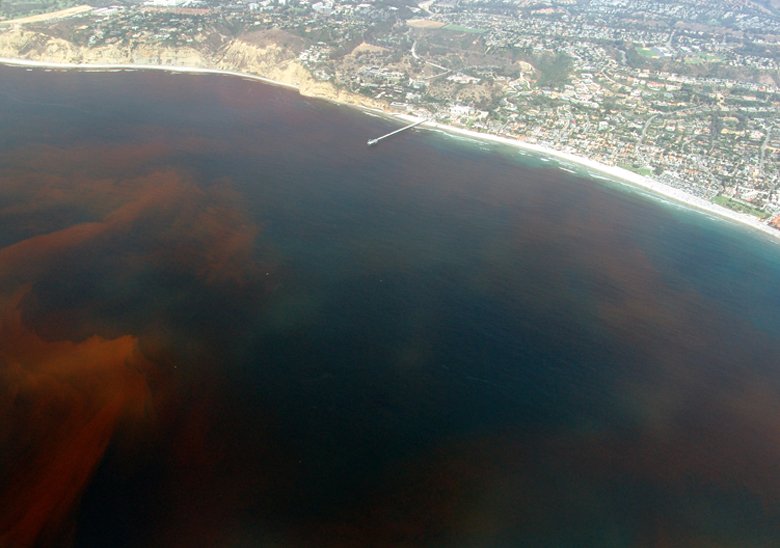
Dead zones are often caused by the decay of algae during algal blooms, like this one off the coast of La Jolla, San Diego, California.
Credit: Alejandro Diaz (public domain)
Scientists Daniel Reed and John Harrison at Washington State University Vancouver have reported in a new study a first-of-its-kind approach for predicting where coastal “dead” zones are likely to appear around the globe. These low-oxygen zones, which can harm fish, other marine animals and humans, result from human activities on land as well as oceanic conditions.
More than 400 low-oxygen zones have been documented worldwide, and the number continues to rise. Some are found in coastal waters off Oregon and Washington. One surprising insight from the study is that oxygen conditions in Pacific Northwest coastal waters may be particularly sensitive to human activities on land, according to the researchers. Their findings have been accepted for publication in Global Biogeochemical Cycles, a journal of the American Geophysical Union.
Dead zones occur when nutrients from agricultural fertilizer use, waste treatment facilities and other sources end up in coastal waters, stimulating the growth of phytoplankton. As these phytoplankton die and sink toward the sea floor, their decomposition consumes oxygen and creates low-oxygen conditions. These conditions will not occur, however, if enough oxygen mixes down to the sea floor fast enough to counterbalance the processes that consume oxygen.
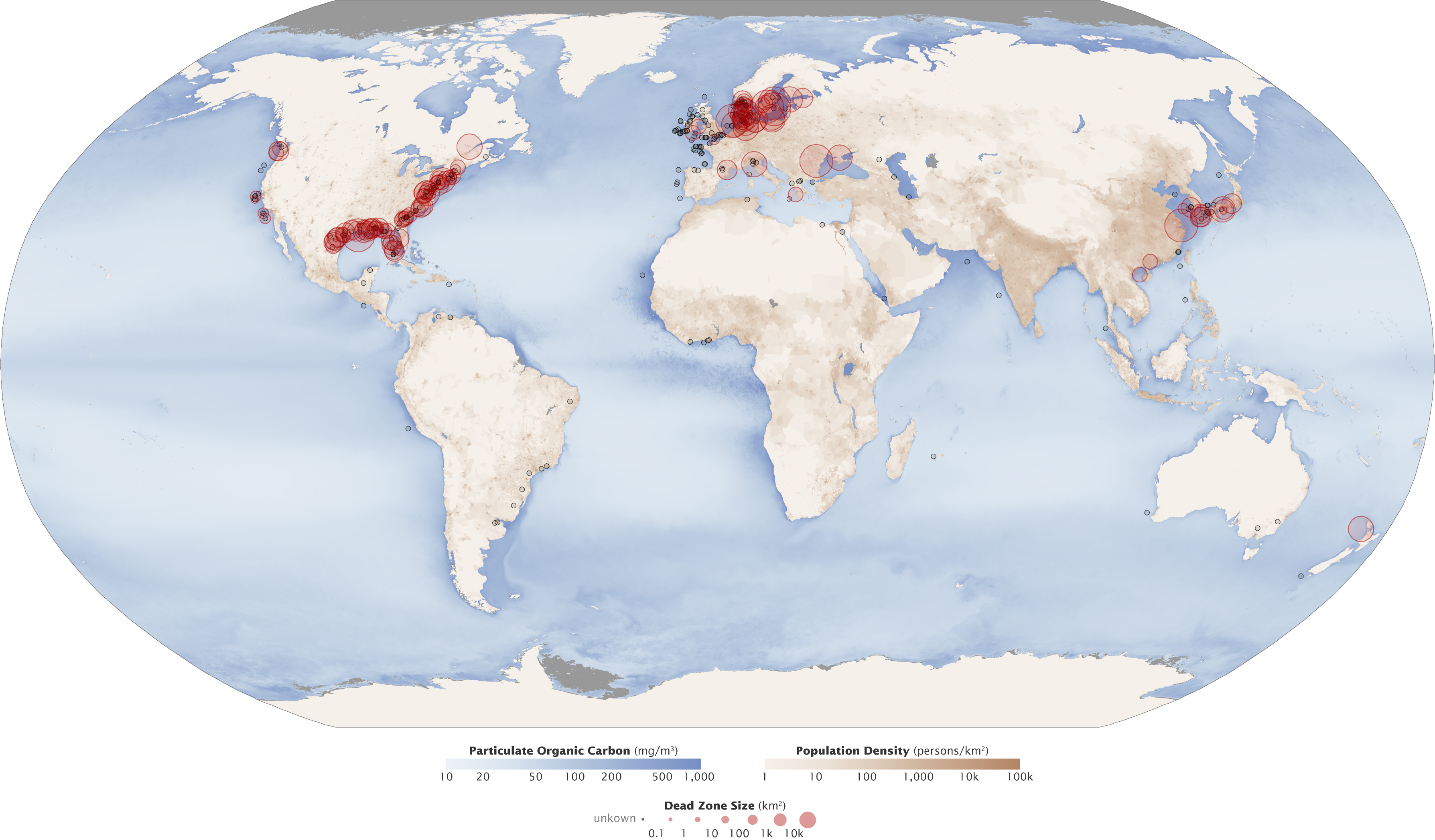
Red circles and black dots show the location of coastal dead zones—areas where deep water is so low in dissolved oxygen that sea creatures can’t survive. Scientists have developed a first-of-its-kind approach for predicting where these dead zones are likely to be.
Credit: Robert Simmon & Jesse Allen – NASA Earth Observatory
Reed and Harrison’s new approach accounts for all relevant factors. Importantly, their Coastal Ocean Oxygen Linked to Benthic Exchange And Nutrient Supply (COOLBEANS) model links coastal oxygen concentrations to nutrient inputs from land. Thus, it can be used to predict where low-oxygen regions will form due to changes in population and land-use practices, and also provides an estimate of how severe the effects of nutrient loading will be.
In addition to its predictions about the Pacific Northwest coast, COOLBEANS predicts that coastal seas in rapidly developing regions such as the Bay of Bengal and parts of Southeast Asia are likely to experience oxygen depletion now or in the near future.
Reed and Harrison have made the model code and supporting data freely available for download via the Internet for use by scientists and natural resource managers seeking to maintain the health of coastal waters and ecosystems.
— Brenda Alling is the director of marketing and communications at WSU Vancouver. This post originally appeared as a press release on the WSU Vancouver website.