
19 December 2014
Electromagnetic imaging helps scientists locate underwater methane
Posted by Nanci Bompey
By Leslie Willoughby
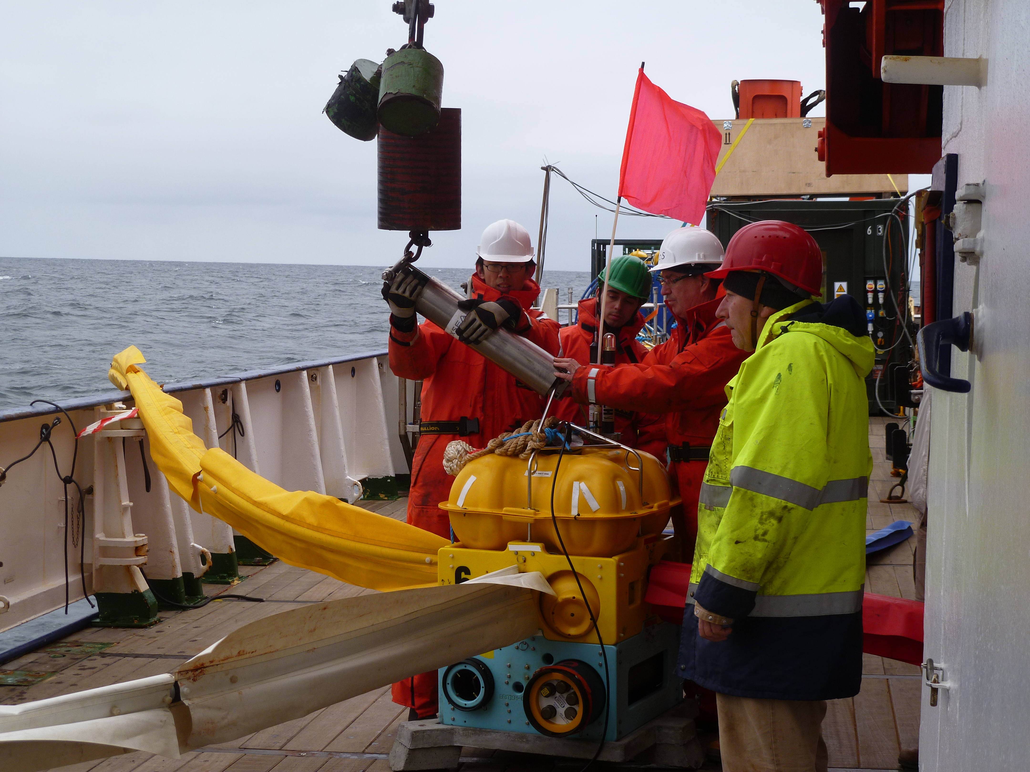
Scientists deploy an ocean bottom electric field sensor on a wire aboard the RV Meteor in May 2012.
Credit: Wu-Cheng Chi.
A simple compound found in underwater structures could generate warmth below the ocean, inside homes, and in the atmosphere. The location of the compound, methane, determines whether it’s dangerous, welcome, or world-changing.
Now, a team from GEOMAR in Kiel, Germany and the University of Southampton in the United Kingdom has used electromagnetic images to more accurately identify and characterize a source of methane beneath the ocean floor.
Finding more exact methods to locate sub-ocean methane and to identify its qualities could protect oilrig operators, assist methane gas prospectors, and provide valuable information for climate scientists.
Methane, the main ingredient in natural gas, can cause blowouts during oil drilling operations. The same substance can comfortably heat a bedroom on a snowy morning. And in the same way that adding an extra blanket to a bed holds more heat beneath the covers, atmospheric methane can trap a layer of heat around the Earth.
Scientists are currently examining whether methane might vent from the ocean floor and contribute to warming of the planet. For now, combinations of temperature and pressure lock most methane beneath the ocean floor in ice. The ice keeps the methane, a gas, from rising to the surface.
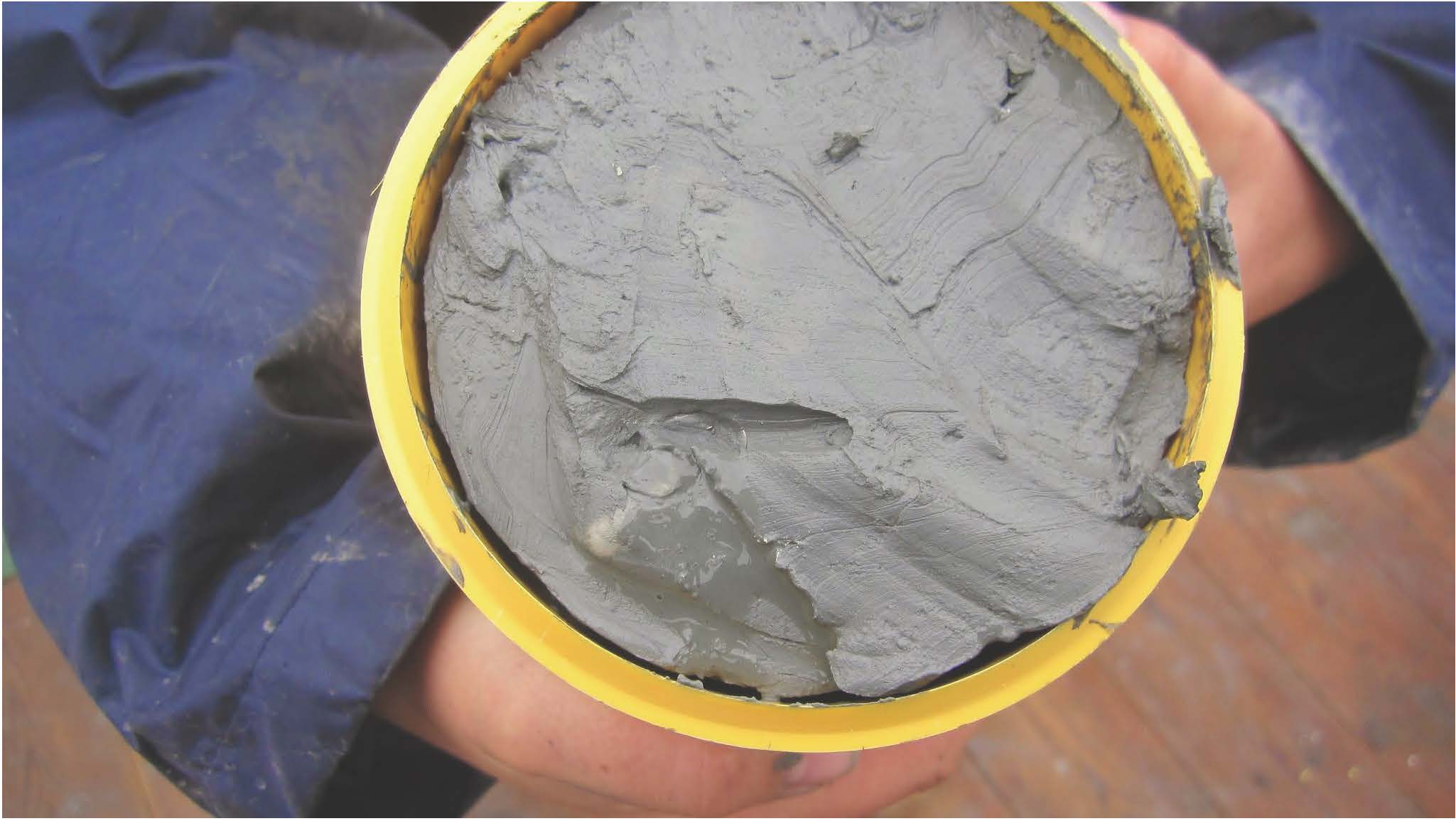
A core sample from a pockmark, collected during the 2014 Arctic Landslide Tsunami project, contains hydrate in the lower left corner. Credit: Millie Watts University of Southampton
“Water forms an ice-like cage around the methane, creating what is called a methane hydrate,” said Eric Attias, a marine geophysicist with the University of Southampton who processed and interpreted the electromagnetic information.
“However, as ocean temperatures warm, the hydrates can break down and we can get venting,” said Karen Weitemeyer, a marine geophysicist at the University of Southampton who collected the electromagnetic information.
Previously, a team of geoscientists used acoustic waves in an area along the west continental slope of Norway to find a dip in the mostly flat seabed. That 300- to 500-foot (100- to 150-meter) diameter pockmark, 2,400 feet (720 meters) beneath the ocean surface, indicated that a chimney might lead up toward the sea floor. And that was a possible sign that hydrates lay below.
Scientists also knew that in the same area, 18,000 years ago, a glacier had rapidly laid down layers of rich organic matter on the ocean floor.
“In places like these, bacteria eat up matter and spit out methane,” said Weitemeyer.
The team wanted to learn what lies beneath the pockmark.
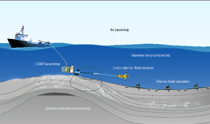
An electromagnetic, or marine resistivity, survey uses a transmitter and electric field receivers. This illustration shows seafloor receivers and a towed receiver.
Credit: modified from Weitemeyer et al., 2006 and Weitemeyer et al., 2010.
Attias and his colleagues set out to describe the chimney contents. To do so, they created electromagnetic images that show how strongly the sediment opposes the flow of electric current, or resistivity. They compared the resistivity of the chimney to that of the surrounding sediments. They assumed that more resistivity indicated the presence of methane hydrates and free methane.
They found that increased resistivity in the chimney indicated the presence of between 33 and 43 percent methane hydrate and free methane in the chimney.
They also found unexpected resistivity in two or three additional areas, an indication that a new pockmark is evolving or that it has been there but had not yet been discovered.
For future research, the team plans to determine the relative concentrations of hydrate and free gas in the chimney. To do so, they plan to examine a combination of acoustic wave information that has already been collected with their new resistivity information.
“With resistivity, we have a better tool to calculate concentration than seismic structure on its own,” said Weitemeyer. “A slow wave in an area that is resistive would suggest free methane gas. A high velocity wave combined with resistivity suggests hydrate.”
Measures of one pockmark may lead to more accurate estimates of methane at a regional scale and among 220 known hydrate deposits worldwide, Attias said.
– Leslie Willoughby is a science communication graduate student at UC Santa Cruz.