
13 November 2014
Satellite nightlight images show flood exposure increasing worldwide
Posted by kwheeling
By Kate Wheeling
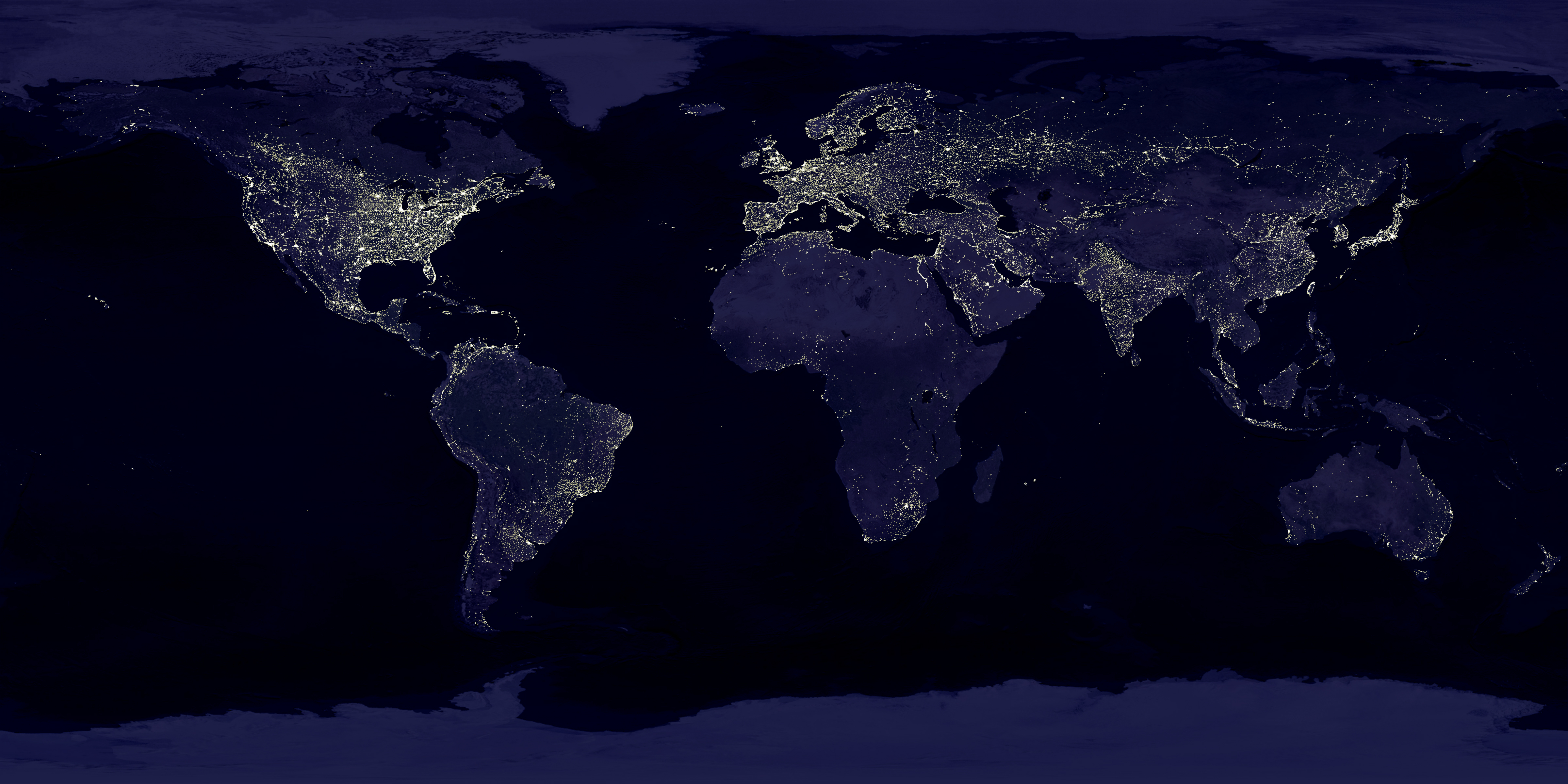
The new study used satellite images of nightlights to identify the regions most at risk for flood deaths and damage. Nightlights, as shown in this composite image of the earth at night from NASA, are a widely used proxy for population density.
Credit: NASA/NOAA
More people around the world live in flood-prone regions than did 20 years ago, increasing death tolls and economic damage from floods and the chances that flooding will cause similar losses in the future, a new study finds. The increased concentration of human populations in flood-risk zones could exacerbate an already expected upsurge in flood-related destruction in a warming climate, the researchers report.
The study has been accepted for publication in Geophysical Research Letters, a journal of the American Geophysical Union. Its authors used satellite images to show that a widely used proxy for population—the number of lights seen at night—increased globally along rivers by an average of 1.2 percent each year between 1992 and 2012.
They also found that the growing number of nightlights along rivers corresponded to mounting economic damage caused by floods, suggesting that nightlight intensity could provide a way to identify regions most at risk for flood deaths and damage. A lack of information about flood risk around the globe often leaves people in flood-prone regions unaware of the dangers they face, making them less likely to take precautions.
Africa, Asia and South America had the greatest increases in flood risk over the past two decades, according to the study. In Africa, the Nile River and its delta stand out as a “hot spot” of flood risk, with significant increases in nightlights over the 20 years of the study. Rapid urbanization along the Nile in Sudan is marked by luminosity increases of nearly 6.4 percent a year from 1992 to 2012. The region has already experienced record flooding in 2007 that destroyed hundreds of thousands of homes, killed hundreds of people and resulted in millions of dollars in economic losses.
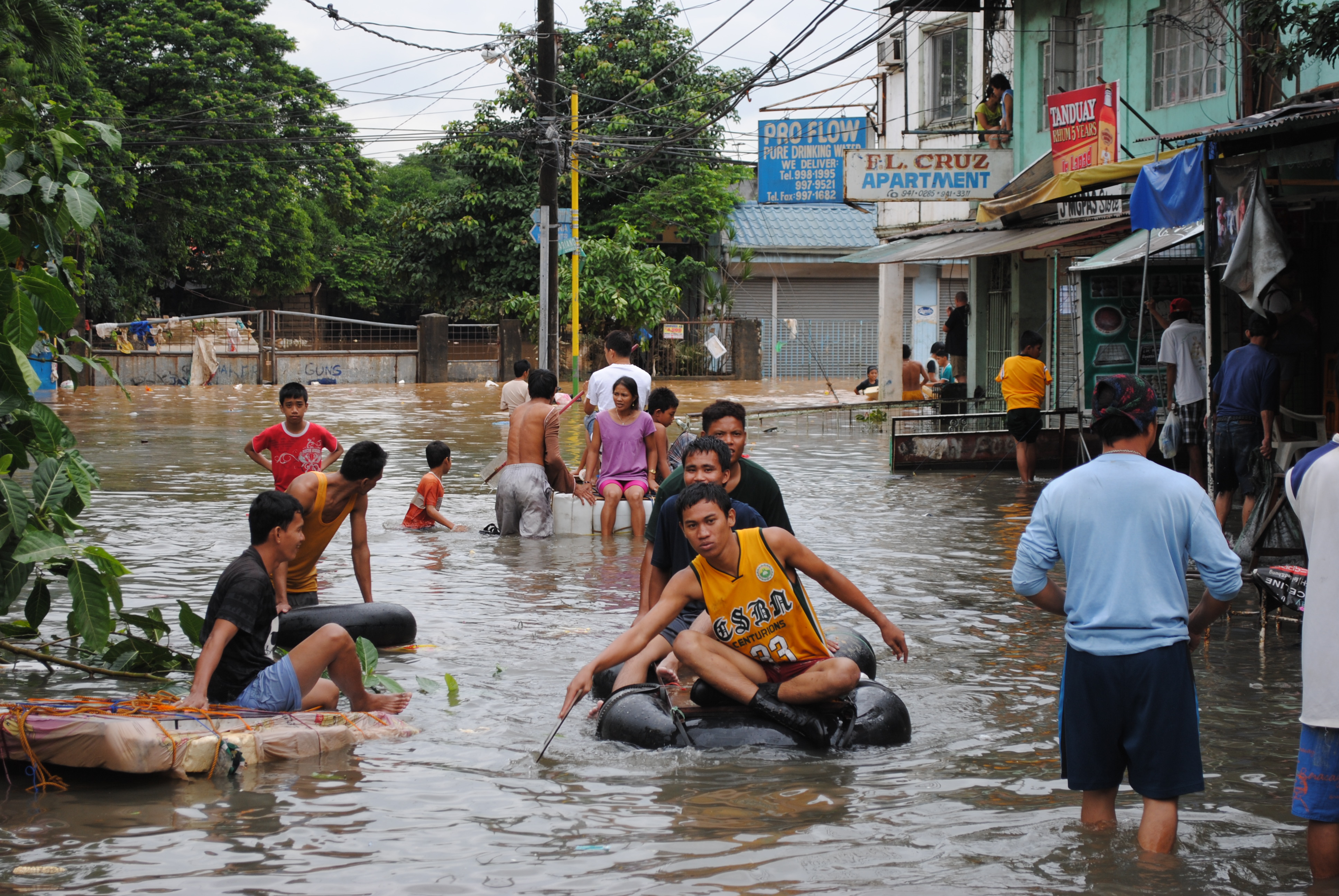
Residents of Manila, in the Philippines, wade through flooded streets after severe storms caused the Marikina River to overflow in 2012. Increased urbanization in the Philippines, seen in satellite images as more abundant nightlights, preceded several economically catastrophic floods in the region in recent years.
Credit: Department of Foreign Affairs and Trade
China experienced a 5.6 percent yearly increase in nightlights over the 20-year period, and also saw major floods in 2010, according to the new study. The catastrophic impacts of floods in the Philippines in 2009, 2011 and 2012, and in northern India in 2013 also likely reflect increased urbanization that can be seen as more abundant nightlights in those nations, according to the study.
Many European countries and the United States had weaker increases in nightlight intensity compared to other regions, the satellite images showed, which the authors speculate could stem in some cases from recent policy changes to reduce light pollution.
“We’re able to identify a value of nightlight for each single square kilometer covering the entire globe,” said Serena Ceola, an environmental engineer at the University of Bologna in Italy and lead author of the new study.
In combination with the satellite images, the researchers used U.S. Geological Survey maps of the worldwide river network to identify regions exposed to river floods. They analyzed global data on flood-related economic losses and the number of people affected by floods over the same time period to discern the relationship between nightlights and flood damage.
Brenden Jongman, a researcher at the Institute for Environmental Studies at VU University Amsterdam in the Netherlands, who was not involved in the study, said using nightlight data to examine changes in human occupation of flood plains is innovative. He noted that the number of people located in flood-prone areas is increasing at a faster rate than overall population growth worldwide, making the need for tools to predict flood risk and potential damages all the more important.
However, Jongman cautions, nightlight data is only a first step towards a comprehensive picture of global flood risk.
“Nightlights are a product of population growth, of economic growth, and of access to electricity,” he said. “There will be many people living along rivers [who] don’t have electricity, so they won’t show up in this database. But they are still dying from floods, and they still have economic losses.”
Nor are all rivers equally likely to flood, Ceola added. More data on the likelihood that a river will overflow, based on weather patterns and the characteristics of the river, will also fill in the picture of flood risk, she said. To further refine that picture, the researchers also plan to incorporate climate-change models and information about the expected frequency of future flood events.
– Kate Wheeling is a science writing intern in the AGU’s Public Information department.