
30 September 2014
Scientists use fiber-optic cables to measure ice loss in Antarctic
Posted by kwheeling
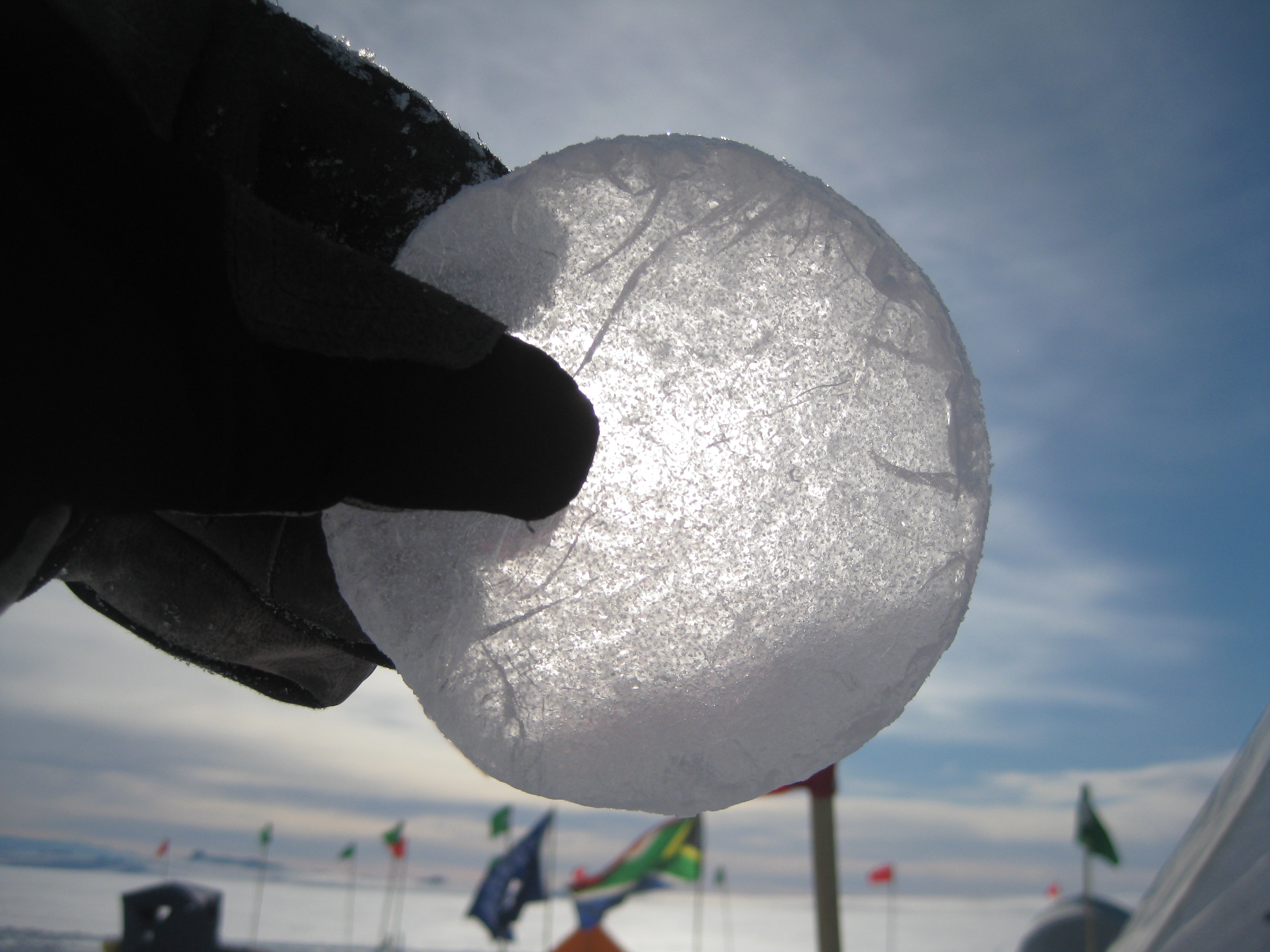
A slice of ice core from the McMurdo Ice Shelf in West Antarctica. Data on the melting rates of ice shelves provides scientists with critical information on the stability of the ice sheets.
Credit: David Holland
By Kate Wheeling
Fiber-optic cables like the ones that bring television and Internet into millions of homes are now being used to measure how fast ice shelves in Antarctica are melting, according to new research.
Researchers installed moorings containing fiber-optic cables hundreds of meters down into the McMurdo Ice Shelf in West Antarctica to collect temperature information about the base of the ice shelf, where the thick platform of floating ice meets the ocean. The sensors were able to measure mere millimeters of ice loss at the interface, demonstrating that the new fiber-optic method could be used to remotely monitor the ice shelves in real-time.
Data on the melting rates of ice shelves provides scientists with critical information on the stability of the Antarctic ice sheets and sea level rise.
GeoSpace spoke with Scott Tyler, a hydrologist at the University of Nevada, Reno and one of the study’s principal investigator, about the new research that has been accepted for publication in Geophysical Research Letters, a journal of the American Geophysical Union.
GeoSpace: How did you become interested in this idea to begin with?
Scott Tyler: My group does a lot of work with fiber optic temperature sensing for environmental monitoring—measuring in lakes, streams, and the atmosphere. A colleague of mine, an ice core specialist, said this would be an interesting tool to measure glacier temperature and look at ocean temperatures in the Antarctic. I talked to Dave Holland an oceanographer at New York University, and Victor Zagorodnov, a glaciologist [at Ohio State University in Columbus, Ohio] and ace ice core driller, and we put together a proposal to the National Science Foundation to measure the temperature of the ocean and the ice continuously with a fiber optic temperature sensing system and [to develop] a light-weight and portable drilling system that could zip down through the ice and get access to the ocean below.
Then Scott Kobs [a graduate student in Geological Sciences and Engineering at the University of Nevada Reno] came up with the idea to look carefully at the temperature record over the 14-month deployment. We can actually see the bottom of the shelf moving up over time; instead of an average annual melt rate we can get the melt rate almost on a daily basis, which is pretty hard to do.
Let’s say I put something down through the ice and it’s now looking up at the bottom of this ice shelf. As the ice shelf melts the sensor gets further and further away from the ice, and at some point it can’t measure the interface anymore because it’s melted up away from it. But because our tool just has this fiber cable hanging in a hole, as the ice melts it exposes more and more of our optical fiber, so we just keep seeing the interface.
GeoSpace: How do the fiber optic sensors work?
Scott Tyler: Think about when you shine a light in a dusty room, you can see the sparkles of the dust in the room. The color of those sparkles—the backscattered light or the reflection—actually tells me the temperature of the dust.
So in an optical fiber I send a little pulse of light down the fiber, just like a flashlight, and then measure the reflection that I see as the light goes down the optical fiber. It’s a really subtle change in color that your eyes can’t see but our instruments can. The color of that light tells me the temperature of that place along the fiber. I can calculate where that was because I know the speed of light in the fiber and a stopwatch [keeps track of] when I sent the light and when I see that sparkle of light. So I can get a temperature and a distance down the optical fiber.
GeoSpace: What difficulties did you run across throughout the research?
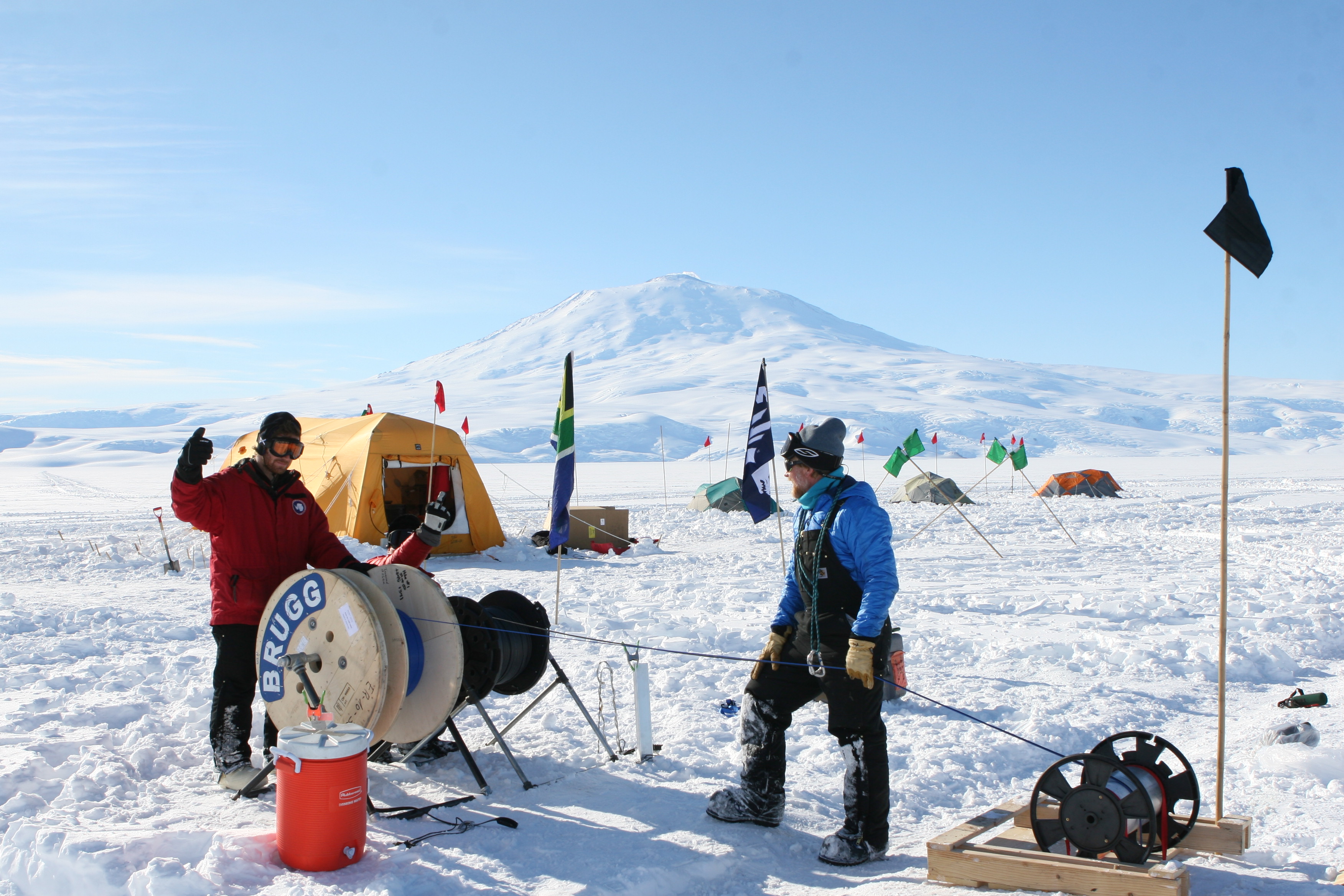
Once the team drills and melts their way down through the ice shelf, they have 20 minutes to get all the instrumentation down through approximately 200 meters (656 feet) of ice before the hole freezes over again.
Credit: Victor Zagorodnov
Scott Tyler: The ice that we drilled through was about 200 meters (656 feet) thick and the ocean below is about a kilometer (3281 feet) deep. If we drilled down through the glacier into the ocean, the water was going to come spurting back up this tiny hole and short out our drill. So we actually melted our way down the last couple meters. Then we had about 20 minutes to get all the instrumentation down into the ocean, through a hole that was less than two inches in diameter, before the hole froze back in again.
We had to keep this thing running through the Antarctic winter, when there’s no sun. We had solar panels which worked only in the summer time, and then we had a wind generator to try to generate electricity through the winter. Sometime in the winter one of our electrical systems had a short. The system stopped working for about three months so we didn’t get any data. As soon as the sun came back up we sent somebody out to the field to hit all the switches and it turned itself back on. So power’s still a bit of an issue.
GeoSpace: How long can they be used for?
Scott Tyler: Optical fibers are designed to last for decades. It’s really not under much stress or strain, it might swing around a little under water but these cables are designed to handle that. They can’t be replaced easily because they’re literally frozen in with 200 meters (656 feet) of ice. The mooring is still frozen into the ice and we’re planning to go back next year, plug back into it and take some measurements.
GeoSpace: What are the next steps for the research?
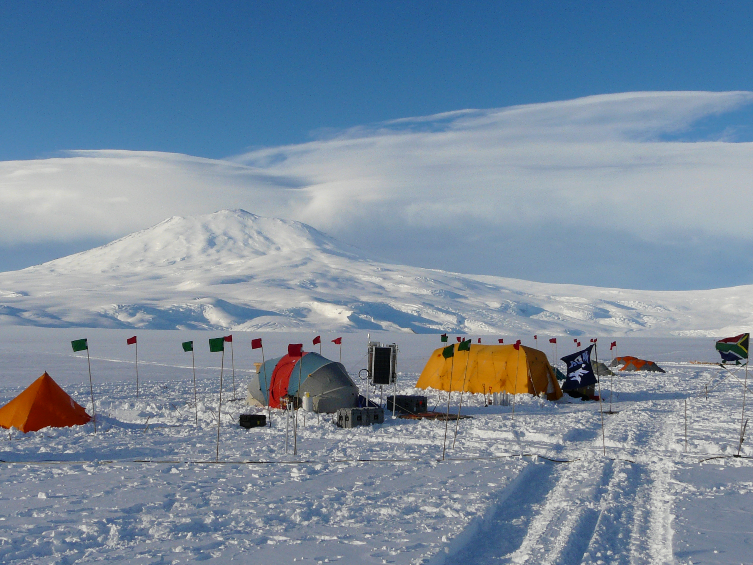
The team’s camp site on the McMurdo Ice Shelf. The group plans to set up monitoring stations on other ice shelves and glaciers throughout Antarctica that may also be threatened by climate change.
Credit: Scott Tyler
Scott Tyler: Now that we’ve proven that we can measure this melt rate and that the systems work well, we’re going to develop a more comprehensive monitoring program. We want to know are the ice shelves melting faster, or accelerating due to climate change? Our goal is now going to be to set up monitoring stations at different places on the Ross ice shelf and some of the other big glaciers—the big shelves that are holding back the west Antarctic ice sheets from dropping into the ocean.
GeoSpace: What do you personally find most exciting about this work?
Scott Tyler: The ability to measure changes in these ice shelves is just amazing. These things are 200 to 300 meters (656 to 984 feet) thick. We’re measuring at the bottom of basically a 30-story building and we can see a millimeter or two (fractions of an inch) change in height. And that’s pretty cool!
This interview has been edited for clarity and brevity.
Click here to see more photos from the Antarctic expedition at AGU on Tumblr.
– Kate Wheeling is a science writing intern in the AGU’s Public Information department.