
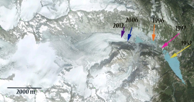
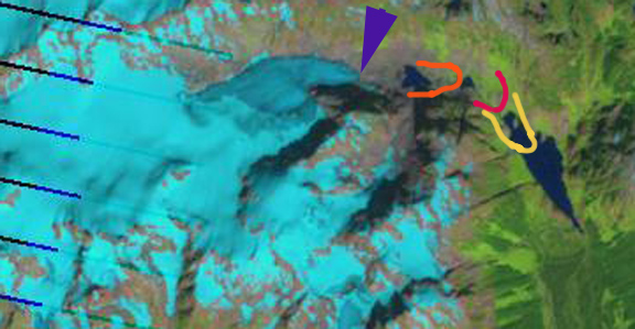
Stave Glacier is a six kilometer long valley glacier in Garibaldi Provinical Park, British Columbia. Koch et al (2009) in their detailed survey of glaciers in the park chronicled the glacier’s retreat from 1952 to 1996. Here we update the changes in Stave Glacier to 2012. Koch et al (2009) completed a map, first image that indicates the retreat rate of the glacier as 26 meters/year from 1900-1952, 33 meters/year 1952-1977 and 53 meters/year from 1977 to 1996. Examined below is Google Earth imagery from 2006, aerial photography from 2009 and Landsat imagery from 2009 and 2012. The Google Earth image indicates the terminus position using arrows in 1952 (yellow arrow), 1977 (pink arrow), 1996 (orange arrow), 2006 (blue arrow) and 2012 (purple arrow). In the Landsat images the same color scheme is used, for terminus front lines also. The retreat from 1996-2012 is 1600 meters, 100 meters/year. This glacier is still not approaching equilibrium as the accelerating retreat indicates. 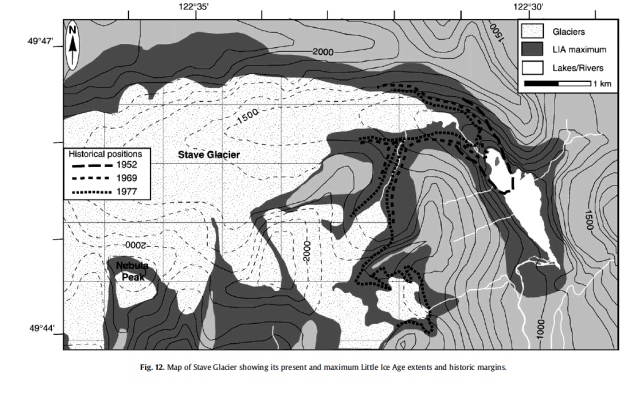

 A close up of the terminus in 2006 (top) and 2009 (bottom) indicates the lowest couple hundred meters is thin and uncrevassed indicating retreat will continue. The glacier terminus is at 1275 meters today. There is an active icefall above the terminus at 1500 meters, the snowline has been at 1900 meters. Unlike the nearby Helm Glacier, Stave Glacier has a persistent accumulation zone and can survive current climate. Its behavior is similar to that of Warren Glacier.

One thought on “Stave Glacier Retreat, British Columbia”
Comments are closed.

Pingback: Snowcap Creek Glacier Retreat, British Columbia « From a Glaciers Perspective