
May 31, 2021
Valdez Glacier, Alaska Significant Calving Retreat in 2020
Posted by Mauri Pelto
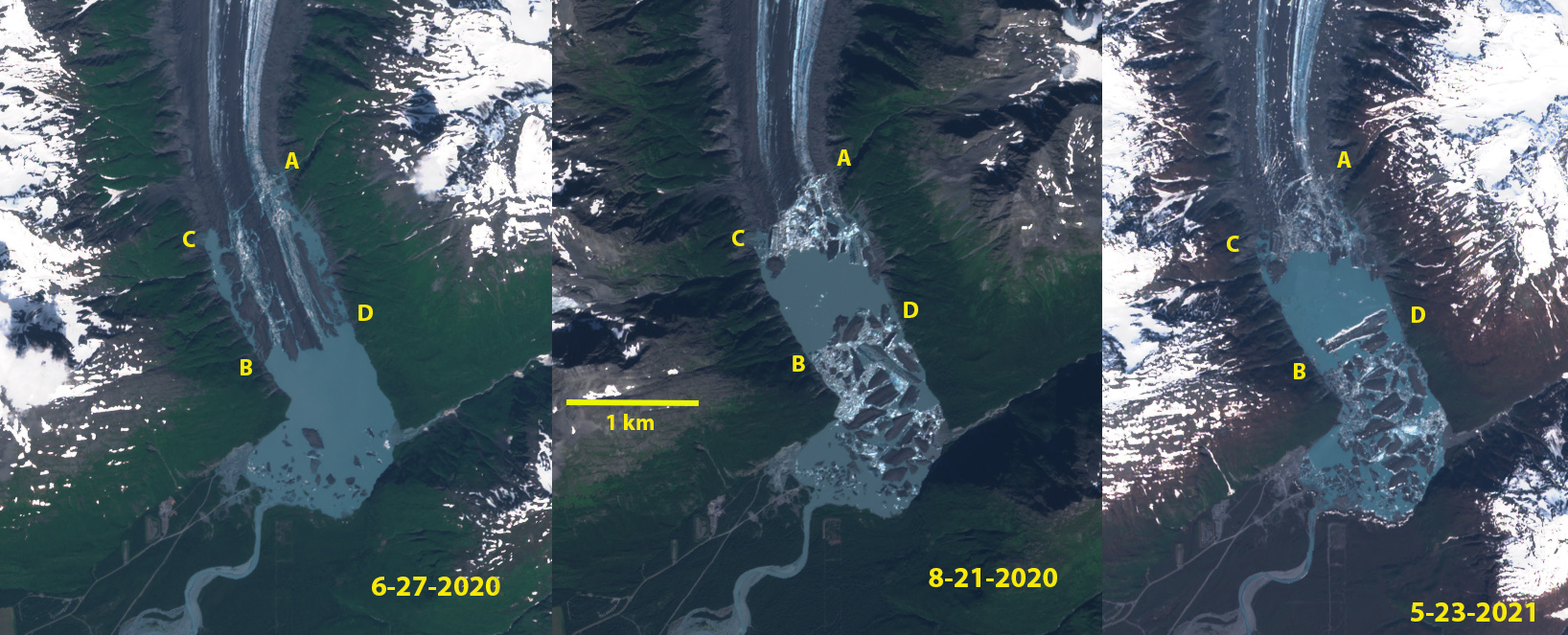
Valdez Glacier terminus in Sentinel images from 6-27-2020, 8-21-2020 and 5-23-2021. In June the glacier’s terminus area is poised to collapse with extensive rifting and marginal proglacial lakes along the east and west margins. In July the terminus breaks up and in August the lake is filled by a flotilla of icebergs. The May image indicates the icebergs are still present.
Valdez Glacier is an outlet glacier from the Chugach Mountains that in the early 20th century descended onto a glacial outwash plain that the city of Valdez, Alaska is built upon. Today the glacier has retreated into a mountain valley and is calving into an expanding lake. David Arnold in the Double Exposure project documenting climate change photographically has a pair of images from 1938 and 2007 of the glacier. This post examines Landsat, Sentinel and Digital Globe images from 1986-2021 to document the retreat and lake expansion.
The 1948 map of the glacier indicates no lake at the terminus of the glacier, and the braided glacier emanating from the end of the glacier still building the outwash plain, note airport just southwest of terminus on plain.The terminus is marked by red arrows in map below. Seven kilometers upglacier of the terminus is a secondary terminus in a side valley. In the 1948 map, see bottom image, this glaciers is just in contact with Valdez Glacier, dark red arrow. With time both glacier termini retreat. By 1986 Landsat imagery indicates the development of a lake at the terminus and that the outwash plain is stabilizing, as indicated by complete vegetation development. The lake has an area of 1.1 km2, and it is 1 km from the southern shore of the lake to the glacier. In 1986 and the snowline on the glacier is at 1000 m. By 2002 the west side of the lake is 1.5 from north to south and has an area of 1.8 km2, the east side still extends to the southern shore of the lake. The snowline in 2002 is at 1300 m.
In 2011 the lake is 2 km from north to south. The snowline in 2011 is at 1300 m. In 2019 the lake is 2.3 km from north to south. Indicating a slow expansion continuing from 2011-2019. The snowline is at 1300 m in 2019. In June of 2020 the terminus is still in the same location though rifting and expansion of marginal open water indicates the terminus is poised to collapse. It does collapse in July and by August the significant calving event that occurred has generated numerous icebergs. The lake is now 4.4 km2 and 3.4 km from the southern shore. The main terminus has retreated 2.8 km since 1986 and the tributary that was just separating in 1948 from the east has retreated 3 km from Valdez Glacier. The lake has increased 300% in area with, 30-40% of this change occurring in 2020. The snowline in 2020 was again at ~1300 m.
In the May 23 Sentinel image the icebergs are still filling a good portion of the lake. As summer 2021 commences anticipate more calving retreat as several significant rifts exist within 0.5 km of the calving front. The snowline elevation at 1300 m in late summer has been a common feature, which leaves 70% of the glacier in the ablation zone. Wouters et al (2019) report that Alaskan mountain glaciers have contributed more to sea level rise than any other region. The retreat at Valdez Glacier is not as large as that at Ellsworth Glacier that also had a significant calving in 2020. The retreat is much less than at Excelsior Glacier or Yakutat Glacier.
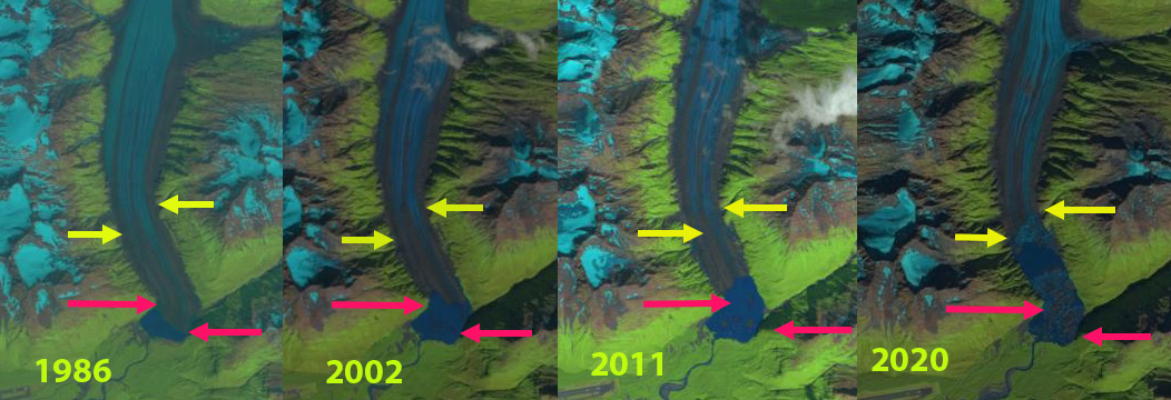
Valdez Glacier terminus in 1986, 2002, 2011 and 2020 Landsat images. Red arrow indicates 1986 terminus location and yellow arrows the 2020 terminus locations. Slow lake expansion from 1986-2019. The iceberg flotilla is evident in the middle of the lake in 2020.
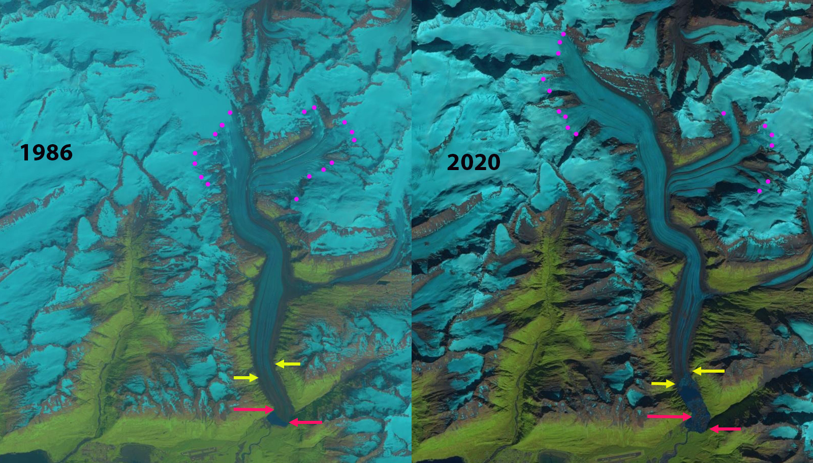
Valdez Glacier in 1986 and 2020 Landsat images. Red arrow is the 1986 terminus, yellow arrow the 2020 terminus and purple dots the snowline.
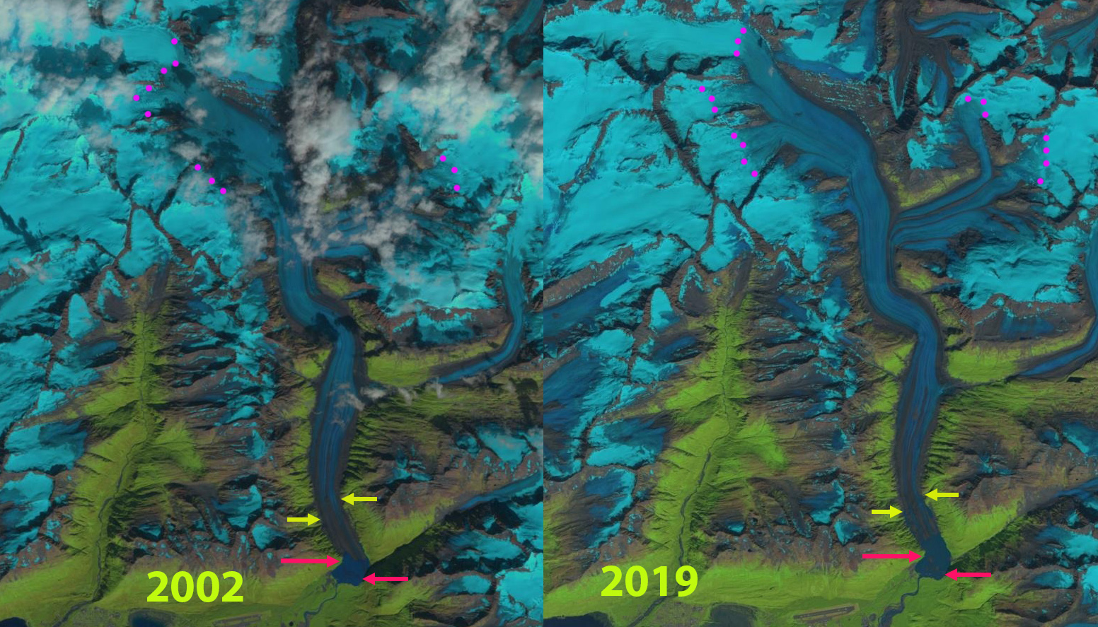
Valdez Glacier in 2002 and 2019 Landsat images. Red arrow is the 1986 terminus, yellow arrow the 2020 terminus and purple dots the snowline.

1948 USGS Topographic map before a lake had formed. Red arrows indicate the terminus.
 Dean of Academic Affairs at Nichols College and Professor of Environmental Science at Nichols College in Massachusetts since 1989. Glaciologist directing the North Cascade Glacier Climate Project since 1984. This project monitors the mass balance and behavior of more glaciers than any other in North America.