
January 15, 2021
Weddel Glacier Retreats from Tidewater, South Georgia Island
Posted by Mauri Pelto
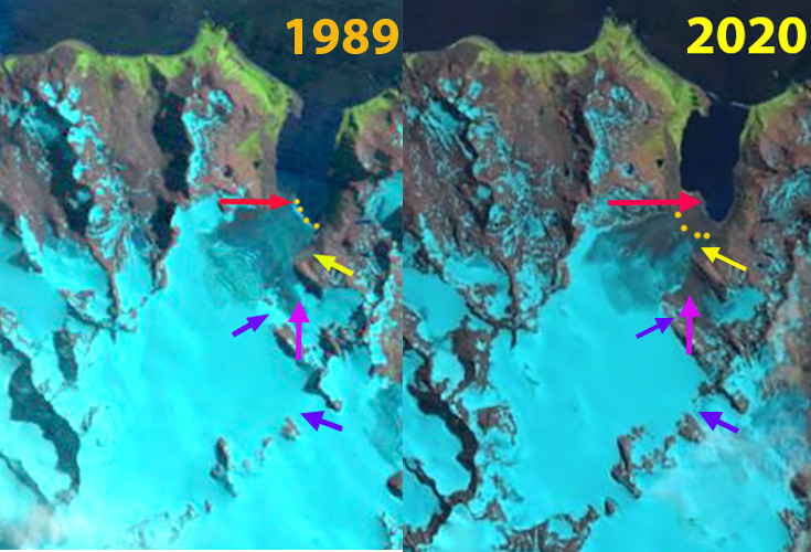
Weddel Glacier in 1989 and 2020 Landsat images.Red arrow marks the 1989 NW terminus, orange dots the terminus location, purple arrows locations of ice spilling over a ridge, pink arrow a tributary glacier and yellow arrow the base of an icefall.
Weddel Glacier is on the southeast coast of South Georgia Island terminating in Beaufoy Cove just north of Gold Harbor. The change in glacier terminus position was documented by Alison Cook at British Antarctic Survey in a BAS retreat map. In 1958 it reached within 400 m of the outlet of Beaufoy Cove. For Weddel Glacier the retreat was rapid from 1960 to 1974 and was slow from 1992-2003. Here we examine Landsat imagery from 1989 to 2020 to visualize and update this change.
In 1989 the glacier terminates near the tip of a peninsula, red arrow in each image. The calving front extends southeast, orange dots. At the yellow arrow the glacier fills a small side valley adjacent to the main glacier. At the purple arrows are two locations where ice spillovers a bedrock ridge. The pink arrow indicates a low elevation tributary glacier joining the main glacier, its highest elevation is 500 m. In 2002 there is only minor retreat between the red and yellow arrow, but thinning has led to the small extension of the main icefall being almost cutoff by bedrock. By 2015 the glacier has retreated 200-300 meters from the 1989 position and the main terminus is narrower and calving has essentially ceased. At the purple arrow this is just bedrock now, there is no glacier extension flowing down the bedrock step. At the pink arrow the tributary glacier connection has narrowed, but is still connected. The glacier connection to Beaufoy Cove is almost gone in 2015. By 2020 the glacier has receded from the tidewater of Beaufoy Cove. The greening of the area around the cove is also evident. The tributary on the east side at pink arrow is no longer connected to the main glacier. The ridge at the upper purple arrow is just bedrock, while the lower purple arrow marking a pass to Bertrab Glacier has narrowed and bedrock has emerged at this 500 m glacier divide.
Weddel Glacier retreat is a 400 m since 1989, which is quite limited compared to Neumayer Glacier which retreated 8.8 km from 1999-2020 or Hindle Glacier which retreated 4.4 km from 1989-2017. This retreat of glaciers on South Georgia is portrayed in NASA Earth Observatory feature.
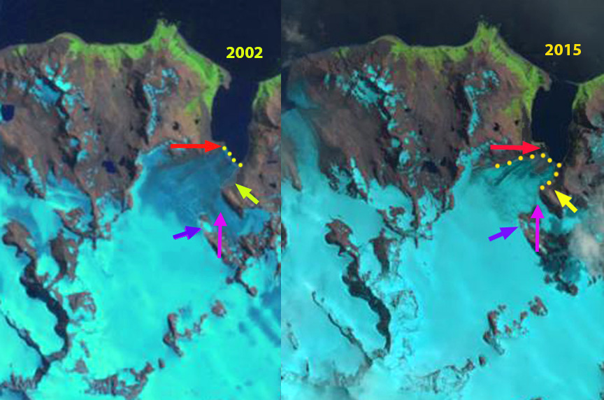
Weddel Glacier in 2002 and 2015 Landsat images. Red arrow marks the 1989 NW terminus, orange dots the terminus location, purple arrow indicates ice spilling over a ridge, pink arrow a tributary glacier and yellow arrow the base of an icefall.
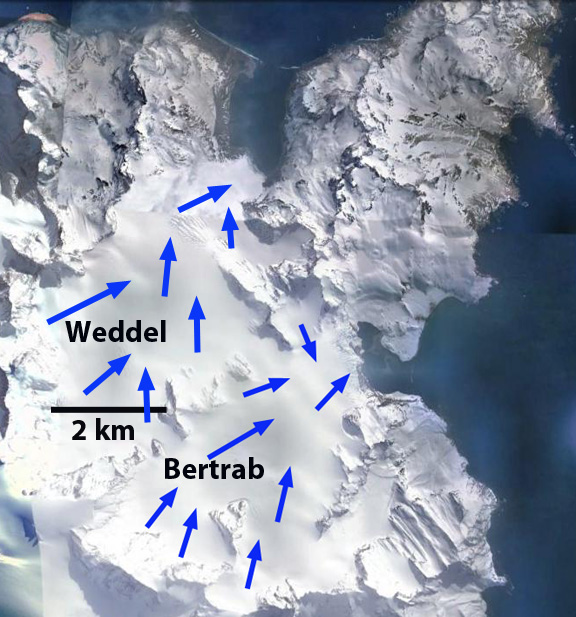
Weddel Glacier flow.
 Dean of Academic Affairs at Nichols College and Professor of Environmental Science at Nichols College in Massachusetts since 1989. Glaciologist directing the North Cascade Glacier Climate Project since 1984. This project monitors the mass balance and behavior of more glaciers than any other in North America.