
July 10, 2020
Harrietbreen, Svalbard Retreats From Coast Loses Accumulation Zone
Posted by Mauri Pelto
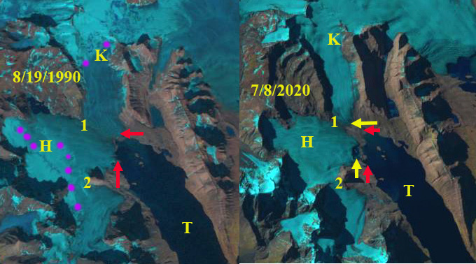
Harrietbreen (H) and Kjerulfbreen (K) in 1990 and 2020 Landsat images. Red arrow 1990 terminus, yellow arrow 2020 terminus and purple dots the snowline. No snow on Harrietbreen in early July 2020. Point 1 and 2 are divides between glaciers.
Harrietbreen is small glacier that feeds into Trygghamna a small fjord the is part of the large Isfjorden on the east coast of Svalbard, mergin with Kjerulfbreen near the terminus. The glacier extends from 400 m to tidewater in 1990. Here we examine the changes in both terminus position and accumulation zone in Landsat images from 1990-2020. Nuth et al (2013) determined that the glacier area over the entire archipelago has decreased by an average of 80 km2 per year over the past 30 years, a 7% reduction, this loss is ongoing (NASA, 2018).
In 1990 Harrietbreen (H) and Kjerulfbreen (K) merge 1.5 km above the terminus at Point 1 and both reach tidewater. The snowline is at 200 m and the divide at Point 2 with Protektorbreen to the south is wide and partly snowcovered. In 1993 the snowline in mid-July is at 150 m. Kjerulfbreen has retreated from tidewater. In 2018 and 2019 by the end of August Harrietbreen has lost all of its snowcover nd Kjerulfbreen is now 700 m from the coastline.
On July 8, 2020 the warm early summer temperatures have already melted all the winter snowcover from Harrietbreen. With two months left in the melt season this will result in substantial mass loss. Harrietbreen has retreated 500 m during the 1990-2020 period and is no longer a tidewater glacier. The connection with Kjerulfbreen at Point 1 has been reduced to 0.6 km. The connection with Protektorbreen at Point 2 has thinned substantially too. The persistent lack of retained snowcover indicates a glacier without a consistent accumulation zone which means Harrietbreen cannot survive (Pelto, 2010).
The retreat here is less significant than at nearby Austre Torelbreenor at Orsabreen, but the prognosis for survival much worse.
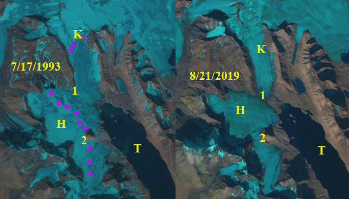
Harrietbreen (H) and Kjerulfbreen (K) in 1993 and 2019 Landsat images. Red arrow 1990 terminus, yellow arrow 2020 terminus and purple dots the snowline. No snow retained in 2019. Point 1 and 2 are divides between glaciers.
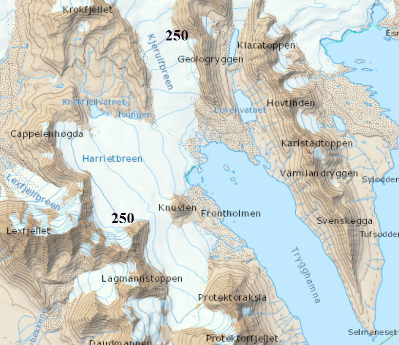
TopoSvalbard map of the region, the 250 m contour is indicated.
 Dean of Academic Affairs at Nichols College and Professor of Environmental Science at Nichols College in Massachusetts since 1989. Glaciologist directing the North Cascade Glacier Climate Project since 1984. This project monitors the mass balance and behavior of more glaciers than any other in North America.