
May 27, 2020
Darwin Glacier, Chile 1986-2020 Retreat Opens New Fjord Arm
Posted by Mauri Pelto
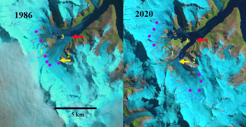
Darwin Glacier in Landsat images from 1986 and 2020. Red arrow indicates 1986 terminus location, yellow arrow 2020 terminus location, purple dots the snowline. Point 1,2 and 3 indicate the same specific location.
Darwin Glacier flows east from the main divide of the Cordillera Darwin entering the head of Fjord Parry. Here we examine changes illustrated by Landsat images from 1986-2020. Melkonian et al (2013) note widespread thinning of four large glaciers in the Cordillera Darwin Range from 2000-2011; Ventisquero Grande, Marinelli, Darwin and Roncagli, while the Garibaldi Glacier increased in volume. They note a maximum velocity of 9.6 m/day at Darwin Glacier and thinning of over 3 m/year during the 2000-2011 period, which emcompasses a period of rapid retreat noted below. Davies and Glasser (2012) note that during the 1870-2011 period the Cordillera Darwin area loss was most rapid from 1986 to 2001. Dussaillant et al (2019) note the mass loss for the central Cordillera Darwin at -0.4 to -0.6 m/year from 2000-2018.
In 1986 Darwin Glacier extended beyond the end of a southwest trending valley (Point 3) and had fully separated from the former tributary flowing eastward. Tributaries at Point 1 and 2 join the main glacier within a 2 km of the current terminus. The snowline is at 500 m. By 2000 the glacier had retreated into the southwest trending valley, with a peninsula emerging on the west side at point 3. The snowline is at 500 m. By 2019 the glacier had retreated beyond the former tributaries at Point 1 and 2. The snowline in 2018 is at 750 m. In 2020 the peninsula at Point 3 has greened up with new vegetation, the glacier has retreated 3100 m since 1986 exposing a new fjord arm. Point 2 is largely a glacier free valley bottom. The snowline is at 800 m. A further 1 km retreat will lead to another tributary separation much as has happened at Ventisquero Grande.
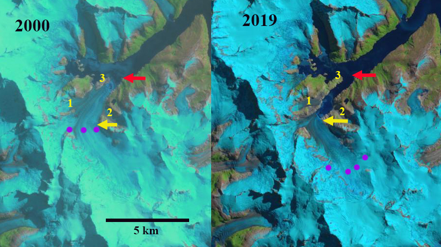
Darwin Glacier in Landsat images from 2000 and 2019. Red arrow indicates 1986 terminus location, yellow arrow 2020 terminus location, purple dots the snowline. Point 1,2 and 3 indicate the same specific location.
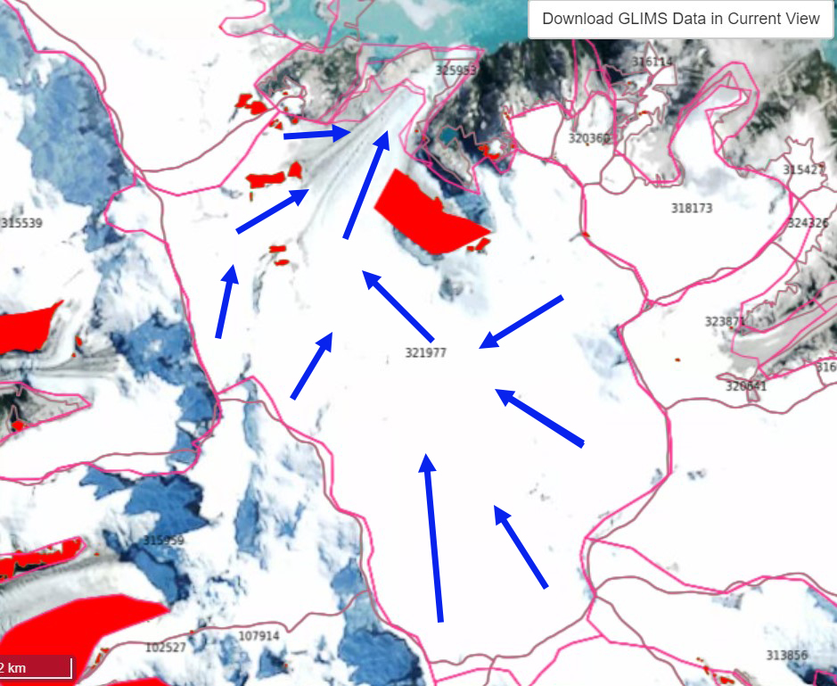
GLIMS view of Darwin Glacier with 1986-2007 margins indicated (Bethan Davies delineated margins). Flow arrows added.
 Dean of Academic Affairs at Nichols College and Professor of Environmental Science at Nichols College in Massachusetts since 1989. Glaciologist directing the North Cascade Glacier Climate Project since 1984. This project monitors the mass balance and behavior of more glaciers than any other in North America.