February 6, 2020
Scott Glacier, Alberta Retreat 1987-2019
Posted by Mauri Pelto
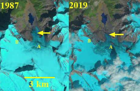
Scott Glacier, Alberta in 1987 and 2019 Landsat images. Yellow arrow indicates the 2019 terminus location and Point A and B are areas of bedrock expansion amidst the glacier.
Scott Glacier is the largest outlet glacier of the Hooker Icefield the drains into the Whirpool River and then the Athabasca River. The icefield straddles the BC/Alberta border. Jiskoot et al (2009) examined the behavior of the Clemenceau-Chaba Icefield, 25 km south finding that from the mid 1980’s to 2001 the Clemenceau Icefield glaciers lost 42 square kilometers, or 14% of their area. On Columbia Icefield 60 km to the southeast Tennant and Menounos (2013) found that from 1919-2009 glaciers had a mean retreat of 1150 m and mean thinning of 49 m for glaciers, with the fastest rate of loss from 2000-2009.
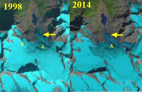
The Scott Glacier in 1987 had terminated at 1500 m, within 300 m of an alpine lake. At Point A there is a convex aspect to the glacier as it passes over a subglacial knob. The snowline is near this knob at 2200 m. In 1998 there is limited retreat of the main terminus and Point A is still beneath the ice. The snowline is just above Point A at 2250 m. In 2014 the glacier has retreated to the base of a step at ~1800 m. The snowline is well above Point A at 2450 m. In 2019 the terminus has retreated 750 m since 1987. Point A has emerged as a bedrock knob at the glacier surface. At Point B a rock rib has widened since 1987 and extends further into the heart of the glacier. The snowline in 2019 is at 2400 m at the end of July.
Scott Glacier’s retreat is less extensive than other nearby glaciers such as Chaba Glacier , Cummins Glacier and Columbia Glacier.
Scott Glacier, Alberta in 1998 and 2014 Landsat images. Yellow arrow indicates the 2019 terminus location and Point A and B are areas of bedrock expansion amidst the glacier.
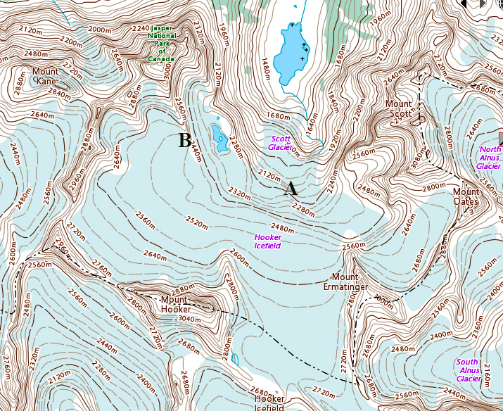
Scott Glacier map indicating the glacier margins in the 1990’s.
Scott Glacier Digital Globe image indicating 1987 terminus location (red arrow) and 2019 terminus location yellow arrow. Point A is where bedrock is emerging and Point B is where the bedrock ridge is extending across glacier. Both Point A and B indicate bedrock steps that the glacier steepens as it flows over. The glacier remains crevassed to the front indicating no stagnant zone.


 Dean of Academic Affairs at Nichols College and Professor of Environmental Science at Nichols College in Massachusetts since 1989. Glaciologist directing the North Cascade Glacier Climate Project since 1984. This project monitors the mass balance and behavior of more glaciers than any other in North America.
[…] Fonte/Source: https://blogs.agu.org/fromaglaciersperspective/2020/02/06/scott-glacier-alberta-retreat-1987-2019/ […]