
October 1, 2019
Ofhidro Glacier, Chile Retreat 1986-2019
Posted by Mauri Pelto
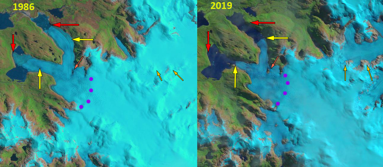
Ofhidro Glacier glacier terminus change an accumulation zone changes from 1986-2019 in Landsat images. Red arrow=1986 terminus, yellow arrow=2019 terminus change, orange arrows expanding bedrock areas and purple dots snowline.
Ofhidro Glacier is an outlet glacier on the northwest corner of the Southern Patagonia Icefield (SPI), that has a northern and southern arm terminating in a proglacial lake. Sakakibara and Sugiyama (2014)a examine the terminus change and velocity of SPI glaciers the northern arm retreating 50 m per year from 1985-2011 and the southern arm 100 m/year 1985-2011. They also noted a decline in velocity Here we examine Landsat imagery from 1986-2019 to identify the change.
In 1986 the southern arm extended across the proglacial lake to the shallows of the western shore. The northern arm had been retreating in a narrower valley with a comparatively consistent width. In 1998 the southern arm in the broader lake reach had collapsed, a retreat of 1800 m. The northern arm had a retreat of 200 m. The snowline was at m. In 2015 the southern arm has retreated into a narrower valley, and the northern arm has retreated to a turn to the south in the valley. The orange arrows indicate the expansion of bedrock as the glacier thins. By 2019 the southern arm has retreated 2800 m (88 m/year) and the northern arm has retreated 1800 m (56 m/year). Jaber et al (2019) noted a thinning of 0.5 m/year from 2000-2012 increasing to 1.2 m/year from 2012-2016. Most of the thinning being in the valley tongues of each arm. There is an area of continuous exposed bedrock more than 3 km long. This fits the observations of Willis et al (2012) who observed that between February 2000 and March 2012 that SPI was rapidly losing volume and that thinning extends even to high elevations. The retreat of this glacier is similar to that of Lucia Glacier and Gabriel Quiroz Glacier to the east.
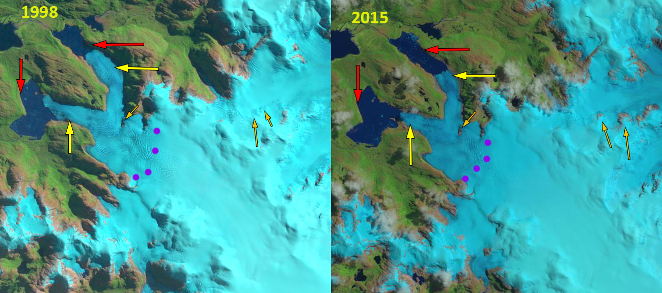
Ofhidro Glacier glacier terminus change an accumulation zone changes from 1998-2015 in Landsat images. Red arrow=1986 terminus, yellow arrow=2019 terminus change, orange arrows expanding bedrock areas and purple dots snowline. 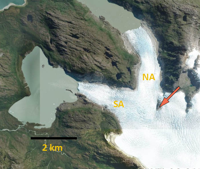
Ofhidro Glacier image from 2015. Notice the trimlines and narrowing of both terminus tongues. Orange arrow indicates new bedrock knob.
 Dean of Academic Affairs at Nichols College and Professor of Environmental Science at Nichols College in Massachusetts since 1989. Glaciologist directing the North Cascade Glacier Climate Project since 1984. This project monitors the mass balance and behavior of more glaciers than any other in North America.