
November 27, 2018
Glacier O’Higgins Calving Front Changes 1986-2018
Posted by Mauri Pelto
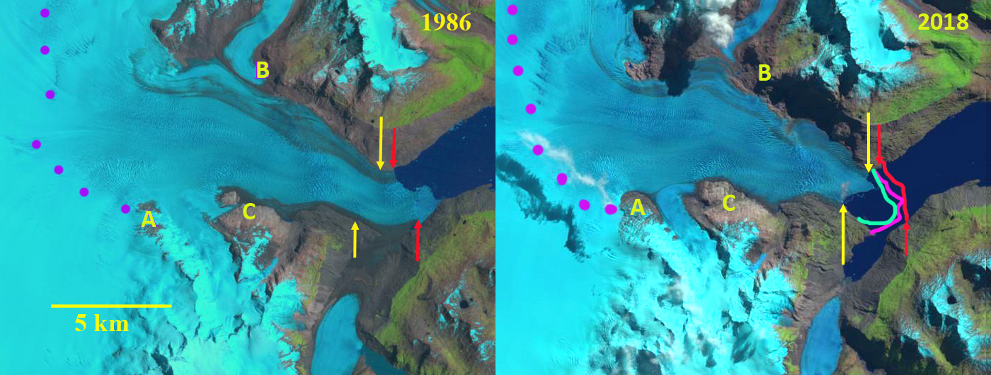
Glacier O’Higgins in 1986 and 2018 Landsat images. Red arrow and line is the 1986 terminus position, pink line the 2002 terminus, green line the 2013 terminus, yellow arrows the 2018 terminus location, purple dots the snowline. Point A, B and C are locations at the margin of the glacier.
Glacier O’Higgins is a large outlet glacier of the Southern Patagonia Icefield (SPI) that terminates in Lago O’Higgins. Cassasa et al (1997) report on terminus changes from 1986 to 1995. In 1896 the glacier terminated on Isla Chica. By 1979 the glacier had retreated 13.8 km up an inlet of Lago O’Higgins. The glacier was stable in this position through 1986 and had retreated 14.6 km by 1995. At this point the terminus had a 2.7 km east facing calving front, with the southern end of the terminus resting on the southern shore of the Lago O’Higgins Inlet. Meier et al (2018) note an 8 % area loss from 1985-2016 for the east side of the SPI. Schaefer et al (2015) examined the mass balance of SPI and found Glacier O’Higgins had a calving flux of 2.15-2.97 cubic kilometers/year, and a calving front velocity of 2300 m/year. Malz et al (2018) note a mean elevation change of -1.04 m/year for Glacier O’Higgins from 2000-2016, with the greatest thinning near the terminus. Here we use 1986-2018 Landsat imagery to identify changes.
In 1986 the terminus is firmly grounded on the south shore of the Lago O’Higgins inlet, with a 2.7 km long calving front, red arrows. There is some melange in front of the south side of the terminus. There is debris covered ice between the terminus and tributary from the southwest that no longer quite reaches the main glacier. By 2002 a new inlet has formed as the southwest tributary retreat and it debris covered terminus area melts away. The southern margin has retreated into Lago O’Higgins and the calving front is now 3.5 km long. In 2013 terminus retreat has been limited, but a narrow finger of open water has spread further along the southern margin of the glacier. The calving front is now 4.0 km long. In 2016 Google Earth imagery there is little change from 2013. From 2016 to 2018 there is a substantial loss of terminus area as the glacier retreats 2500 m on the southern margin, 2100 m in the center and 1100 m on the north side. The calving front is now 2.6 km long. The calving front is less vulnerable. As the glacier retreats there is potential for the calving front to widen one kilometer upglacier of the calving front. There also is an increase in crevassing and surface slope suggesting a reduction in water depth, which would reduce calving. At Point A you can see the expansion of the bedrock ridge that had been an isolated knob in 1986. At Point B this area has been deglaciated as the tributary from the north has contracted.At Point C a narrow finger of glacier ice remained between bedrock and a knob, today it is just part of the ridge. The retreat of this glacier has been rapid from 2016 to 2018, but over the larger period the retreat is much less than the spectacular 13 km retreat of HSP-12 on the western side of the icefield or Onelli Glacier to the north.

Geoeye view of Glacier O’Higgins, yellow arrows indicate the 2018 terminus. Tr indicates the Little Ice Age trimline and IC is the Isla Chica where the glacier terminated in 1896.
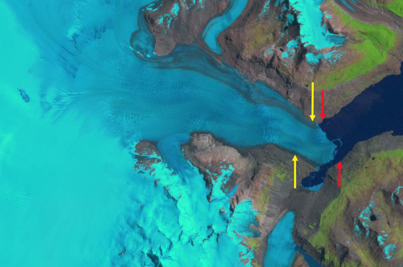
Glacier O’Higgins in 2002 landsat image, red arrow is the 1986 terminus position and yellow arrows the 2018 terminus location.
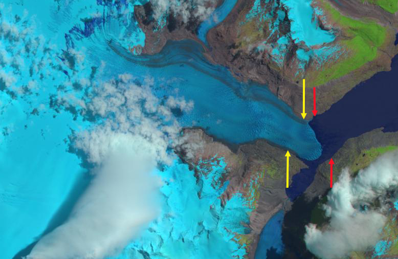
Glacier O’Higgins in 2013 landsat image, red arrow is the 1986 terminus position and yellow arrows the 2018 terminus location.
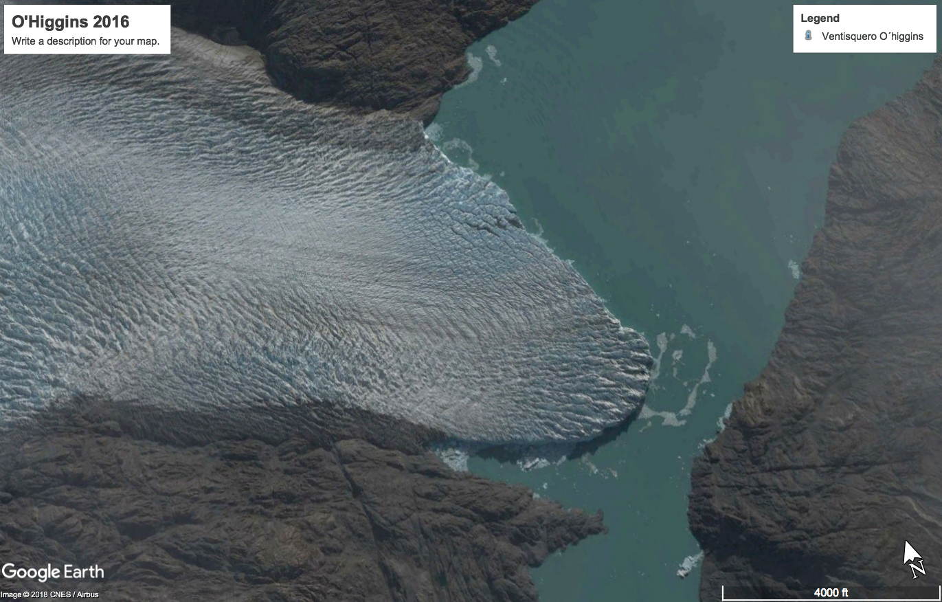
Google Earth 2016 image of Glacier O’Higgins, note the extent of crevassing that indicates vigorous flow to the calving front in 2016. Several pockets of upwelling at the calving front.
 Dean of Academic Affairs at Nichols College and Professor of Environmental Science at Nichols College in Massachusetts since 1989. Glaciologist directing the North Cascade Glacier Climate Project since 1984. This project monitors the mass balance and behavior of more glaciers than any other in North America.