
October 23, 2018
Sermip Nunataa, Greenland No Longer a Nunatak
Posted by Mauri Pelto
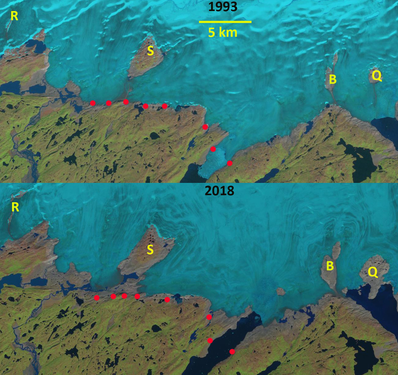
Sermip Nunataa (S) and nearby nunataks in 1993, Q, R and B in 1993 and 2018 Landsat images. Red dots indicate the 1993 margin.
Sermip Nunataa (Nunatak-Island within ice sheet glacier) was a nunatak of the southern Greenland Ice Sheet between Sermilik Brae and Sondre Qipisaqqu Brae. Here we examine changes from 1993-2018 of the margin of the ice sheet in the area and the impact on this and neighboring nunataks.
In 1993 the Sermip Nunatak was 2.5 km inland from the ice sheet margin. At Nunatak R there is a single short ridge, 1.5 km long. Nunatak Q is 3 km from margin and Nunatak B is 1.5 km from margin. By 2004 the two glacier tongues encircling Sermip are beginning to separate. Nunatak R is 2 km long. Nunatak B has expanded in length and width. Nunatak Q is now just reaching the glacier front. By 2017 Sermip is no longer a nunatak and a second ridge has formed at Nunatak R. By 2018 only one of the four nunataks remains surrounded by ice and is still an a nunatak. The mass loss and recession in this area is due to surface melt as there is very limited calving at the ice fronts. The retreat of Qaleraliq (Nunatak B and Q) and of Tasermiut are other example of local glacier retreat. Glaciers in this region have experienced substantial retreat since 1990 Weidick et al (2012) and Howat and Eddy (2011). NSIDC (2018) illustrates that 2018 had a positive melt day anomaly in this region of the GIS.
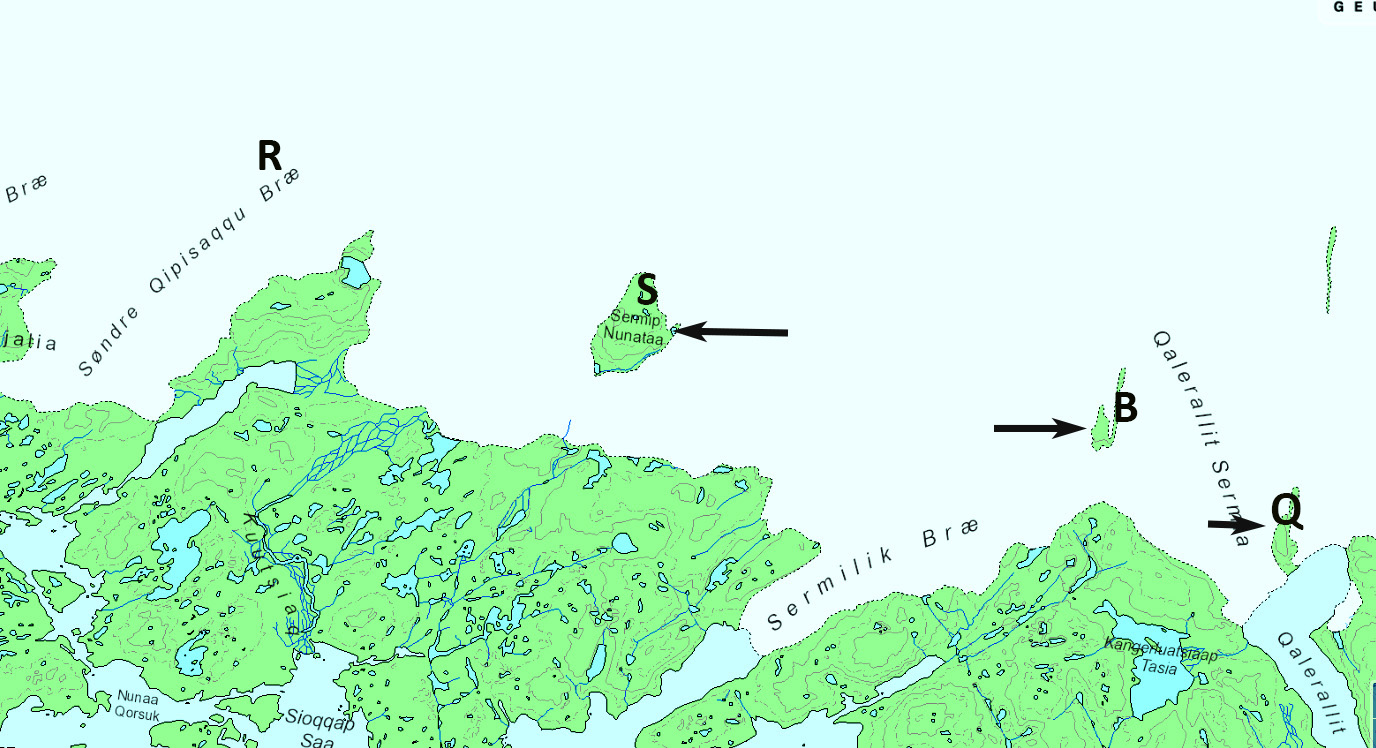
Sermip Nunataa (S) and nearby nunataks in Greeland Topographic map.
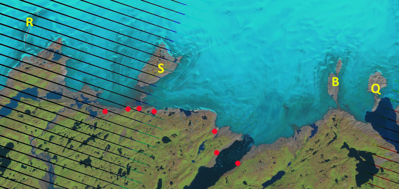
Sermip Nunataa (S) and nearby nunataks in 1993, Q, R and B in 2004 Landsat image. Red dots indicate the 1993 margin.

Sermip Nunataa (S) and nearby nunataks in 1993, Q, R and B in 2017 Landsat image. Red dots indicate the 1993 margin.
 Dean of Academic Affairs at Nichols College and Professor of Environmental Science at Nichols College in Massachusetts since 1989. Glaciologist directing the North Cascade Glacier Climate Project since 1984. This project monitors the mass balance and behavior of more glaciers than any other in North America.