
October 10, 2018
Vera Glacier, Novaya Zemlya Retreat
Posted by Mauri Pelto
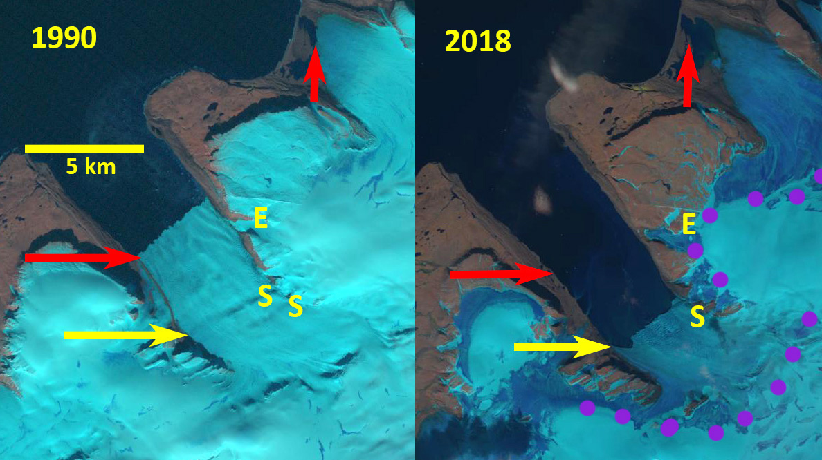
Vera Glacier in Landsat images from 1990 and 2018. Red arrow is the 1990 terminus and yellow arrow the 2018 terminus location. Purple dots indicate the snowline, E indicates the eastern tributary and S the bedrock step.
Vera Glacier is on the west coast of Northern Noyaya Zemlya terminating in a fjord Carr et al (2017) examined Novaya Zemlya glacier retreat between 1973/76 and 2015, finding that between 2000 and 2013, retreat rates were significantly higher on marine-terminating outlet glaciers than during the previous 27 years. Here we examine changes in Vear Glacier from 1990-2018 using Landsat imagery.
In 1990 the glacier terminated at the red arrow 1 km beyond a tributary entering from the east. There is a marked rib at the yellow arrow in the 1990 image, suggesting a bedrock step beneath the glacier. In 1995 the tributary from the east no longer reaches the main glacier, the terminus front has retreated several hundred meters and the snowline is at 300 m. By 2016 the terminus has retreated well south of the eastern tributary nearly doubling the length of the fjord. The terminus is now close to the bedrock step seen in the 1990 image. By 2018 the glacier has retreated The snowline is again at 300 m. By 2018 Vera Glacier has retreated 3500 m since 1990, including past a second eastern tributary. The fjord is now over10 km long. The glacier is at the bedrock step with another bedrock step 500-1000 m upglacier. Each step should indicate a reduced water depth and reduced calving. The snowline in early August in 2018 is at 300 m, but rises to 600 m by the end of the month on neighboring Inostrantseva Glacier. Pelto (2017) and Carr et al (2017) discuss the role reduced Barents Sea Ice duration played in the retreat. The retreat here is similar to that of other nearby Novaya Zemlya glaciers such as Mack and Velkena Glacier or Inostrantseva Glacier.
The glaciers in this region are also a potential source for radiation from nuclear weapons testing by Russia from 1957-1962.
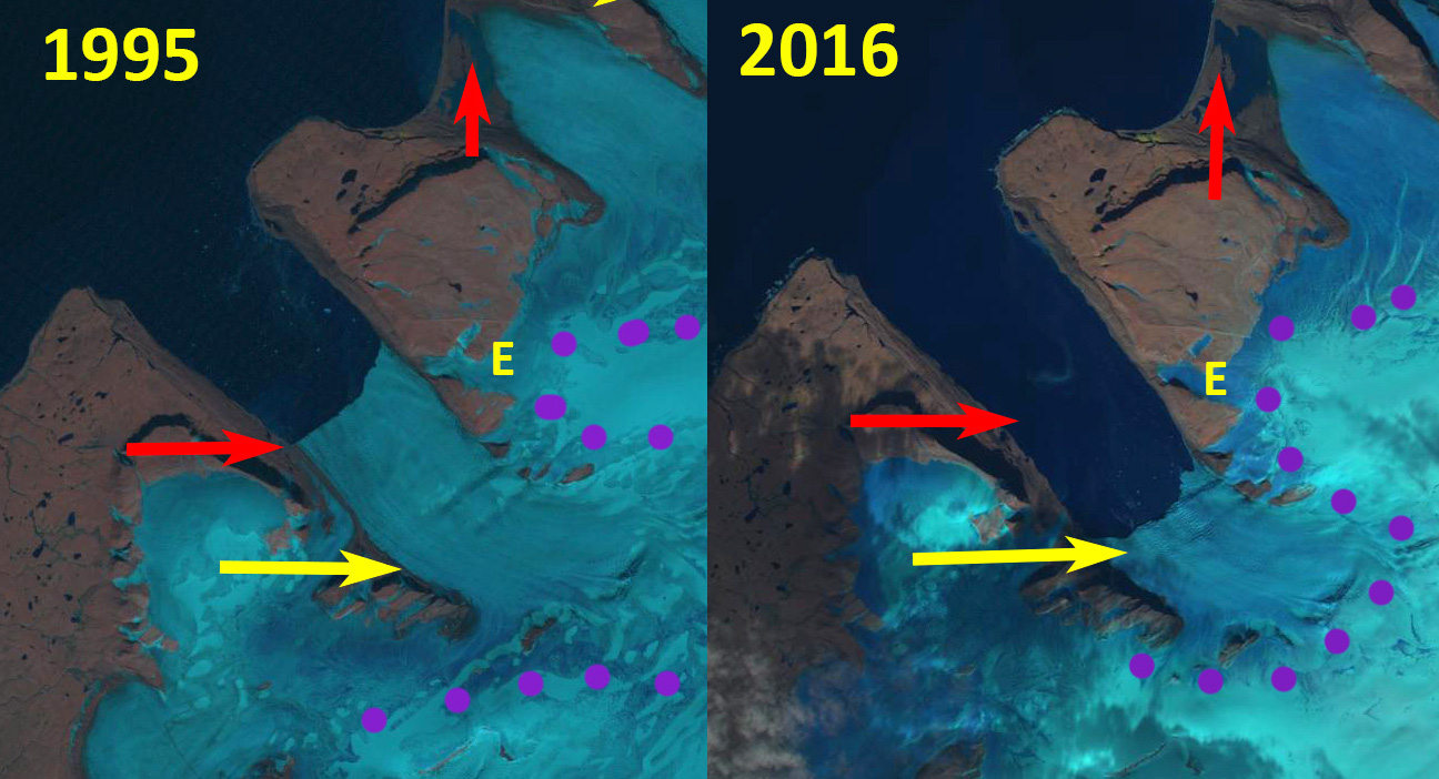
Vera Glacier in Landsat images from 1995 and 2016. Red arrow is the 1990 terminus and yellow arrow the 2018 terminus location. Purple dots indicate the snowline and E indicates the eastern tributary.
 Dean of Academic Affairs at Nichols College and Professor of Environmental Science at Nichols College in Massachusetts since 1989. Glaciologist directing the North Cascade Glacier Climate Project since 1984. This project monitors the mass balance and behavior of more glaciers than any other in North America.