
March 9, 2018
Aavatsmarkbreen, Svalbard More Calving & Less Accumulation a Deadly Recipe
Posted by Mauri Pelto
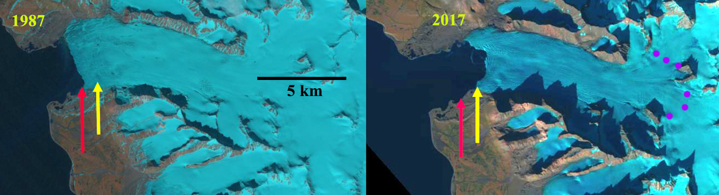
Aavatsmarkbreen, Svalbard in 1987 and 2017 Landsat images. Red arrow 1987 terminus, yellow arrow 2017 terminus and purple dots the snowline.
Aavatsmarkbreen is a tidewater glacier on the west side of Svalbard. The glacier is the fjord just south of Kongsfjord and Kronebreen Glacier. Nuth et al (2013) determined that the glacier area over the entire archipelago has decreased by an average of 80 km2 per year over the past 30 years, a 7% reduction. Here we examine Landsat imagery from 1987 to 2017.
In 1987 the glacier terminated at the red arrow and had a 4 km wide front. By 1999 the glacier had retreated 400 m with the retreat being largest in the center of the glacier. In 2015 the calving front was 3.5 km long and nearly straight from north to south. The snowline in 2015 was at 500 m. By 2017 the glacier front had developed a significantly concave front with retreat of 1400 m since 1987 in the glacier center and 700 m on the southern and northern margin. The snowline in 2017 again at 500 m. The head of the glacier is at 600 m, and a snowline at 500 m leaves much too limited an accumulation zone to sustain the glacier. A view of the terminus from Toposvalbard indicates the substantial crevassing that indicates greater ice velocity and calving the glacier center. The combination of reduced accumulation on the glacier and enhanced calving is dangerous recipe for a glacier, one that will drive further significant retreat. The retreat is less than Hinlopenbreen to the northwest and the neighboring Kronebreen Glacier
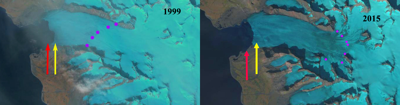
Aavatsmarkbreen, Svalbard in 1987 and 2017 Landsat images. Red arrow 1987 terminus, yellow arrow 2017 terminus and purple dots the snowline.
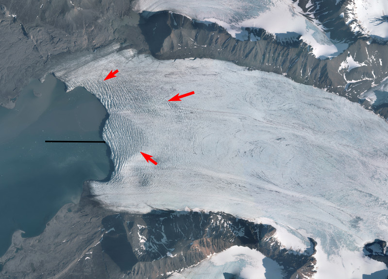
Calving front of Aavatsbreen in 2017, red arrows indicating crevassing indicating acceleration. Black line center retreat.
 Dean of Academic Affairs at Nichols College and Professor of Environmental Science at Nichols College in Massachusetts since 1989. Glaciologist directing the North Cascade Glacier Climate Project since 1984. This project monitors the mass balance and behavior of more glaciers than any other in North America.