
March 6, 2018
Rio Engaño, Chile Headwater Glacier Retreat GLOF Threat Drops
Posted by Mauri Pelto
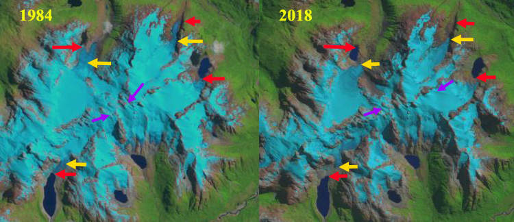
Comparison of glaciers at the headwaters of Rio Engaño in 1984 and 2018 Landsat images. The 1984 terminus location with red arrows, yellow arrows the 2018 terminus location, purple arrows wind drift patterns.
Rio Engaño drains into Lago General Carrera and its headwaters is a group of alpine glaciers. In March of 1977 one of the glaciers, generated a glacier lake outburst flood (GLOF) that reached a depth of 1.5 m at the small village of Bahía Murta Viejo 25 km down river (Anacona, et al 2015). Davies and Glasser (2012) observe that glaciers just northeast of the Northern Patagonia Icefield lost area at a rate of 0.2% per year from 1986-2011. Paul and Molg (2014) observed a more rapid retreat of 25% total area lost from glaciers in northern Patagonia from 1985-2011, the study area was north of the Northern Patagonia Icefield, including the Cordillera Lago General Carrera icefield.
Here we examine changes of four glaciers at the headwaters of Rio Engaño using Landsat imagery for the 1984 to 2018 period.
In 1984 the Northwest (NW) glacier had two terminus tongues and no lake at the terminus, red arrow. The Northeast (NE) glacier had a length of 4 km. The East (E) glacier terminated at the margin of a proglacial lake. The South (S) Glacier which experienced the GLOF, terminated on the northern end of a proglacial lake. By 2000 the NW glacier had lost its eastern terminus and a small lake is forming at the western terminus. The NE glacier had retreated 400 m. The S glacier no longer reaches the proglacial lake. In 2016 the snowline is quite high on the NW and S glacier, purple dots. The wind features, purple arrow indicate the strong wind sculpted features from the west winds. In 2018 the NW glacier no longer reaches the proglacial lake that began forming after 1984, total retreat 800 m. The NE Glacier has retreated 700 m and is now 3.3 km long. The E glacier terminates at the base of a steep slope 200 m from the proglacial lake it reached in 1984. The S glacier has retreated 600 m from the lake it reached in 1984. The NE and E glacier have substantial areas above 1600 m and have retained snowpack each year over a significant portion of the glacier. The NW and S glaciers have little area above 1600 m and in several years have retained minimal snowpack and will continue a rapid retreat.
Wilson et al (2018) documented a 43% increase in the number of glacial lakes and 7% in the area of lakes in the central and Patagonian Andes. In the Rio Engaño headwaters both the area and number of lakes has increased. The threat of GLOF in for these specific glaciers appears to be declining as the glaciers retreat further from the lakes. Iribarren et al (2014) list that glacier contact and glacier steepness adjacent to the lake are variables that raise GLOF hazards, and these factors are declining at the Rio Engaño headwaters. They also noted that the GLOF in 1977 had a volume of 7.36 million cubic meters the second largest in their record of 16 GLOF’s.

Comparison of glaciers at the headwaters of Rio Engaño in 2000 and 2016 Landsat images. The 1984 terminus location with red arrows, yellow arrows the 2018 terminus location, purple arrows wind drift patterns and purple dots the snowline in 2016.
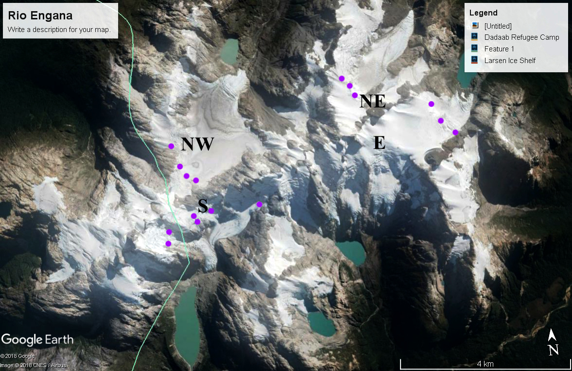
Google Earth image from 2017 indicating the snowline leaving limited snowcovered area on NW and S glacier.
 Dean of Academic Affairs at Nichols College and Professor of Environmental Science at Nichols College in Massachusetts since 1989. Glaciologist directing the North Cascade Glacier Climate Project since 1984. This project monitors the mass balance and behavior of more glaciers than any other in North America.