February 19, 2018
Pared Nord Glacier, Chile Retreat & Landslide Transport 1987-2018
Posted by Mauri Pelto
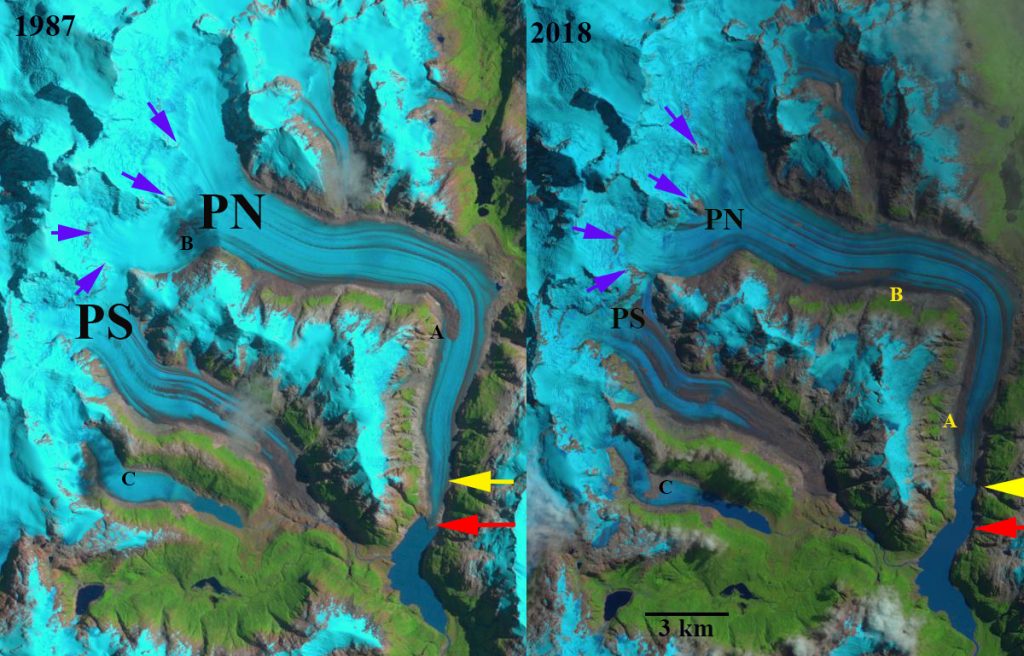
Pared Nord Glacier, Chile in 1987 and 2018 Landsat images. The red arrow indicates the 1987 terminus location, yellow arrow the 2018 terminus location and purple arrows areas of expanding rock in the lower accumulation zone. Point A is the front of a wide debris zone from a former landslide, Point B is the front of another landslide deposited debris zone. Point C is a recent landslide deposit on a an unnamed glacier. The movement f debirs at Point A and B indicate glacier velocity
Pared Nord (Norte) Glacier is a southeast outlet glacier of the Northern Patagonia Icefield (NPI). Davies and Glasser, (2012) identify this region of the icefield as retreating faster from 1975-1986 than during any measured period since 1870, the retreat since 2001 has been relatively rapid. Loriaux and Casassa (2013) examined the expansion of lakes of the Northern Patagonia Ice Cap. From 1945 to 2011 lake area expanded 65%, 66 square kilometers. Glasser et al (2016) note on Pared Nord that ice-surface debris was transported and redistributed down-ice by glacier flow merging with marginal supraglacial debris.
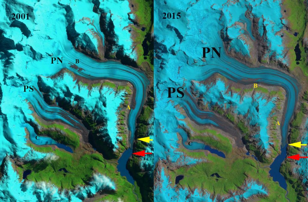
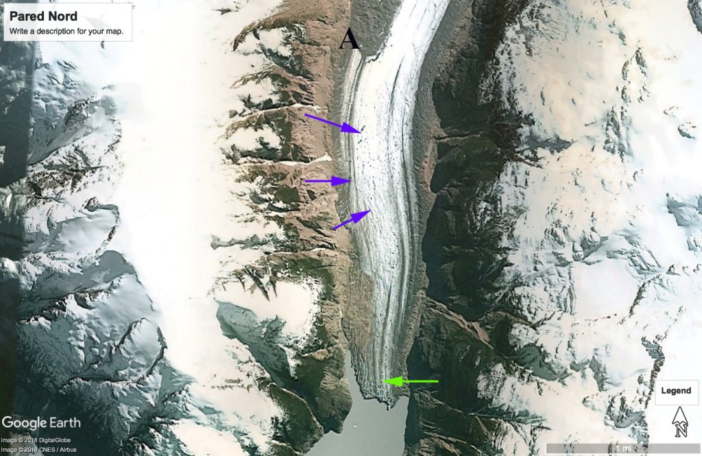
In 1987 Pared Nord Glacier terminates at a narrow point in the proglacial lake, red arrow. The debris band at Point A has just turned the corner south towards the terminus and the debris at Point B is near the snowline at the base of the icefall. By 2001 Point B had shifted 4 km downglacier entering the main glacial valley and Point A had shifted 2.5 km towards the terminus. The terminus had retreated some but was still at the narrow pinning point of the valley. In 2015 at Point C a landslide had spread across the unnamed glacier. The debris band at Point B had reached the head of a valley from the south side of the glacier. In 2018 the purple arrows indicate substantial expansion of bedrock areas near the snowline indicating a rising snowline and glacier thinning. Glasser et al (2016) note the recent 100 m rise in snowline elevations for the NPI, which along with landslide transport explains the large increase in debris cover since 1987 on Pared Nord. The main glacier terminus has retreated 1400-1500 m and is currently one kilometer from a widening of the valley, which should lead to an increased calving retreat. The glacier in 2013 has numerous glacial drainage features, purple arrow in Google Earth image below and substantial crevassing which will lead to calving at the terminus, green arrow. The movement of Point B has been ~4.8 km in 31 years, and of Point A ~3.3 km in 31 years, a velocity of 160 m/year and ~100 m/year respectively.
The retreat of this glacier is less than that of Colonia Glacier to the north and more than HPN4 glacier to the west. All the outlet glaciers of NPI have retreated in the last 30 years most leading to expanding proglacial lakes (Pelto, 2017).
Pared Nord Glacier, Chile in 2001 and 2015 Landsat images. The red arrow indicates the 1987 terminus location and yellow arrow the 2018 terminus location. Point A is the front of a wide debris zone from a former landslide, Point B is the front of another landslide deposited debris zone. Point C is a recent landslide deposit on a an unnamed glacier. The movement of debris at Point A and B indicate glacier velocity.
Pared Nord terminus in 2013 Google Earth image. Purple arrows indicate relict glacial drainage features and green arrow large crevasses near the calving front.


 Dean of Academic Affairs at Nichols College and Professor of Environmental Science at Nichols College in Massachusetts since 1989. Glaciologist directing the North Cascade Glacier Climate Project since 1984. This project monitors the mass balance and behavior of more glaciers than any other in North America.