
January 25, 2018
Blockade Glacier, Alaska Retreat Generates Expanding Lake
Posted by Mauri Pelto

Blockade Glacier in 2000 and 2017 Landsat images. Red arrow indicates 2000 terminus locations, yellow arrows 2017 terminus locations and purple dots the snowline.
Blockade Glacier drains east from the Neacola Mountains in southern Alaska. The glacier has two prominent terminus locations, the western terminus is in Blockade Lake, blocked by the glacier and the eastern terminus is in a new expanding lake at the headwaters of the MacArthur River. Arendt and Larsen (2012) assessed the glacier changes in Alaska National Parks and found in Lake Clark NP that glacier area declined by 11% from 1956 to 2008. Hallo and Spotted Glacier in the same region have had substantial retreats with lake expansion.
In 2000 the eastern terminus of Blockade Glacier terminates on an outwash plain with a narrow discontinuous fringe of open water. In 2000 and 2003 the western terminus in Blockade Lake is actively calving across the 1.5 km front, making the front difficult to distinguish. The snowline is at 1000 m. The eastern terminus has not changed since 2000 and the snowline is at 900 m. By 2016 the western terminus has retreated 600 m and with retreat the width of the calving front has increased to 1.8 km. The wider calving front along with what should be increasing lake depth should lead to a greater calving flux and retreat of the western terminus. The eastern terminus has two embayments filled with a glacier lobe. The southern lobe has collapsed opening up a a 1 square kilometer lake area. The snowline in 2016 is at 1000 m. By 2017 the eastern terminus has retreated 1200 m on the south side and 1700 m on the north side. The northern lobe has now largely collapsed like the southern lobe leading to a lake expansion of 1.5 square kilometers. The lake depth should be increasing and when the center pulls back from the outwash plain it is still grounded on, glacier retreat will increase. The snowline is at 1200 m in 2017.

Blockade Glacier USGS map, indicating the lack of a lake at the eastern terminus.
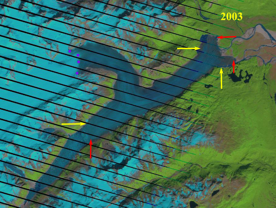
Blockade Glacier in 2003 Landsat image. Red arrow indicates 2000 terminus locations, yellow arrows 2017 terminus locations and purple dots the snowline.

Blockade Glacier in 2016 Landsat image. Red arrow indicates 2000 terminus locations, yellow arrows 2017 terminus locations and purple dots the snowline.
 Dean of Academic Affairs at Nichols College and Professor of Environmental Science at Nichols College in Massachusetts since 1989. Glaciologist directing the North Cascade Glacier Climate Project since 1984. This project monitors the mass balance and behavior of more glaciers than any other in North America.