
December 6, 2017
Zhongni Glacier Retreat, China and Hydropower
Posted by Mauri Pelto

Zhongni Glacier changes from in Landsat images from 1994 to 2015. The red arrow is the 1994 terminus, yellow arrow the 2015 terminus, purple dots the snowline and purple arrows lakes adjacent to the margin of the western glacier in 1994.
Zhongni Glacier is 15 km northwest of Gangotri Glacier just across the border into China. The glacier drains in to the Langgen Zangbo, which becomes the Sutlej River in India. The Sutlej River has a 1000 MW Karcham Wangtoo hydropower plant and a 300 MW Baspa hydropower plant (see below).
The glacier is comprised of three main tributaries separated by two prominent medial moraines. The width of the medial moraine extending to the main terminus is over 200 m. Here we use Landsat imagery to identify the glacier changes from 1994 to 2017.
The western tributary acts as a separate glacier and in 1994 has several adjacent small melt lakes, purple arrow terminating with a narrow band of ice at the red arrow. The snowline is at ~5900 m. The eastern two tributaries extends 700 m further downvalley before terminating. In 2000, there has been retreat of 100-200 m of the western tributary and main glacier, and the snowline is at 5750 m. In 2013 the snowline is at 5800 m. In 2015 the snowline is at 5750 m. By 2015 the western tributary margin has receded from the lakes at the purple arrow. The snowline in 2015 is at 5750 m. In each case the images are far from the fall and the snowline during the post-monsoon season is not the highest elevation. In 2017 there is new snowfall in late November obscuring the snowline. Overall retreat from 1994-2015 of the eastern tributary has been 500 m and of the western tributary 900 m. The western tributary has also lost 200 m of width at the purple arrow. On nearby Gangotri Glacier, India it has been observed that the ablation season has been extending through fall into early winter. The retreat is less pronounced than glaciers terminating in pro-glacial lakes such as Chutanjima Glacier.
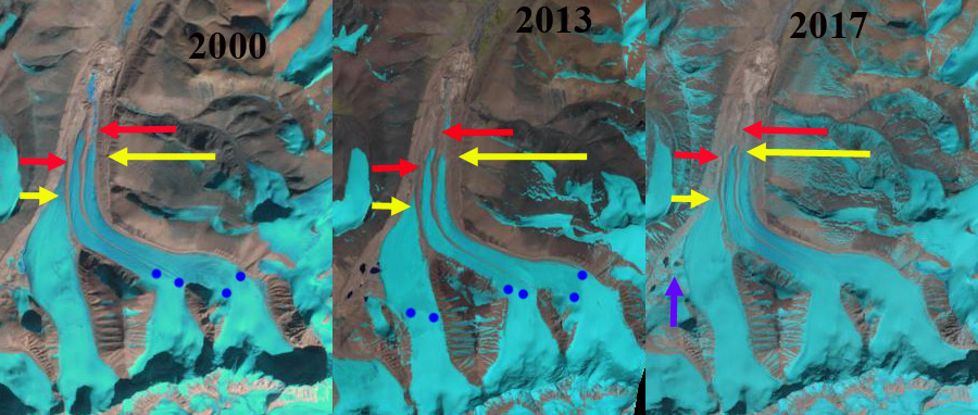
Zhongni Glacier changes from in Landsat images of 2000, 2013 and 2017. The red arrow is the 1994 terminus, yellow arrow the 2015 terminus, purple dots the snowline and purple arrows lakes adjacent to the margin of the western glacier in 1994.
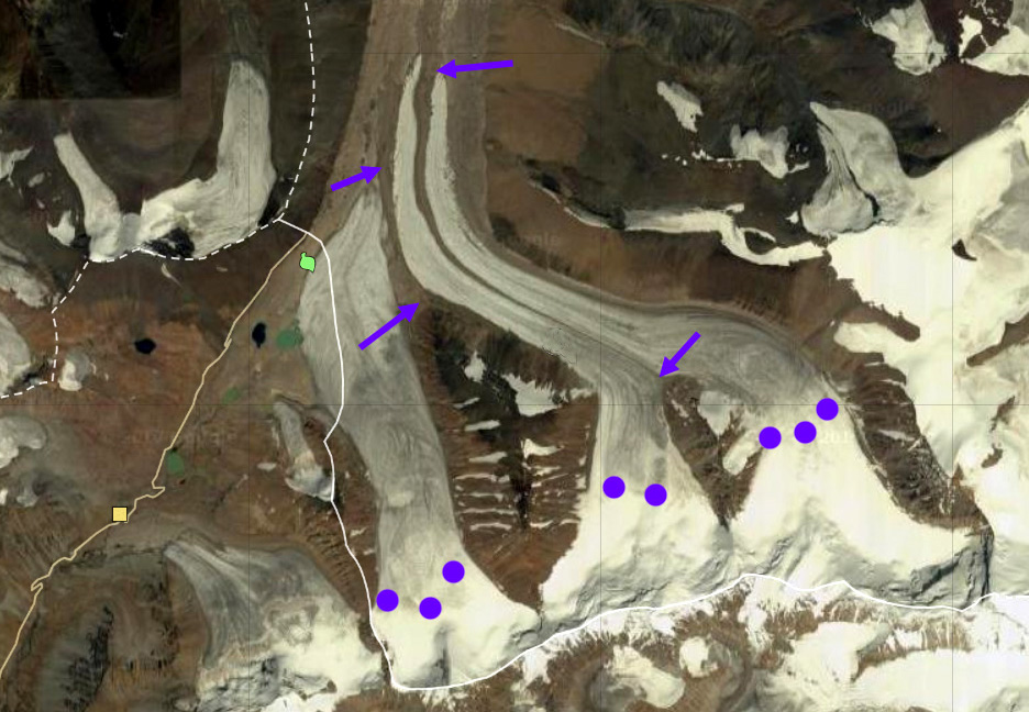
Zhongni Glacier in 2012 with the snowline at 5900 m in Digital Glacier imagery. Purple arrows indicate medial moraines.
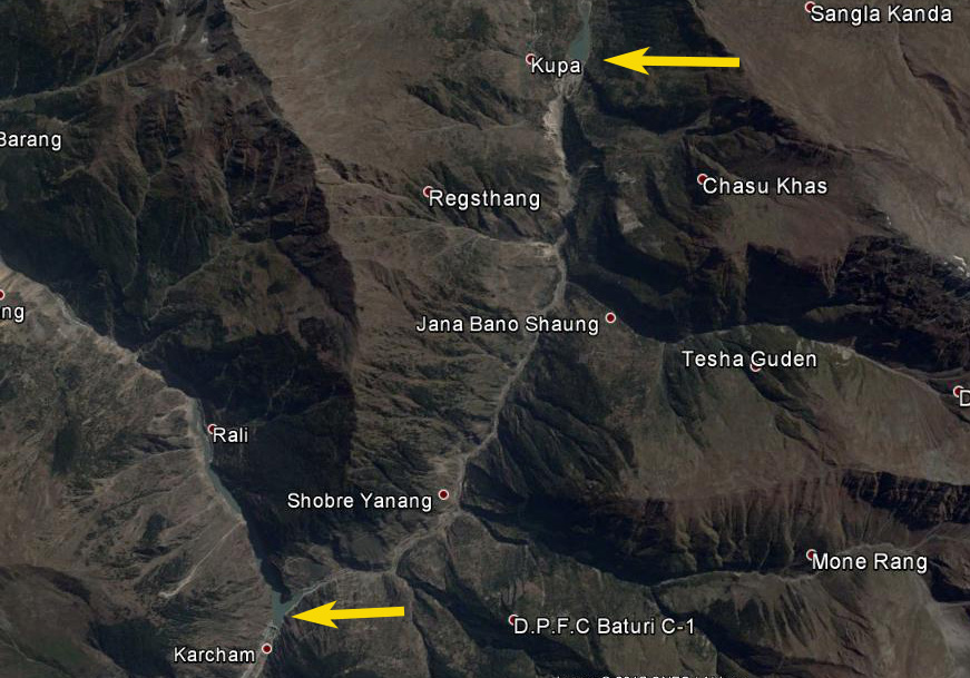
The Karcham Wangtoo Hydropower (lower yellow arrow) and Baspa Hydropwer station (upper yellow arrow) which both have small reservoirs.
 Dean of Academic Affairs at Nichols College and Professor of Environmental Science at Nichols College in Massachusetts since 1989. Glaciologist directing the North Cascade Glacier Climate Project since 1984. This project monitors the mass balance and behavior of more glaciers than any other in North America.