
June 13, 2017
Torfajökull, Iceland Accumulation Zone Demise Drives Recession
Posted by Mauri Pelto
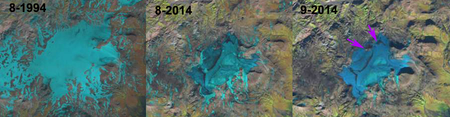
Torfajökull in 1994, adn 2014 Landsat images. Note the lack of retained snowpack in 2014 and emerging bedrock areas within icecap, purple arrows.
Torfajökull is a small ice cap north of Myrsdaljökull in Iceland. The glacier’s lowest elevation is 750 m and the highest elevation is 1150 m. This low of an elevation range in a climate driving higher snowlines places this type of ice cap at great risk for losing its accumulation zone and its ability to survive. The Iceland Glaciological Society spearheads an annual terminus monitoring program led by Oddur Sigurðsson. In 2013 the report indicates all seven glaciers in the region near Torfajokull were in retreat. In this post we look at the loss of the accumulation zone in 2014 and the longer term change in size noted by the Iceland Glaciological Society. This is not a good area for acquiring a suntan as the lack of clear imagery indicates for 2015 or 2016.
In 2006 the Iceland Glaciological Society began monitoring the terminus of this glacier, the measurement is completed at the northeastern terminus. From 2006-2014 the glacier has retreated 150 m. The monitored terminus the location where areas of bedrock have begun to emerge from beneath the thinning ice cap, purple arrows. The bedrock areas exposed within the ice cap were not evident in 1994 images or the 2000 glacier outline. The loss of glacier area from 1946-2000 in the Iceland Glaciological Society map indicates area loss around the entire margin of the icecap including the highest elevations, located on the southern margin. Recession at the head of a glacier suggests a glacier that lacks a persistent accumulation zone.
The change from 2000 to 2014 has been more pronounced on the eastern lobes that extend away from the main glacier. The loss in ice cap area from 2000-2014 is ~10%. In 2014 the glacier had 12% retained snowcover on August 12th, note Landsat image above and Google Earth below, by Sept.2014 there was no retained snowpack. There is some retained firn the lightest blue, but even this is limited indicating that the snowpack from the previous few winters had not survived over most of the glacier either.
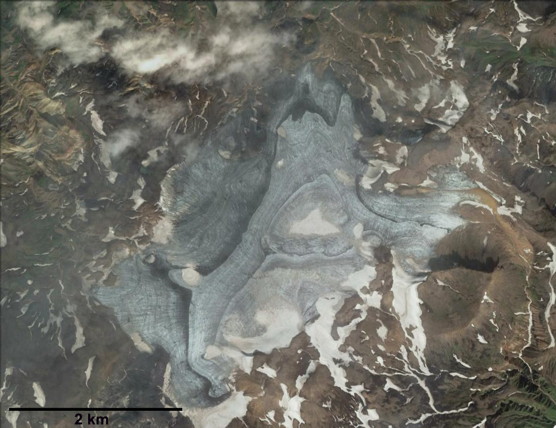
This is a recipe for glacier loss. The snowline on Aug. 12, 2014 shown below on Myrsdaljökull was at 1225 m, well above the top elevation of Torfajökull. This glacier lacks the higher accumulation zone of some smaller Icelandic ice caps such as Eiriksjökull.
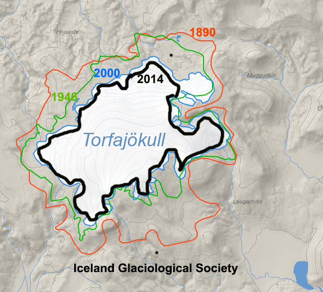
Iceland Glaciological Society map of glacier boundaries in 1890, 1946 and 2000, with the 2014 boundary added from the Landsat images above.
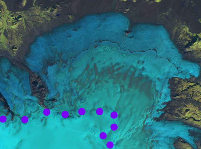
Landsat image of Myrdalsjokull on 8/12/2014 with snowline at purple dots., 1225 m.
 Dean of Academic Affairs at Nichols College and Professor of Environmental Science at Nichols College in Massachusetts since 1989. Glaciologist directing the North Cascade Glacier Climate Project since 1984. This project monitors the mass balance and behavior of more glaciers than any other in North America.