
April 19, 2017
Nuusuaq Peninsula West Greenland Glacier Disintegration
Posted by Mauri Pelto
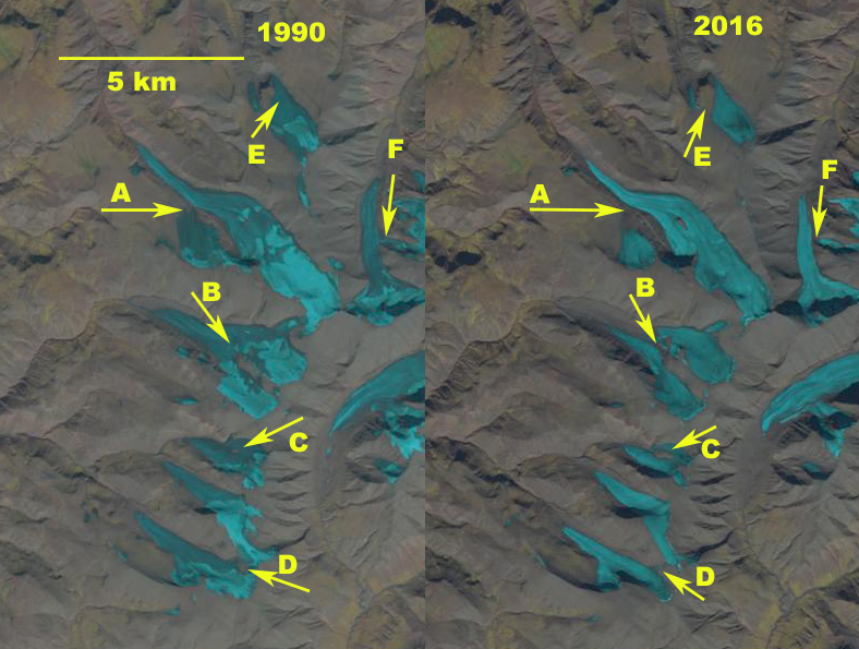
Comparison of alpine glaciers on Nuussuaq Peninsula in 1990 and 2016 Landsat images. Each arrow is at a specific location in both images exhibiting glacier separation/disintegration.
The Nuussuaq Peninsula is just north of Disko Island in West Greenland and is home to many alpine glaciers and small ice caps. Here we examine the furthest west group of alpine glaciers on the peninsula. This group is 125 km west of the ice sheet and is not influenced directly by the ice sheet, but instead is most sensitive to the conditions over the Davis Strait and Baffin Bay just 25 km away. The glaciers are near Snokpulen Peak, 1928 m. Smaller ice caps around the Greenland Ice Sheet have been losing mass. Citterio et al (2011) documented the existence of 1172 glacier in 2001 on Disko Island, Nuussuaq Peninsula and Svartenhuk Peninsula. West Greenland. Bolch et al (2013) using Landsat imagery and ICESat altimetry data noted that peripheral ice caps and glacier provided a significant fraction,~14 or 20% of the reported overall mass loss of Greenland to sea level. This is equivalent to 10% of the estimated contribution from the world’s alpine glaciers and ice caps to sea level rise. Noël et al, (2017) observed that in ~1997 a tipping point for the peripheral ice caps/alpine glaciers of Greenland occurred in terms of mass balance. The onset of a rapid deterioration in the capacity of the glaciers firn to refreeze meltwater led to mass losses and consequent glacier runoff increased 65% faster than meltwater production. Mittivakkat Glacier is an example of this trend.
Here we compare 1990-2016 Landsat images indicating the changes in the alpine glaciers near Snokpulen Peak. At Point A,B,D and F there is a glacier connection between tributaries or adjacent glaciers. At Point C and E there is an area of limited bare ground amidst the glacier. Also notice in 1990 there is retained snowpack on the glaciers. In the 2002 image below there is also retained snowpack. In 2016 there is not retained snowpack on the glaciers, indicating the lack of an accumulation zone. Without an accumulation zone there is not firn for meltwater to percolate into and refreeze. Meltwater is then not recaptured and is lost as noted by Noël et al, (2017), to be a widespread occurrence. The adjacent glaciers at Point A, B, D and F are now separated. The extent of bare ground near point C and E has expanded significantly. The area loss here underscores the volume loss of the peripheral ice caps that Bolch et al (2013) observed.
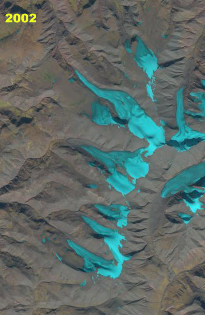
2002 Landsat image indicating some retained snowpack on the glaciers.
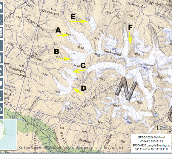
Topographic Map of the region on Nuussuaq Peninsula.
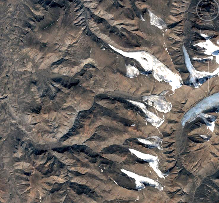
Google Earth image of region, indicating the separation/disintegration that is occurring.
 Dean of Academic Affairs at Nichols College and Professor of Environmental Science at Nichols College in Massachusetts since 1989. Glaciologist directing the North Cascade Glacier Climate Project since 1984. This project monitors the mass balance and behavior of more glaciers than any other in North America.