
January 31, 2017
Hindle Glacier Rapid Retreat Continues, South Georgia
Posted by Mauri Pelto
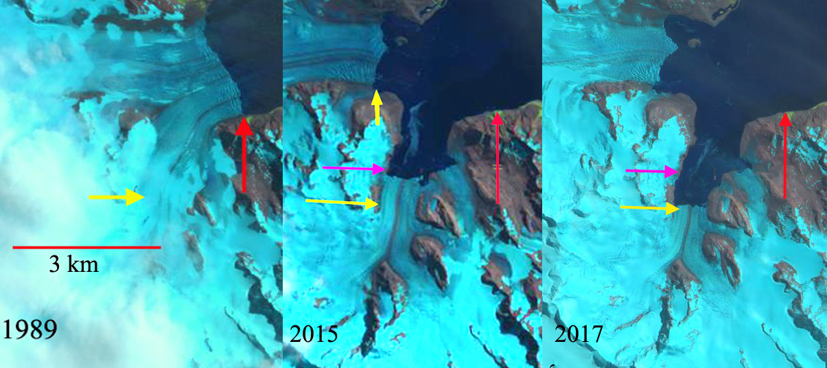
Hindle Glacier comparison in 1989, 2015 and 2017 Landsat images. Red arrow is 1989 terminus, pink arrow the 2015 terminus and red arrow the 2017 terminus location.
South Georgia is south of the Polar Front preventing any truly warm season from persisting. The cool maritime climate leads to numerous glaciers covering a majority of the island and quite low equilibrium line altitudes. Hindle Glacier enters Royal Bay on the east coast of South Georgia Island. The British Antarctic Survey (BAS) has been the principal research group examining glacier change on South Georgia Island. Cook et al (2010) and Gordon et al (2008) have emphasized that there is a pattern island wide with many calving glaciers having faster retreat. Gordon et al., (2008) observed that larger tidewater and calving outlet glaciers generally remained in relatively advanced positions from the 1950’s until the 1980s. After 1980 most glaciers receded; some of these retreats have been dramatic and a number of small mountain glaciers will soon disappear. The change in glacier termini position have been documented by Alison Cook at British Antarctic Survey in a BAS retreat map, she identified that 212 of the Peninsula’s 244 marine glaciers have retreated over the past 50 years and rates of retreat are increasing. Here we examine Landsat imagery from 1989 to 2017 to identify the rapid retreat rate. NASA Earth has piggy backed on this assessment, with excellent imagery.
For Ross-Hindle the retreat was minimal from 1960 to 1989 with the glaciers joined In 1989 the glaciers joined 2.5 km from the terminus. The glacier spanned Royal Bay with a 3.2 km wide calving front. By 2002 the glacier front had retreated 800 m, but they were still joined. By 2008 the glaciers had separated due to an additional retreat of 1.4 km. The front was now retreating south up a separate embayment from Ross Glacier. The calving front in 2008 was 1.6 km wide. By 2015 further retreat led to the separation of Hindle from an eastern Tributary at the first prominent headland in the fjord, a 1.6 km retreat in seven years. By 2017 an additional 600 m of retreat had occurred with total retreat of 4.4 km in 28 years. This is a rate of over 150 m/year, which is an exceptional rate. The exceptional retreat rate of Hindle Glacier suggests that Ross Glacier acted as a pinning point stabilizing the terminus reach of the glacier. The low surface slopes in 2017 for the lowest 3 km of the glacier suggest the fjord head is at least 3 km south of the present terminus and the calving retreat will continue until the head of the fjord is reached. This location is close to the origin of the medial moraine that runs right to the glacier front currently. This embayment will open up new areas for Gentoo Penguins and elephant seals to immigrate into. Levy et al (2016) discuss the shift and dispersal of colonies in the region, that climate change is an important driver of.
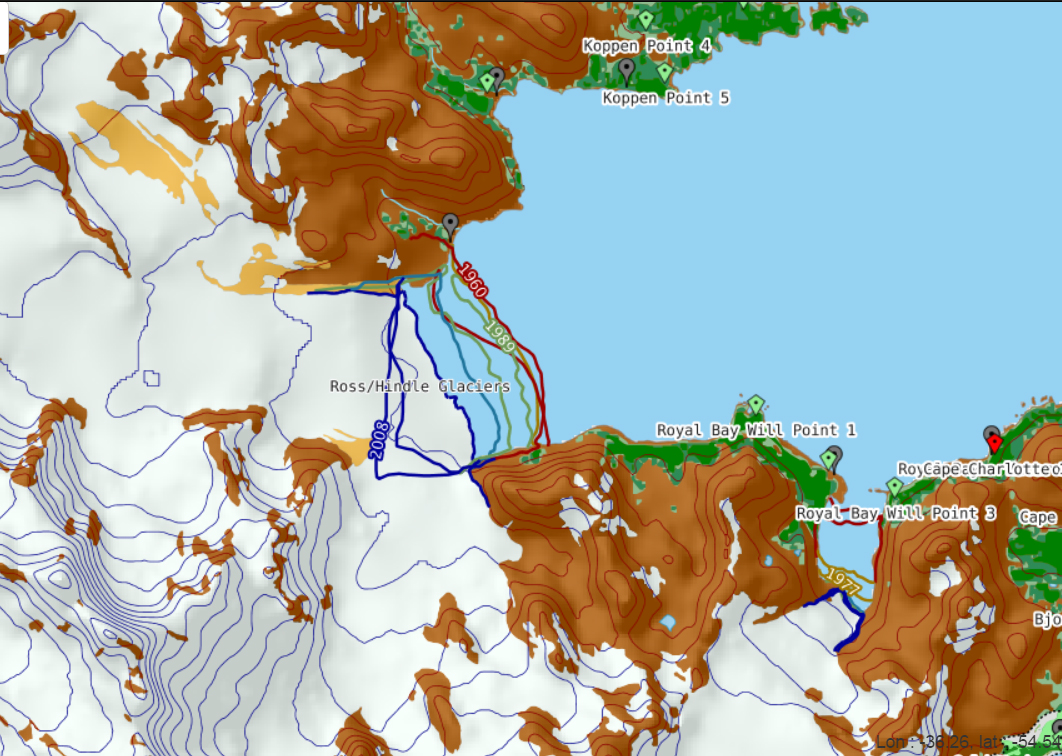
Map of terminus retreat of Ross and Hindle Glacier from the BAS. Green Pin Locations are Gentoo Penguin colonies.
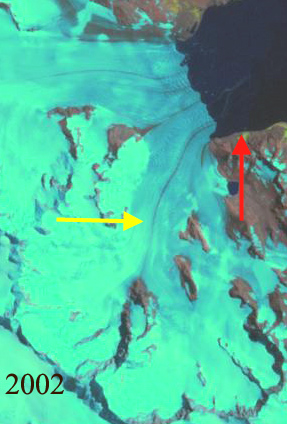
2002 Landsat image of Hindle Glacier. Red arrow is 1989 terminus and yellow arrow the 2017 terminus location.
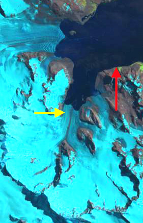
Hindle Glacier 2016 Landsat image. Red arrow is 1989 terminus and red arrow the 2017 terminus location. 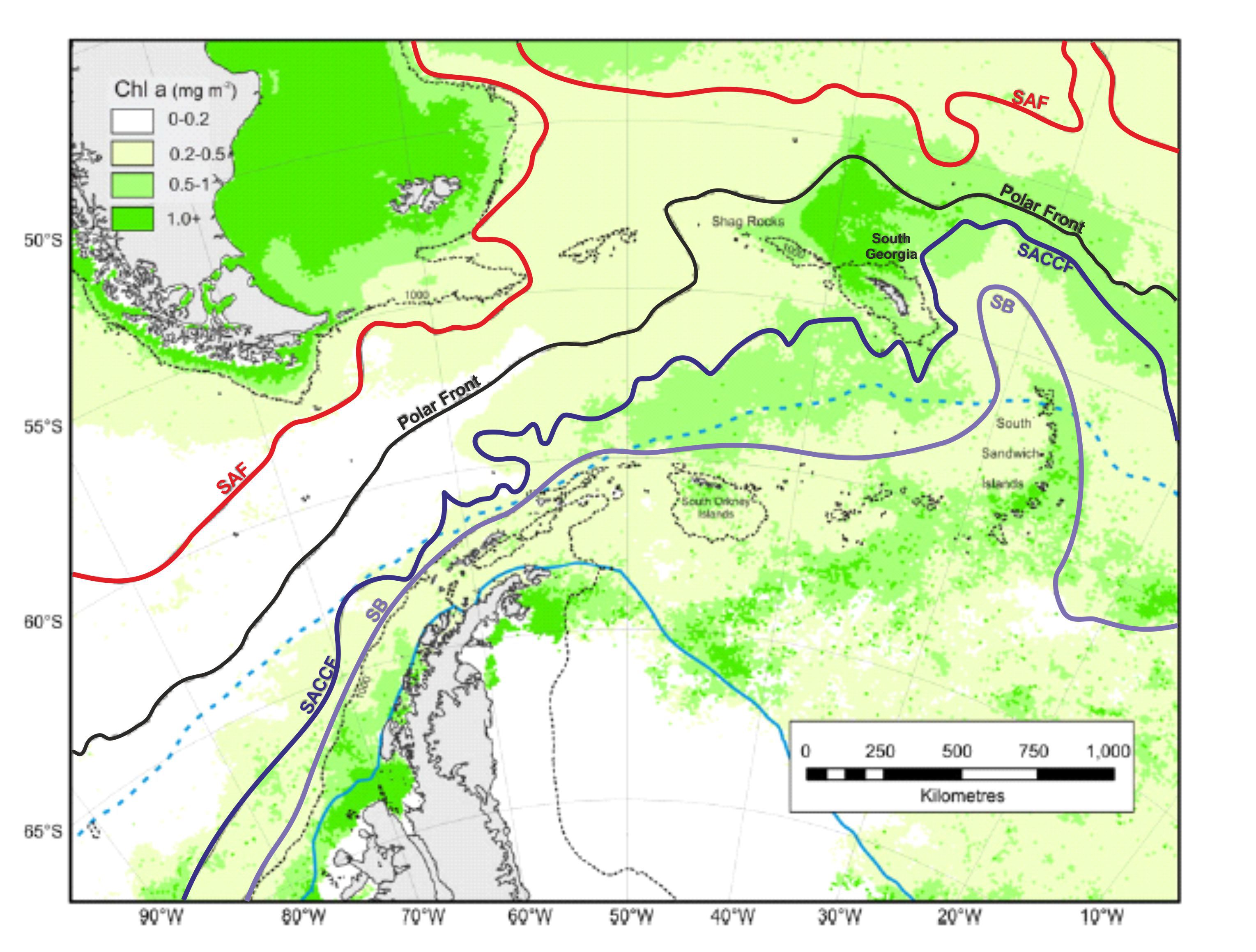
Location of South Georgia versus atmospheric and ocean circulation features (From South Georgia Future Science).
 Dean of Academic Affairs at Nichols College and Professor of Environmental Science at Nichols College in Massachusetts since 1989. Glaciologist directing the North Cascade Glacier Climate Project since 1984. This project monitors the mass balance and behavior of more glaciers than any other in North America.