October 18, 2016
Kangersuneq Qingordleq, Greenland Retreat Causes Separation
Posted by Mauri Pelto
Landsat comparison from 1999, 2001, 2013 and 2016 of Kangersuneq Qingordleq. Red arrow is 1999 terminus, yellow arrow is 2016 terminus. Purple dots mark the transient snowline and the purple arrow a detached tributary.
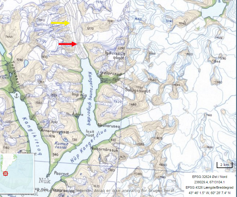
Kangersuneq Qingordleq is one of the most southerly tidewater glaciers in Greenland. It is a 15 km long glacier flowing from the mountains between Prince Christian Sound and Lindenow Fjord. It is more akin to an Alaskan tidewater outlet glacier than ice sheet fed Greenland outlet glaciers. Greenland tidewater outlet glaciers in this region have experienced substantial retreat since 1990, Weidick et al (2012) and Howat and Eddy (2011). Howat and Eddy (2011) examined 200 tidewater glaciers in Greenland from 2000 and 2010 observing that 191 had retreated, rapid retreat was observed in all sectors of the ice sheet. Moon and Joughin (2008) observed a synchronous ice sheet–wide increase in tidewater retreat from 2000–2006 versus 1992–2000, coincident with a 1.1°C increase in mean summer temperature. There was also an increased in sea surface temperature (Straneo et al, 2013). The retreat of glaciers in southern Greenland is changing the physical geography and hence physical oceanography of the fjords.
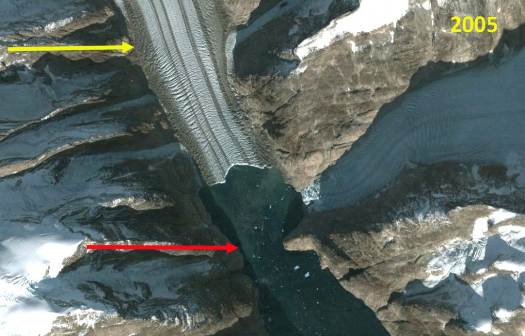
Here we examine Landsat imagery from 1999-2016 to identify recent behavior. In 1999 the glacier terminated at a narrow point in the fjord, red arrow. This location is also just beyond a junction with a tributary from the east. The fjord was just 600 m wide which would act as a pinning point restricting calving. It would not be surprising if fjord depth was also reduced here. By 2001 the glacier has retreated a short distance from the narrow point and is beginning to separate from the tributary. The transient snow line is at 950-1000 m. By 2005 the glacier had retreated 800 m and had fully separated from the eastern tributary, the ice front was 1 km wide. By 2013 the glacier has retreated into a section of the fjord that is 1.2 km wide and the transient snowline is at again at 950-1000 m. By 2016 the glacier has retreated 2.8 km since 1999. The transient snowline is 1000-1050 m in 2016, which is high enough to drive continued retreat. The fjord further widens to 1.4 km, 2.5 km behind the glacier front. This suggests that retreat will continue as there will be less sidewall stabilization. The glacier since 1999 has lost nearly 20% of its total length. To the northeast Qaleraliq has experienced a 3.2 km of its west arm and 1.2 km of its east arm from 1992 to 2012. To the northeast Tingmiarmiit Glacier retreat from 1999-2015 has led to complete separation of the western and northern tributary. The western tributary is the main glacier and has retreated 2.4 km and the northern tributary has retreated 2.2 km in the 16 year period. In the case of nearby Tasermiut Fjord retreat has led to fjord losing its tidewater connection.
Terminus of Kangersuneq Qingordleq in 2005 Google Earth image. Red arrow is 1999 terminus, yellow arrow is 2016 terminus.
Map of the region around Kangersuneq Qingordleq. Red arrow is 1999 terminus, yellow arrow is 2016 terminus.


 Dean of Academic Affairs at Nichols College and Professor of Environmental Science at Nichols College in Massachusetts since 1989. Glaciologist directing the North Cascade Glacier Climate Project since 1984. This project monitors the mass balance and behavior of more glaciers than any other in North America.