
May 6, 2016
Mittlerer Guslarferner, Austria Disintegrates 2003-2015
Posted by Mauri Pelto
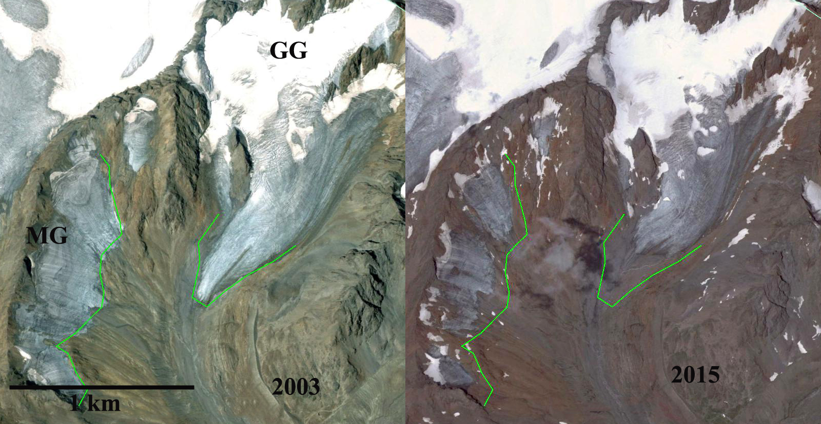
Google Earth images of Mittlerer Guslarferner (MG) and Grosser Guslarferner (GG) from 2003 and 2015. The green line is the 2003 margin.
Mittlerer Guslarferner and Grosser Guslarferner are a pair of Austrian glaciers in the Ötztal Alps. A comparison of Google Earth images from 2003 and 2015 indicates that substantial changes that have occurred in just 12 years. In this region between 1997 and 2006 Abermann et al (2009) noted an 8.2% area loss in just a decade for Ötztal Alps glaciers. The Austrian Alpine Club completes an annual terminus survey of glaciers. This survey is one of the world’s most comprehensive, and is currently directd by Andrea Fischer. The report on the 2015 inventory documents another poor year with 96% of the 92 glacier retreating. The average retreat was 26 m, with Hornkees and Gepatschferner leading the way. Abermann et al (2010) Figure 2 illustrate the beginning of the separation of MG in 2010. A comparison of the two glaciers indicates that frontal retreat has been 330 m for Mittlerer Guslarferner and 260 m for Grosser Guslarferner. The frontal changes do not tell the story for Mittlerer Guslarferner. In 2003 the glacier did not have any retained snowcover and very limited firn retained from previous years, this indicates the lack of an accumulation zone, without which a glacier cannot survive (Pelto, 2010). The glacier is continuous across a width of 1300 m and has an average length of 300 m. The glacier has disintegrated into four parts since 2003, with outcrops of rock emerging not just near the terminus, but near the top of the glacier, red arrows. In 2015 with a few weeks left in the melt season only 10% of the glacier has retained firn. Glacier area has declined by 40% in just a decade.
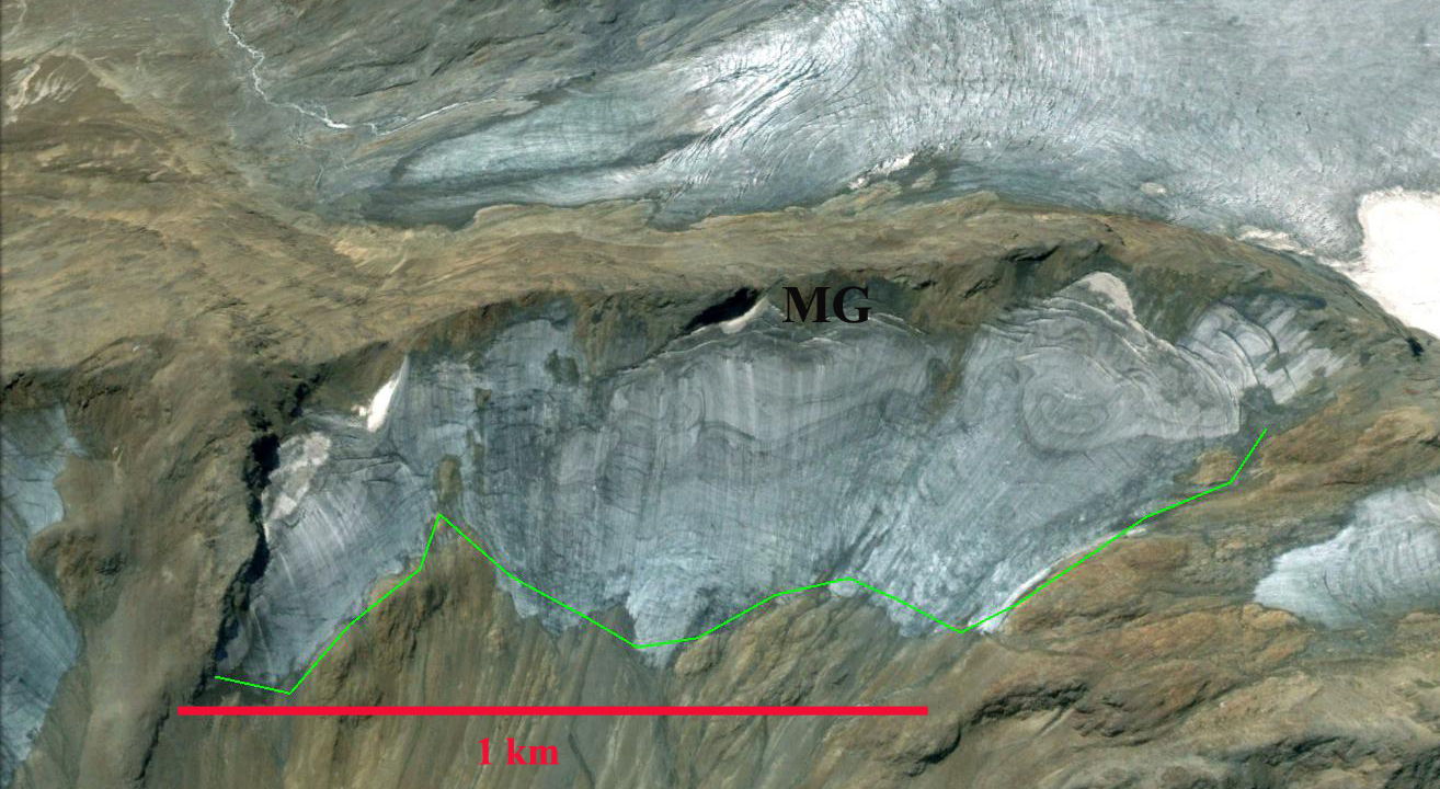
Mittlerer Guslarferner in 2003
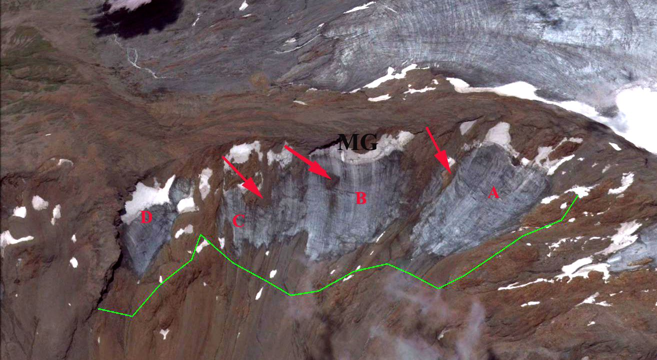
Mittlerer Guslarferner in 2015, having separated into four segments with new outcrops near top of glacier.
 Dean of Academic Affairs at Nichols College and Professor of Environmental Science at Nichols College in Massachusetts since 1989. Glaciologist directing the North Cascade Glacier Climate Project since 1984. This project monitors the mass balance and behavior of more glaciers than any other in North America.