April 24, 2016
Pacific Northwest Glaciers: Widespread early Melt Season Arrival
Posted by Mauri Pelto
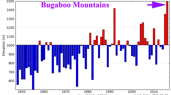
The 2016 melt season is off to an early start in Greenland, but this is not the only location. This winter proved to be warm, but relatively wet across much of the Pacific Northwest. A look at the average freezing level (determined by North American Freezing Level Tracker-Developed by John Abatzoglou and Kelly Redmond) from January 1 to April 20 indicates freezing levels well above average on Mount Baker North Cascades, Washington, Bugaboo Mountains British Columbia and Juneau Icefield Alaska. Reports from the field in British Columbia, Alaska and Washington identify a peak snowpack in late March instead of early May at glacier elevations.
In British Columbia the University of Northern British Columbia field team is currently on Conrad Glacier in the Bugaboos, having just finished Kokanee Glacier. This is part of a five-year study led by Dr. Brian Menounos, UNBC Canada research chair in glacier change, funded by the Columbia Basin Trust. UNBC PhD student Ben Pelto heads the research team. They have found that despite snowpack observations for the region from the BC River Forecast Centre of slightly above average snowpack on April 1, the high winter freezing levels and very warm April conditions have left the Kokanee Glacier snowpack quite similar to the low 2015 snowpack, with close to 4.5 m of retained snowpack. The snowmelt season was noted by the River Forecast Centre as starting several weeks early. The freezing level from January-April 20 was a record for the 1948-2016 period by over 100 m for the Bugaboo mountains. The region based on the warm spring causing rapid snow melt at lower elevations is leading many, Including John Pomeroy, to expect high forest fire danger and low streamflow during the summer across the Western Canada.
Snowpit being excavated on Zillmer Glacier April 2016, Jill Pelto and Micah May. (Ben Pelto)
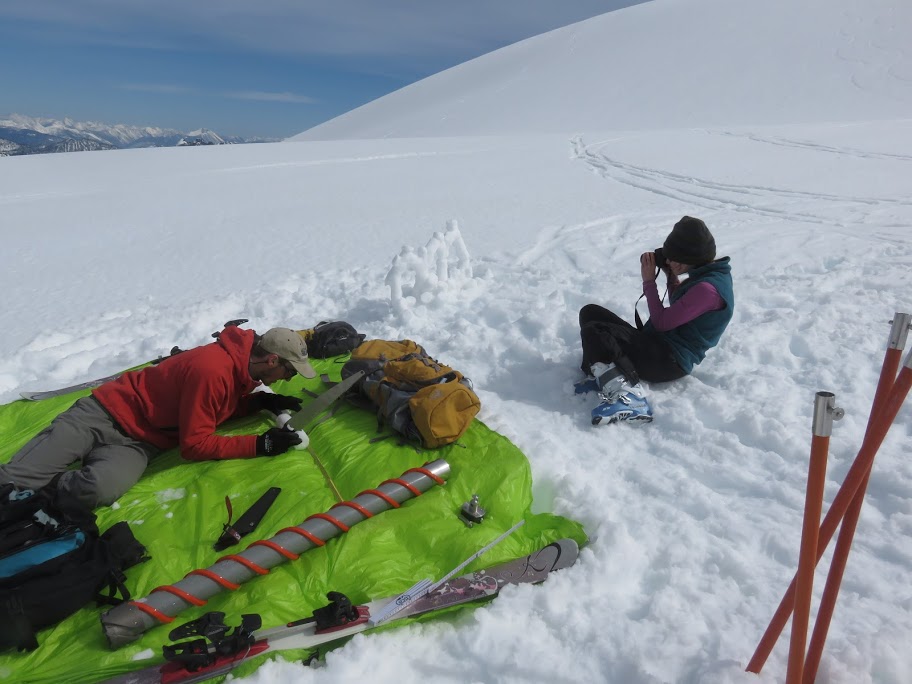
Jill Pelto and Ben Pelto measuring density of firn core on Kokanee Glacier. (Tom Hammond)
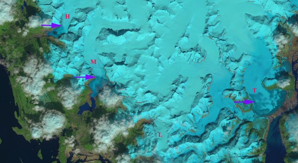
In Alaska USGS-Glaciology has been completing GPR surveys of their benchmark glaciers in recent weeks. On the Juneau Icefield Lemon Creek Glacier is a reference for the World Glacier Monitoring Service. Mass balance records exist since 1953 for this glacier (Pelto et al, 2013). In April the glaciers are typically covered head to toe by snow. The last four months indicate a freezing level of nearly 900 m a record for the 1948-2016 period of record. An April 19th Landsat image indicates the snowline on Herbert and Mendenhall Glacier at 600 m. This is below the terminus of Lemon Creek Glacier at 800 m. Near the Juneau Icefield the Long Lake Snotel site at 260 m in elevation had its snowpack drop from 64 cm water equivalent to 38 cm water equivalent in the last month.
USGS Wolverine Glacier Base Camp last week with field work underway.
April 19 Landsat image of the southwest side of the Juneau Icefield. Snowline indicated by Purple arrows. M=Mendenhall, H=Herbert, L=Lemon Creek and T=Taku Glacier.
For Mount Baker, Washington the freezing level from January-April 20 was not as high as the record from 2015, but still was 400 m above the long term mean. Observations at the base of Easton Glacier, one of our key glaciers in the North Cascades, indicate that the snowpack has declined from a depth of 4.8 m to 3.4 m during the first three weeks of April. This is mainly due to compaction, versus snow water equivalent loss, but still represents the rapid densification that occurs as snowmelt begins in earnest.
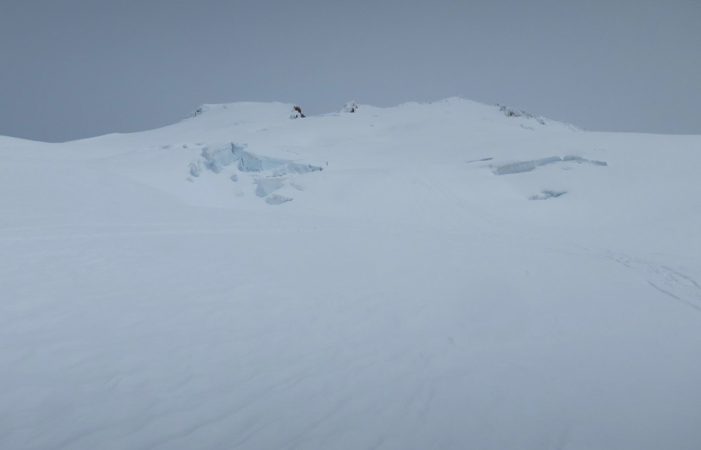
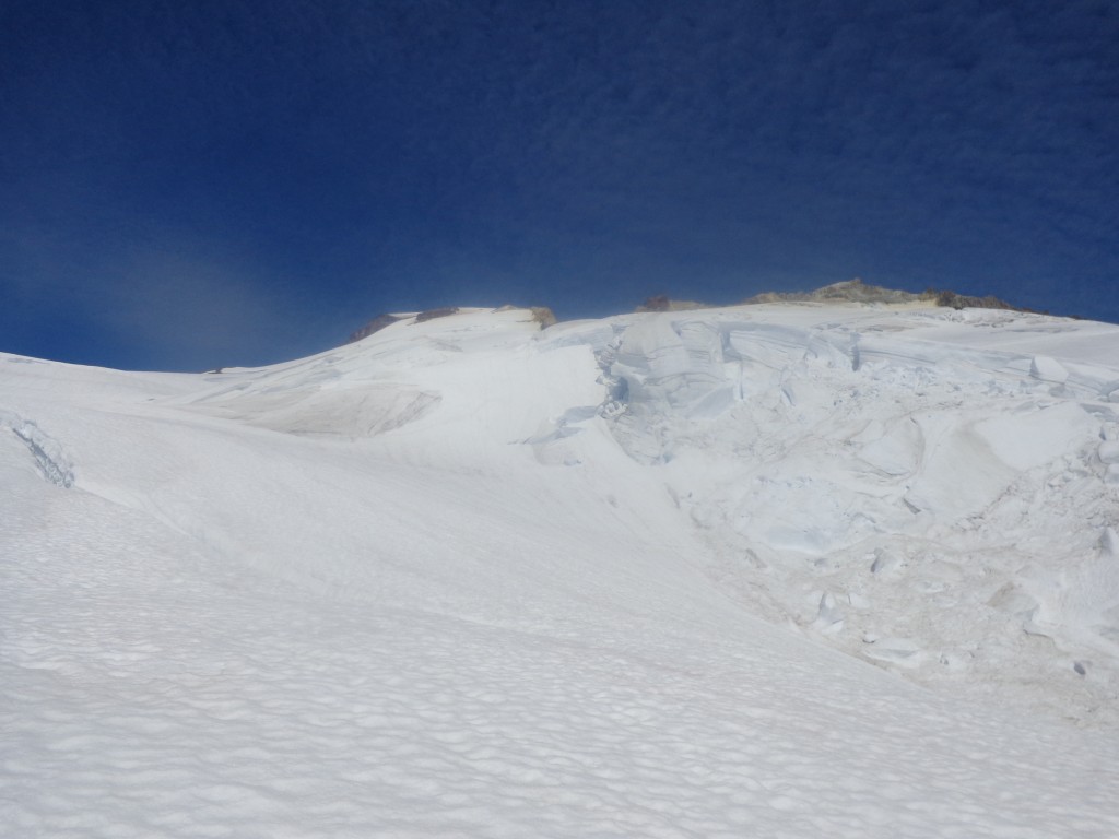
April 2016 image from icefall on Easton Glacier at 2500 m above (Adam Dunn) and in August below same area (Jill Pelto).




 Dean of Academic Affairs at Nichols College and Professor of Environmental Science at Nichols College in Massachusetts since 1989. Glaciologist directing the North Cascade Glacier Climate Project since 1984. This project monitors the mass balance and behavior of more glaciers than any other in North America.