
October 8, 2015
Yoho Glacier, British Columbia Accumulation Zone Woes
Posted by Mauri Pelto
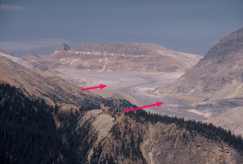
Yoho Glacier in 2005 no accumulation zone in sight.
Yoho Glacier is the largest southern outflow draining the south from the Wapta Icefield in the Kootenay region of British Columbia. It flows 6.5 km from the 3125 m to a terminus at 2200 m. The glacier terminus reach is thin, gently sloping and uncrevassed poised for continued retreat. An exploration of Mount Balfour in 1898 a party led by Professor Jean Habel with the packer Ralph Edwards as a guide were the first to visit and describe Yoho Glacier. There descriptions of the magnificent Takakkaw Falls down river of the glacier quickly led to it becoming a frequent destination of visitors. The glacier was also accessible. Retreat up a steep slope at 2000 m made actually visiting the glacier difficult in the middle of the 20th century. The glacier has retreated 2.1 km in the last century leaving a vast area of bare terrain, dotted by several small new alpine lakes. Here we examine changes in the glacier from 1986 to 2015 with Landsat imagery.
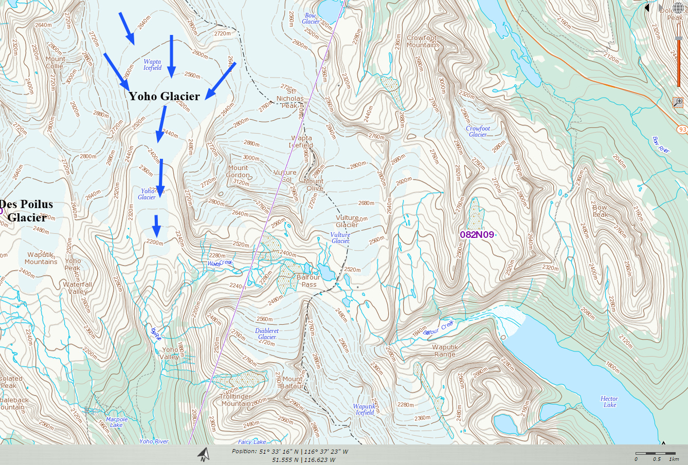
CanadianTopographic map
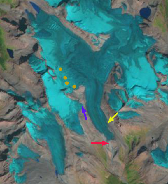
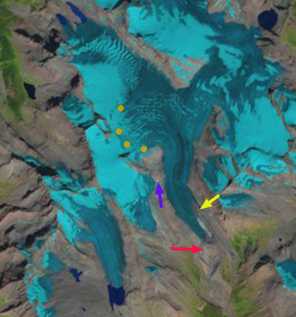
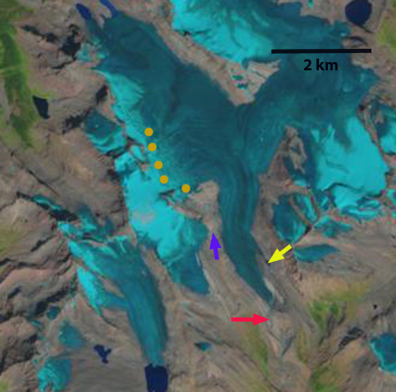
In 1986 the glacier terminated in a broad 500 m wide glacier terminus at 2150 m, red arrow, the glacier tongue remained wide up to the yellow arrow, 800 m. A tributary connected to the glacier at the purple arrow, and the glacier snowline, orange dots was at 2550 m. In 1998 the terminus had not retreated significantly, but had narrowed noticably. The tributary at the purple arrow was no longer connected and the snowline was at 2750 m, leaving little of the glacier snowcovered, which equates to a significant mass loss. In 2013 the snowline again was high at 2700 m. In 2015 the glacier terminus has retreated 300 m since 1986 and is only 250 m wide. The width at the yellow arrow is 450 m. The width reduction is an indicator of how much the glacier has thinned. The snowline is at 2800 m in this mid-August image, clinging only to the high slopes of Mount Collie, and would still rise for several more weeks in the summer. The nearby Peyto Glacier has an annual mass balance record indicating a thinning of 25 m during this period (Kerhl et al, 2014). A glacier typically needs more than 50% of its area to be in the accumulation zone at the end of the summer to be in equilibrium. In recent years when the snowline exceeds 2700 m less than 10% of the Yoho Glacier is in the accumulation zone. If the snowline is as high as it has been recently on Yoho Glacier, that indicates the lack of a significant accumulation zone and it cannot survive even current climate. However, in both cases the Peyto and Yoho Glacier are rapidly losing volume, but remain substantial in size and are not on the verge of disappearing in the next few decades. The retreat is similar to that of Des Poilus Glacier shown in the lower left of the Landsat images here.
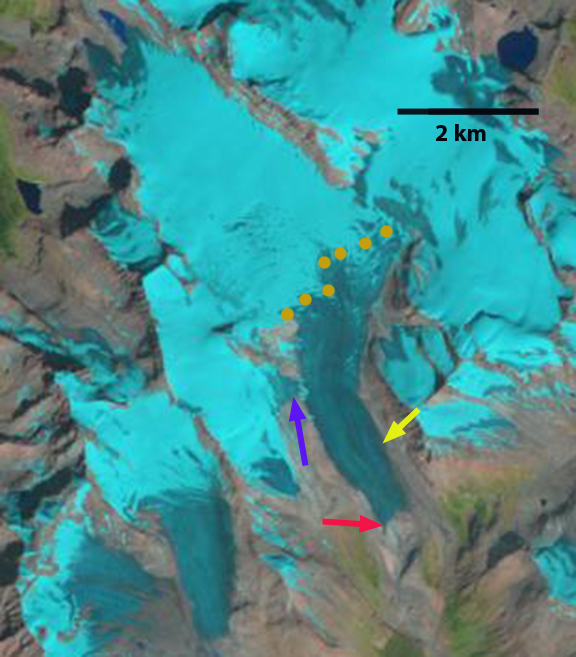
1986 Landsat Image
1998 Landsat Image
2013 Landsat image
2015 Landsat image
 Dean of Academic Affairs at Nichols College and Professor of Environmental Science at Nichols College in Massachusetts since 1989. Glaciologist directing the North Cascade Glacier Climate Project since 1984. This project monitors the mass balance and behavior of more glaciers than any other in North America.