
July 15, 2015
Samarinbreen, Svalbard Rapid Retreat 1990-2014
Posted by Mauri Pelto
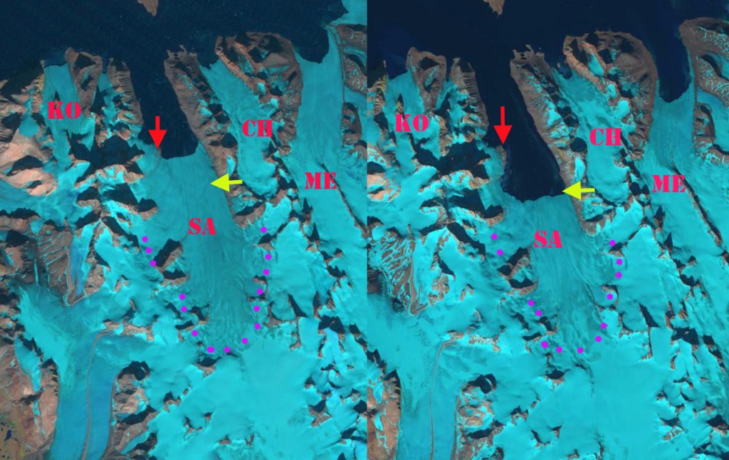
Samarinbreen (SA) 1990 left, and 2014 right, Landsat image comparison. KO=Korberbreen, CH=Chomjakovbreen,
ME=Mendeleevbreen Red arrows indicate 1990 terminus position, yellow arrows 2014 terminus. and purple dots the snowline.

Samarinbreen terminated in a calving front in Samarinvagan, a bay on the southern side of Hornsund Fjord. Hornsund is a fjord that in 2015 almost cuts through the southern Island of Svalbard, due to the retreat of Hamberbergbreen and Hornbreen. The Institute of Geophysics Polish Academy have maintained a Polish Research Station in Hornsund since 1957. The 1984 map, from the University of Silesia, of the glaciers and geomorphology document the extent of the glaciers in 1983 in the region. Blaszczyk et al (2009) analysis identified 163 Svalbard glaciers that are tidewater with the total length calving ice−cliffs at 860 km for the 2001-2006 period. They observed that 14 glaciers had retreated from the ocean to the land over the last 3-4 decades. Nuth et al (2013) determined that the glacier area over the entire archipelago has decreased by an average of 80 km2/year over the past 30 years, a 7% reduction.In the most recent period 1990-2007, terminus retreat was larger than in an earlier period from 1930-1990, while area shrinkage was smaller. A more detailed examination by the same researchers, Blaszczyk, Jania and Kolondra (2013) reported the total area of the glacier cover lost in Hornsund Fjord area from 1899–2010 was approximately 172 km2. The average glacier area retreat increased from a mean of 1.6 square kilometers per year to 3 square kilometers per year since 2000. Samarinbreen begins near the height of land of Sorkappland sharing the divide with Olsokbreen at an elevation of below 400 m.
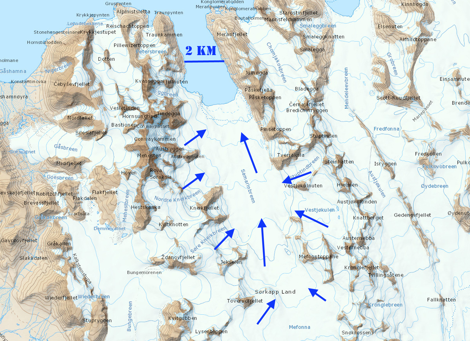
Map from Topo Svalbard
Samarinbreen retreat is documented by the map produced by the University of Silesia; 1936-1949 retreat equals 750 m, 1949-1961 retreat equals 1200 m, 1961-1983 retreat equals 1700 m. Landsat imagery from 1990-2014 illustrates that the retreat of the glacier has been 2.1 km. The 1990 terminus is indicated by the red arrow, and the 2014 terminus is the yellow arrow. The tidewater front shows limited icebergs from calving in all images I have reviewed, yet calving must be a key means of volume loss. The snowline in 1990 is between 300 m in 1900. In 2014 the image is earlier in the melt season, but is at at 275 m. The 2012 image of the terminus region illustrates the snowline again near 300 m. There is limited glacier area above 400 m, indicating the high snowfall and low melt rate of the region allowing a glacier to have such a low mean elevation. That the snowline is consistently so close in elevation to the highest section of the glacier indicates that mass loss will continue as will retreat.
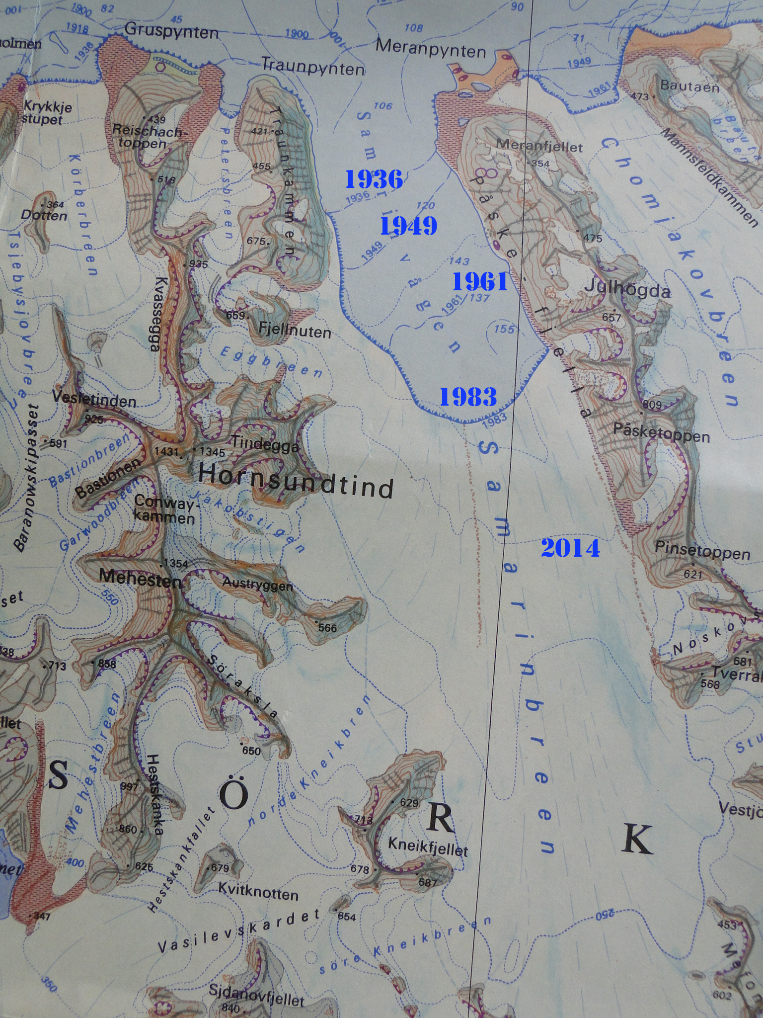
University of Silesia Map of Hornsund

Samrinbreen 2012 image from Topo Svalbard, red arrow indicates new island.
 Dean of Academic Affairs at Nichols College and Professor of Environmental Science at Nichols College in Massachusetts since 1989. Glaciologist directing the North Cascade Glacier Climate Project since 1984. This project monitors the mass balance and behavior of more glaciers than any other in North America.