
December 23, 2014
Marinelli Glacier Retreat, Chile
Posted by Mauri Pelto
Marinelli Glacier, Chile is the largest glacier of the Cordillera Darwin Icefield. This ice cap is in Tierra del Fuego, a region famous for cloudy, stormy weather. Fernandez et al. (2011) indicate that rapid retreat particularly since 1945 has led to high erosion and sedimentation rates. They also provide an excellent diagram of the glacier from three time periods. The glacier extended to the Little Ice Age-Neoglacial moraine at the red arrow. Koppes et al (2009) indicate a retreat of 13 km from 1960 to 2005, 300 m/year.
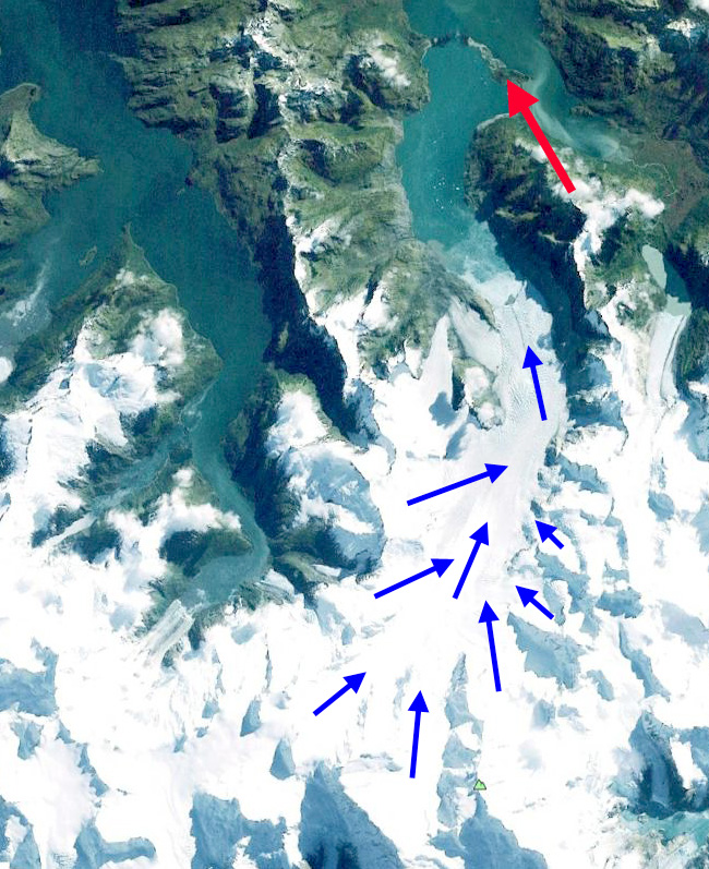
Marinelli Glacier in Google Earth
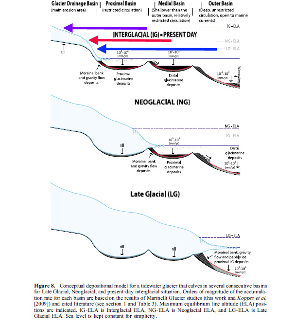
Cross section of glacier from Fernandez et al (2011)
Melkonian et al (2013) note widespread thinning with a peak on Marinelli Glacier. They also note frontal velocities of 7.5 m/day to 10.5 m/day from 2000 to 2011. They note approximately a 4 km retreat during this period and an average accumulation area ratio (AAR) of 38 (Melkonian et al, 2013). A non-calving glacier needs an AAR over 50 and typically over 60, since calving is an additional loss, calving glaciers typically need an AAR above 70 (Pelto, 1987).
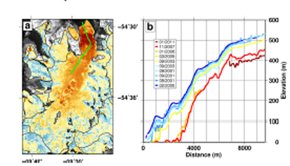
Change in thickness on Marinelli Glacier from Melkonian et al. (2013)
Here we examine Landsat imagery from 1998 to 2014. In 1998 Marinelli Glacier had a main calving tidewater terminus and a land based terminus, red arrow. The tidewater terminus extends beyond the land based terminus. The land based terminus is connected to a tributary at the pink arrow. A tributary from the east is connected to the main glacier at the purple arrow. The yellow arrow is the 2014 terminus position. By 2001 the tidewater terminus has retreated up fjord of the land terminating terminus. The tributary on the west is still connected with the land terminating section of the glacier. By 2008 the main terminus has retreated exposing a new island in the center of the calving front. The land terminating section is now separated from the main glacier and with no supply of new ice will melt away, orange arrow. The tributary from the west is separated from the land terminus now at the pink arrow. The east tributary sill has a connection at the purple arrow to the main glacier. By 2014 the island at the main terminus has expanded in size as the glacier has retreated. The east tributary at purple arrow is separated from the main glacier. The isolated stagnant former land based terminus section between the red and orange arrows continues to melt away. The tidewater terminus of the glacier has retreated about 3.75 km from 1998 to 2014. This is a rate of less than 300 m/year the long term average. The glacier will not stop retreating until its AAR rises and the calving margin reaches a pinning point. In this case there is no lateral pinning point apparent, hence it will have to be a rise in the elevation of the base of the glacier. The velocity and thickness change profile indicate such a location may exist 3-4 km behind the current calving front. This glacier is retreating faster than the other glaciers of this icefield and is more in line with glaciers in the Southern Patagonian Icefield such as, Onelli Glacier, Glaciar Steffen, Glaciar Chico and Jorge Montt Glacier.

Landsat image 1998

Landsat image 2001

Landsat image 2008
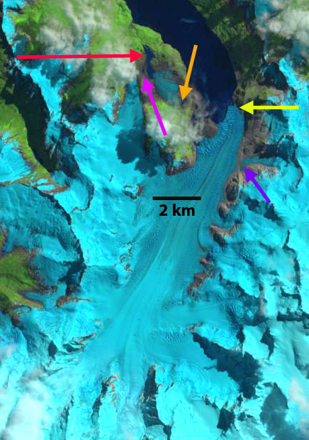
Landsat image 2014
 Dean of Academic Affairs at Nichols College and Professor of Environmental Science at Nichols College in Massachusetts since 1989. Glaciologist directing the North Cascade Glacier Climate Project since 1984. This project monitors the mass balance and behavior of more glaciers than any other in North America.