
November 20, 2014
Kuh-E Myana Glacier Retreat, Afghanistan
Posted by Mauri Pelto
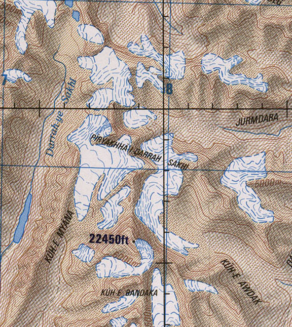
Kuh-E Myana Glacier is in Hindu Kush Range in Badakhshan Province of northeast Afghanistan. This region of the Hindu Kush has not been the focus of detailed glacier study. Northeast of Takhar Province in the Wakhan Corridor a group of glaciers was examined by Umesh Haritashya and others (2009) and found 28 of thirty had retreated. Examples are Zemestan Glacier and Tchap Dara Valley. The Hindu Kush follows the pattern of the high mountains of central Asia including the Himalaya

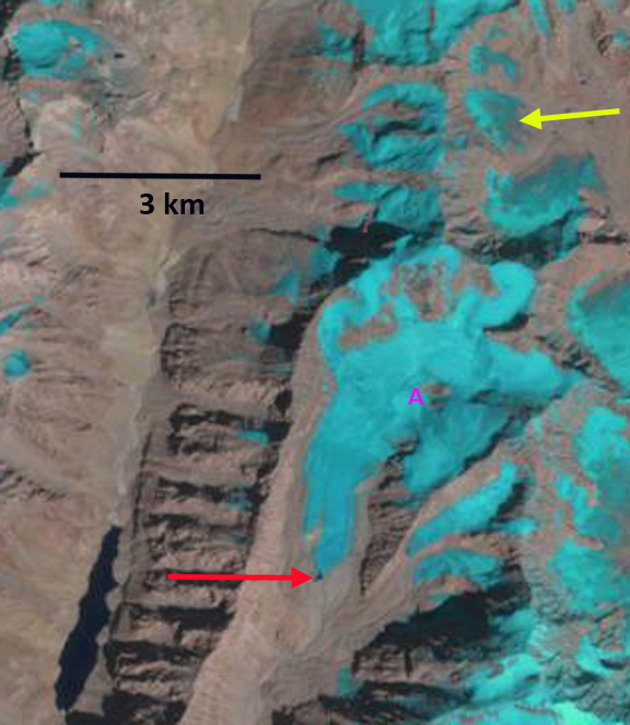
2004 Google Earth image
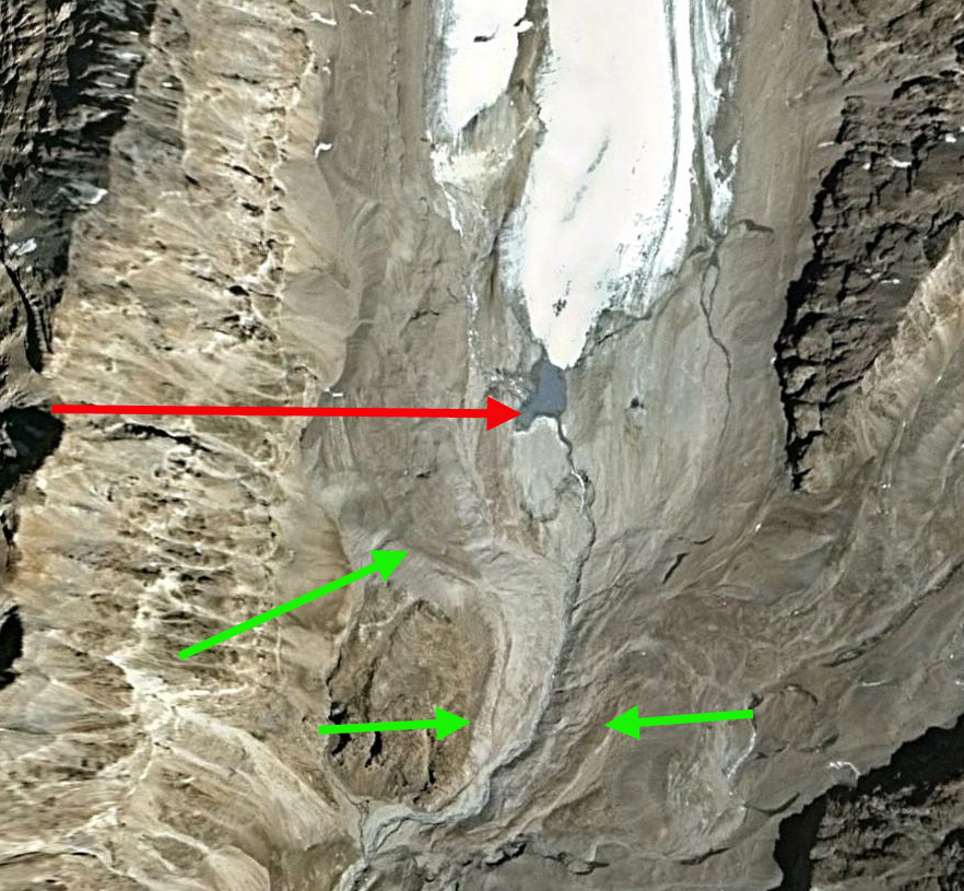
Here we examine the changes of the glacier from 1998-2014 using Landsat imagery. In 1998 the glacier ended in a small proglacial lake, red arrow. A nunatak is at Point A. In 2002 the glacier still reaches the edge of the proglacial lake. A small niche glacier is indicated by the yellow arrow. The 2004 Google Earth image indicates an expansion of the proglacial lake, and that the glacier terminus is quite thin. By 2014 the glacier has retreated 250 from the proglacial lake, red arrow. The majority of this retreat has occurred in the last decade. The glacier has retreated 1200 m from the Little Ice Age moraines to the 2004 terminus, green arrows on 2004 terminus image. The retreat since 2004 is much faster than the overall retreat. The nunatak at Point A has expanded. The niche glacier at the yellow arrow has developed a pair of substantial bedrock gaps as the thinning glacier disappears. 
1998 Landsat image
2002 Landsat image
2004 Google Earth Image
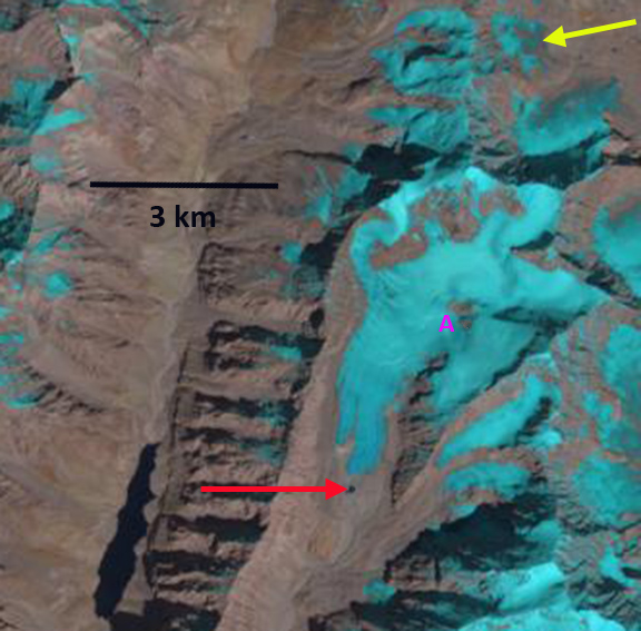
2014 Landsat image
 Dean of Academic Affairs at Nichols College and Professor of Environmental Science at Nichols College in Massachusetts since 1989. Glaciologist directing the North Cascade Glacier Climate Project since 1984. This project monitors the mass balance and behavior of more glaciers than any other in North America.