
October 12, 2014
Ferebee Glacier Rapid Retreat, Alaska 1986-2014
Posted by Mauri Pelto
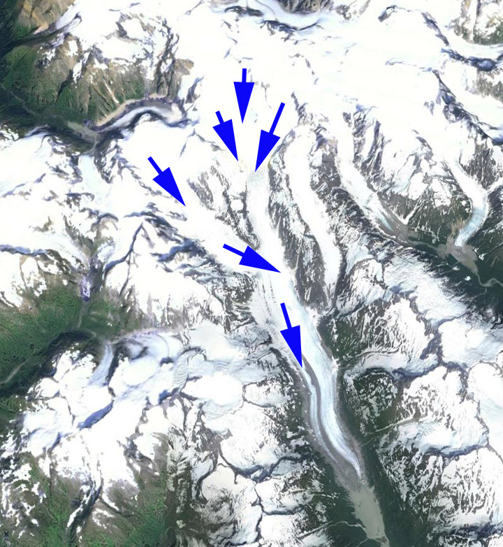
Ferebee Glacier is in the Coast Range of Alaska 15 km northeast of Skagway. The Ferebee River that drains the glacier flows into the Chilkoot Inlet. The glacier begins at 1800 m in the Klukwah Mountains and flowed south and terminated on an outwash plain at 200 m in the USGS map of the region from 1955. Little change in the terminus occurred prior to 1981. I observed the glacier from the air in 1981 and there was no lake at the terminus and only a minor several hundred meter wide devegatated zone from recent retreat. Here we examine Landsat imagery from 1986-2014 to identify recent change. A landslide occurred onto Ferebee Glacier in 2014, that will add debris cover to the surface that is limited today.
Google Earth image

USGS map of area
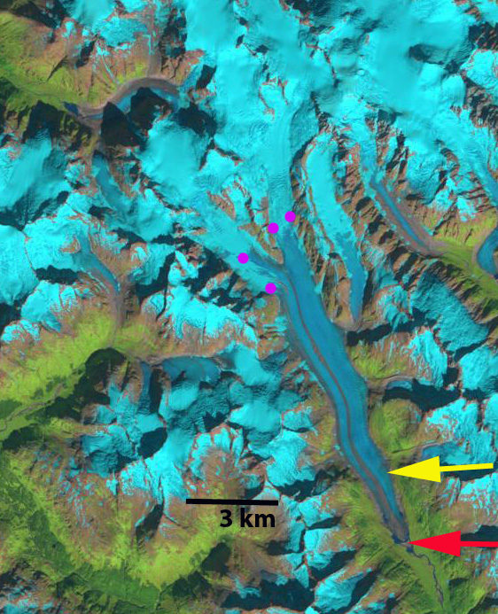
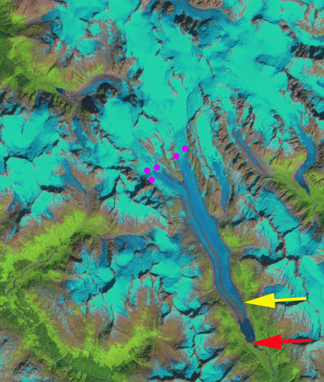
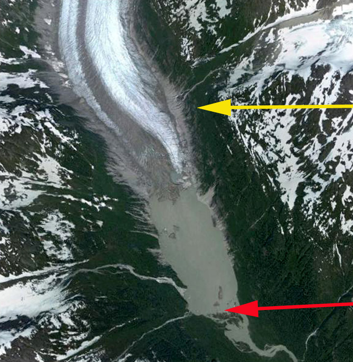
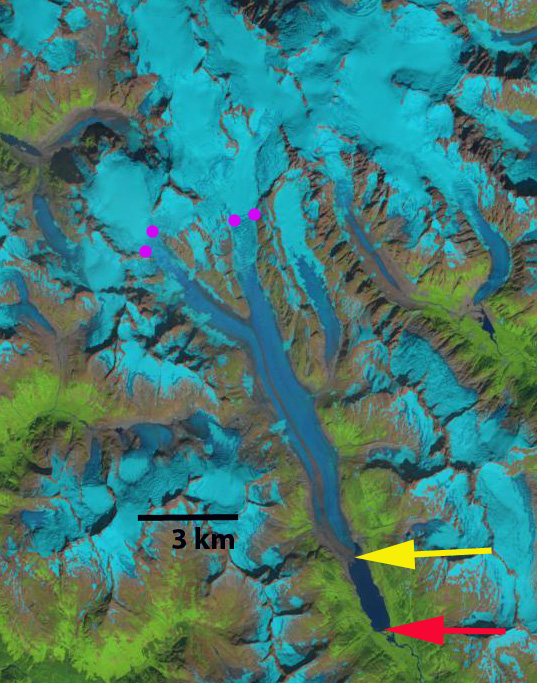
In each image the red arrow marks the 1986 terminus, the yellow arrow the 2014 terminus and the purple dots the snowline. In 1986 the glacier still terminated on the outwash plain at the south end of what is a newly forming lake small pockets of open water are evident on the lateral margins. The snowline is at the base of the lower icefall at 900 m. By 1999 a lake has formed at the terminus, that is 1.2 km long, a retreat of nearly 100 meters per year. The snowline is at 1000 m in 1999. A 2004 Google Earth image of the terminus area indicates two regions of concentric crevassing upglacier of the terminus, one adjacent to the yellow arrow, this indicates ice that has been lifted and then dropped by water, which only happens if the ice is thin enough for flotation. By 2013 the lake has more than doubled in length and the snowline is near the top of a pair of icefalls at 1300 m. In 2014 the lake is 2.7 km long on the eastern shore and 2.5 km long on the western shore. The glacier has retreated 2.6 km in 28 years, still nearly 100 m/year. The lake is not becoming narrower and there is no elevation step on the glacier, to suggest the end of the developing lake is near. The snowline in 2014 even in early August is at 1400 m. This glacier will continue to retreat as long as the snowline is above the top of the icefalls at 1250 m. The retreat of this glacier is like the Meade Glacier across Chilkoot Inlet, LeBlondeau Glacier just to the west and Gilkey Glacier to the south.
1986 Landsat image
1999 Landsat image
2004 Google Earth image
2013 Landsat image
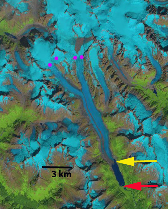
2014 Landsat image
 Dean of Academic Affairs at Nichols College and Professor of Environmental Science at Nichols College in Massachusetts since 1989. Glaciologist directing the North Cascade Glacier Climate Project since 1984. This project monitors the mass balance and behavior of more glaciers than any other in North America.