
August 22, 2014
Blaueis Gletscher Retreat, Bavaria Germany
Posted by Mauri Pelto
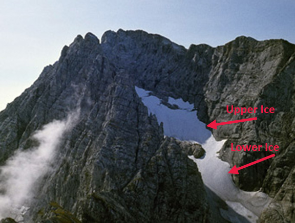
The Blaueis Gletscher is the furthest north glacier in the Alps. It occupies a narrow deep valley oriented north, between the summits of Blaueisspitze and Hochkalter. Hagg et al (2012) in an examination of Bavarian glaciers over the last 120 years note the changes in area of Blaueis Gletscher. The glacier increased in area from 16 to 20 hectares during the 1889 to 1924. Retreat from 1924 to 1970 led to a decrease in area to 12.6 hectares. Advance in the 1970’s increased the area back to 16 hectares by 1980. Since 1980 rapid area loss to 7.5 hectares by 2009. This rapid loss has led to many media reports of the imminent loss of the glacier. Here we examine imagery of the glacier from 1982-2014 to identify its current status. In 1982 the glacier consisted of the main upper reach and a thin lower ice in a photograph from R. Drescher from the Bayerische Gletscher website. By 2005 the thin lower ice has declined in area and thickness and is not connected to the upper glacier allowing ice transfer. There is some fringing thinner ice in 2005 on the lower margin of the upper ice. By 2009 the thin marginal ice at the downhill end of the upper glacier, has declined and become largely detached from the main glacier. A closeup in 2009 indicates the glacier has 45-48 annual layers of accumulation exposed at the glacier surface. This image indicates that no recent accumulation has been retained as all of the layers are blue ice and no snow or recent firn exists on the upper glacier. A glacier without consistent accumulation cannot survive (Pelto, 2010). This survival forecast method does not detail how long it will take to disappear. The number of annual layers exposed indicates the glacier thickness is still significant, further the location precludes rapid melt. Thickness maps from 2007, from the Bayerische Gletscher group, indicate the main upper ice is 5-10 m thick, with some areas over 10 m thick, based on radio echo sounding. Based on the number of annual layers and lack of crevassing reaching the glacier base, it seems to me the average thickness is somewhat greater. Glacier’s that I have worked on develop significant crevasses that reach the glacier base as the thickness drops below 10 m. Using typical volume-area scaling coefficients suggest the average thickness to be 12-15 m. There is a webcam at the Blaueis Hut that indicates the glacier today 8/22/2014 still has substantial snowcover. With the current climate this glacier in the least exposed niche on the mountain should be able to endure more than a decade.
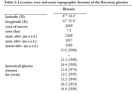
Data from Hagg et al (2012)
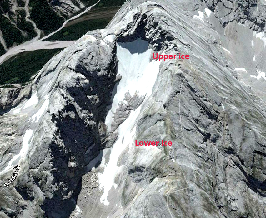
2005 Google Earth image

2009 Google Earth image
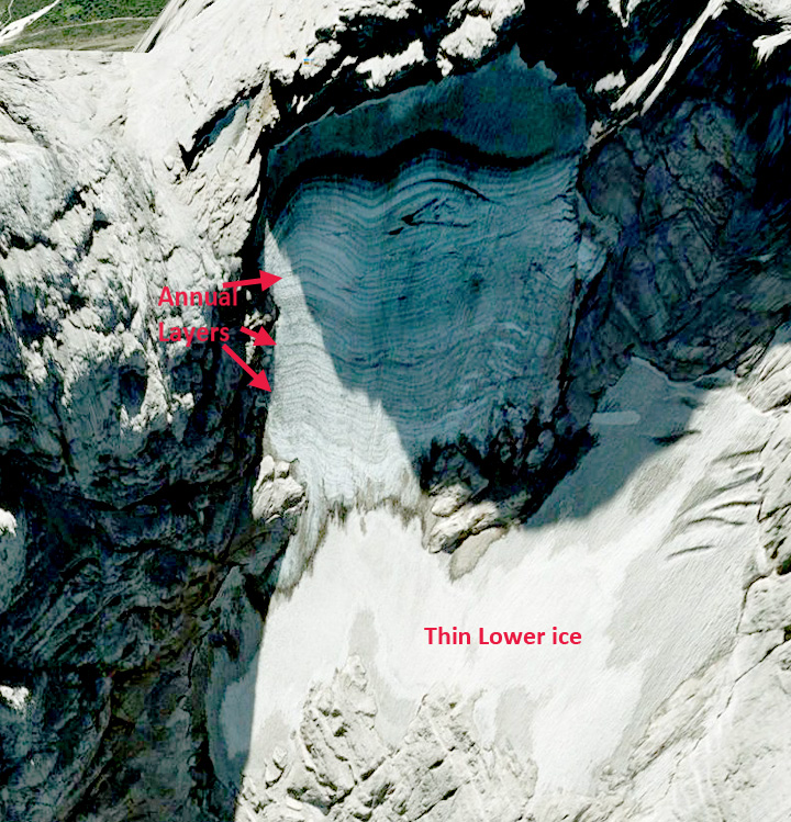
2009 Google Earth image

8/22/2014 Webcam image
 Dean of Academic Affairs at Nichols College and Professor of Environmental Science at Nichols College in Massachusetts since 1989. Glaciologist directing the North Cascade Glacier Climate Project since 1984. This project monitors the mass balance and behavior of more glaciers than any other in North America.