
July 27, 2014
Fourpeaked Glacier Retreat, Katmai area, Alaska
Posted by Mauri Pelto
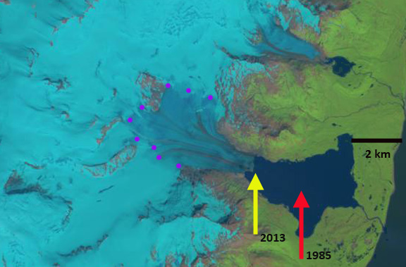
Fourpeaked Glacier drains east from the volcano of the same name in the Katmai region of southern Alaksa. The Park Service in a report (Giffen et al 2008) noted that the glacier retreated 3.4 km across a broad proglacial lake that the glacier terminates in from 1951-2986, a rate of 95 m/year. From 1986-2000 they noted a retreat of 163 m, or 13 m/year. In a more recent report with the Park Service Arendt and Larsen (2012) provide a map of the change in glacier extent from 1956-2009, Figure 4, but note the poor data overall on historic changes of Fourpeaked. Here we utilize Landsat imagery to examine retreat from 1981 to July 2014.
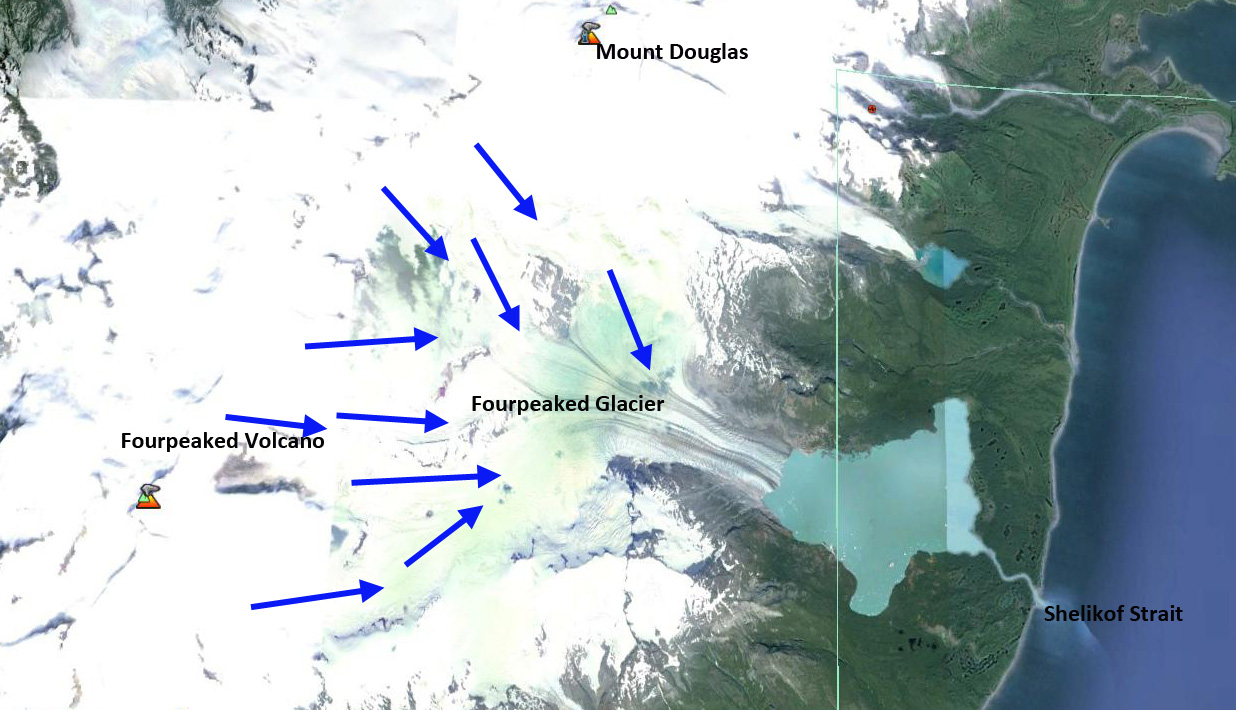
Google Earth image
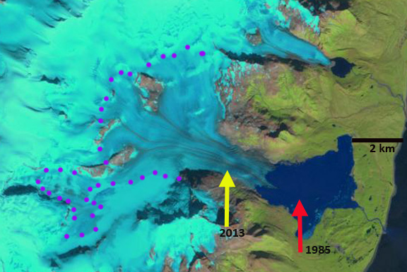
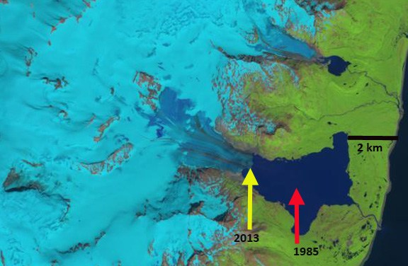
A Landsat 2 image from 1981 with relatively low resolution indicates much of the proglacial lake still occupied by ice, but much of this is floating icebergs detached from glacier, which is hard to distinguish in this image. In each image the red arrow is the 1985 terminus and the yellow arrow is 2013-2014 terminus. In 1985 the terminus is at the red arrow, with considerable floating ice still evident that is not part of the glacier. The snowline, purple dots, is at 750-800 m though this is not near the end of the summer. By 2000 the floating ice is gone, and the terminus has retreated into a narrower inlet. The snowline is at 850 m. By 2013 the glacier has receded further up this inlet and the width of the lower glacier is less. This is a July image and the snowline is still relatively low. In the July 2014 image the snowline is quite high at 700 m, given that this is mid-summer. It is not apparent in the Landsat image, but the large local forest fires in the spring could reduce albedo and enhance melt this summer. The terminus has retreated 1.9 km from 1986 to 2014 a rate of 68 m/year. The retreat from 1981-2000 was fed by calving in a broad proglacial lake. From 2000-2014 the retreat has continued despite the narrowing of the calving front. That the glacier has narrowed even more and thinned in the lower reach is indicative of a retreat that will continue. This glacier is behaving like other Katmai area glaciers, Giffen et al (2008) noted that 19 of 20 are retreating. The glacier retreat has led to formation and expansion of a large lake much like other glaciers in the region; Bear Glacier, Excelsior Glacier and Pedersen Glacier. The last image is an animated gif created by Espen Olsen illustrating the change in the glacier. 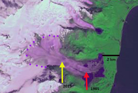
1981 Landsat image

1985 Landsat image
2000 Landsat image
2013 Landsat image
2014 Landsat image

Espen Olsen animated gif of Landsat images
 Dean of Academic Affairs at Nichols College and Professor of Environmental Science at Nichols College in Massachusetts since 1989. Glaciologist directing the North Cascade Glacier Climate Project since 1984. This project monitors the mass balance and behavior of more glaciers than any other in North America.
[…] also dig for razor clams in the sand flats, and catch salmon from the rivers. Learn more here and here. Explore more of Hallo Bay and the Katmai […]