April 27, 2014
Arago Glacier Retreat, Kerguelen Island
Posted by Mauri Pelto
Kerguelen Island sits alone isolated at the edge of the furious fifties in the southern Indian Ocean. The island features numerous glaciers, the largest being the Cook Ice Cap at 400 square kilometers. Here we focus on the Arago Glacier and an adjacent glacier to the south on an icecap on the Raillier du Bay Peninsula Ice Cap using satellite imagery from 2001-2011. Arago Glacier descends east from the ice cap currently ending in a proglacial lake.
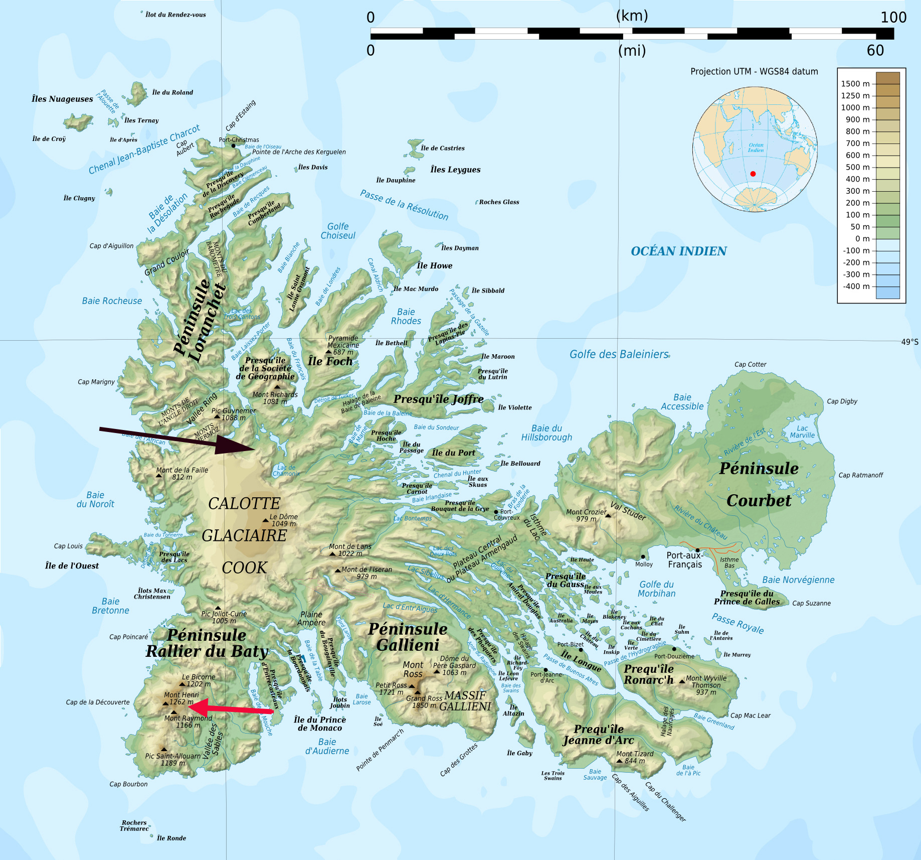
Kerguelen Island Map
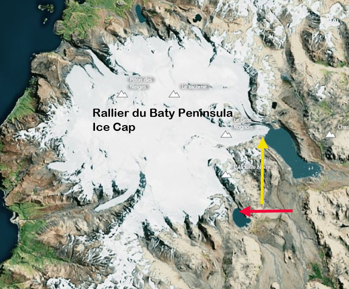
Rallier du Baty Peninsula Google Earth image
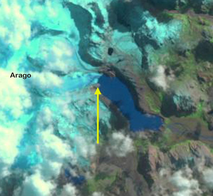
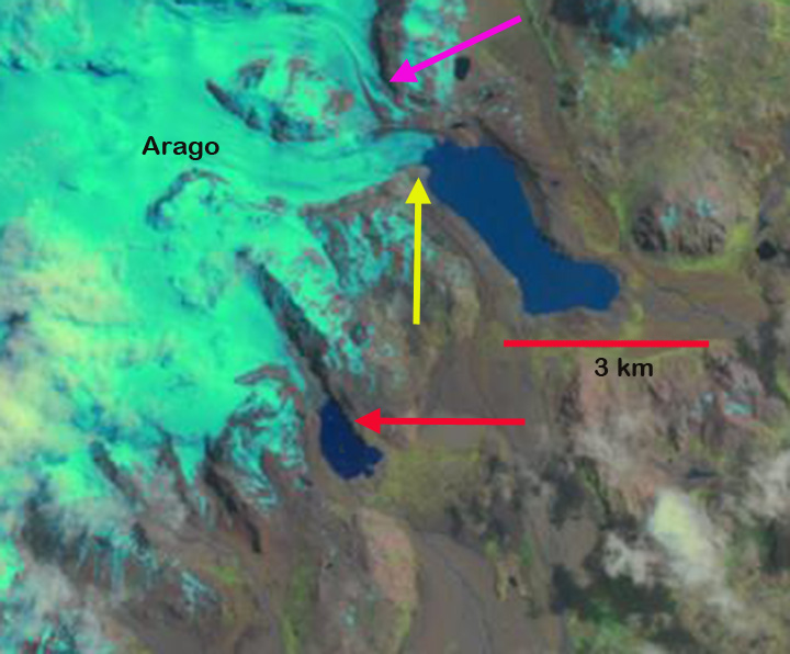
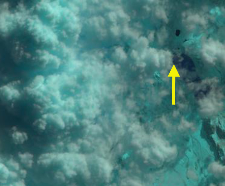
Berthier et al (2009)note that this glacier had retreated 3 km from 1964-2001. In 1964 the glacier filled the lake basin, yellow line in first figure below. They had a single profile across the glacier shortly above the terminus that indicated 80 km of thinning from 1964-2000 and 30 m from 2000-2005. The profile is the blue dotted line from their paper in the first figure below. In 2001 Arago Glacier terminated at the tip of a peninsula, yellow arrow. The Arago Glacier is joined just above the terminus by a tributary from the north, which has a substantial width in 2001 at the pink arrow. The glacier to its south ended at the northern end of a lake, red arrow. By 2006 Arago Glacier has retreated from the peninsula. Cloud cover obscures the glacier to the south. By 2011 Arago Glacier has retreated from the peninsula, 300-400 m since 2001, expanding the proglacial lake. The glacier tributary at the pink arrow width has declined substantially. This is indicative of a thinning glacier as well. The contribution of this tributary to the main terminus is quite limited by 2011. The glacier to the south at the red arrow has also retreated 300-400 m, leading to lake expansion there. This island is notoriously cloud covered, and I have not located an image with a clear view of the region since 2011, when I do the post will be updated. The retreat of Arago Glacier follows the pattern of retreat of the glaciers of other glaciers on the island including Ampere Glacier and the northern outlet of the Cook Island Ice Cap
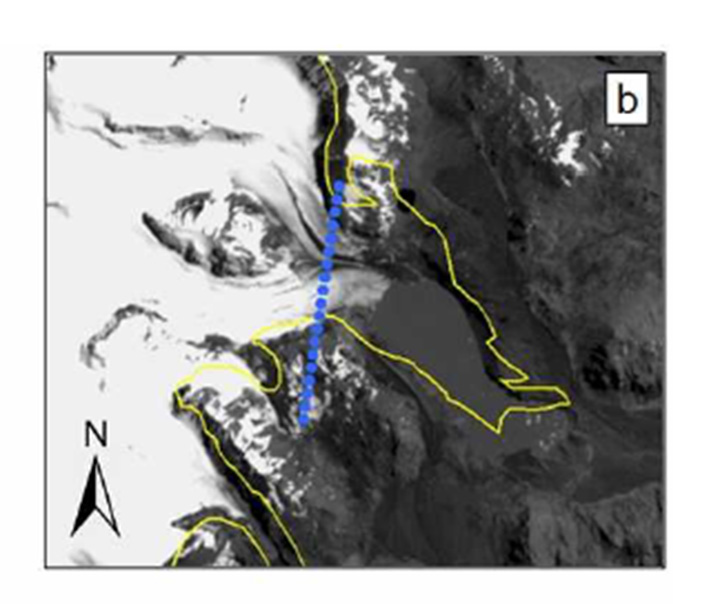
Figure 8 from Berthier et al (2009)
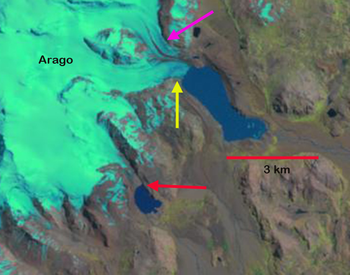
Landsat image in 2001


 Dean of Academic Affairs at Nichols College and Professor of Environmental Science at Nichols College in Massachusetts since 1989. Glaciologist directing the North Cascade Glacier Climate Project since 1984. This project monitors the mass balance and behavior of more glaciers than any other in North America.