
April 17, 2014
Aneto Glacier, Spain-Retreating and Disappearing
Posted by Mauri Pelto
Aneto Glacier in the Pyrenees of Spain is listed as its largest glacier in a 1984 inventory. In 1984 the glacier had an area of 1.32 square kilometers and a length of 1.6 km (Serrat and Ventura, 2005). The glacier is located on the northeast side of Aneto Peak. The glacier is just a few kilometers from the rapidly retreating Maladeta Glacier. SOER (2010) indicate that more than 80% of the glacier area on the Maladeta-Aneto Massif was lost between 1984 and 2007.
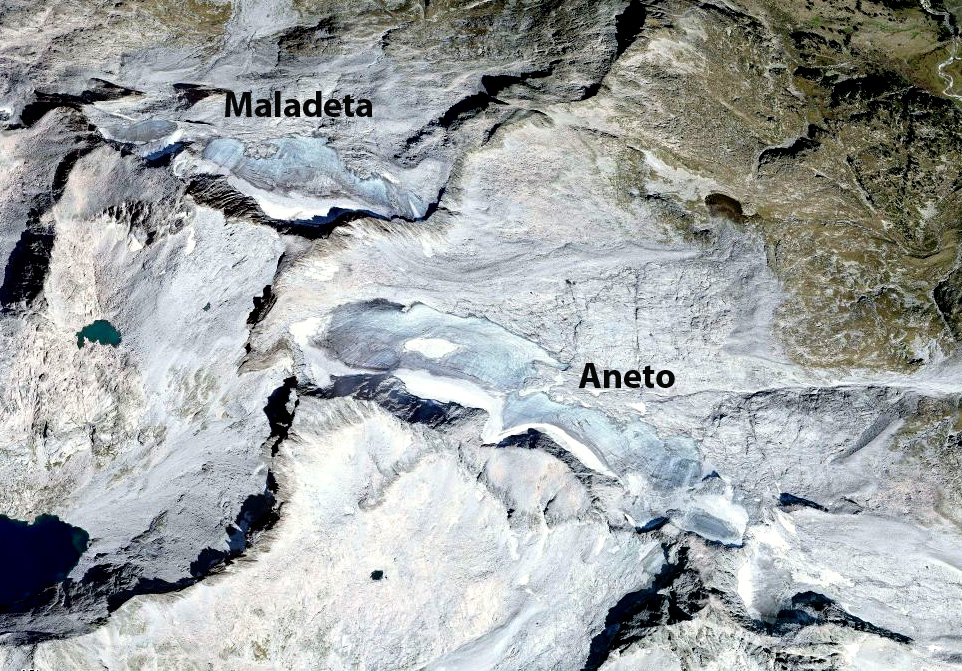
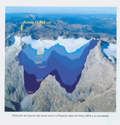
Image from SOER (2010)
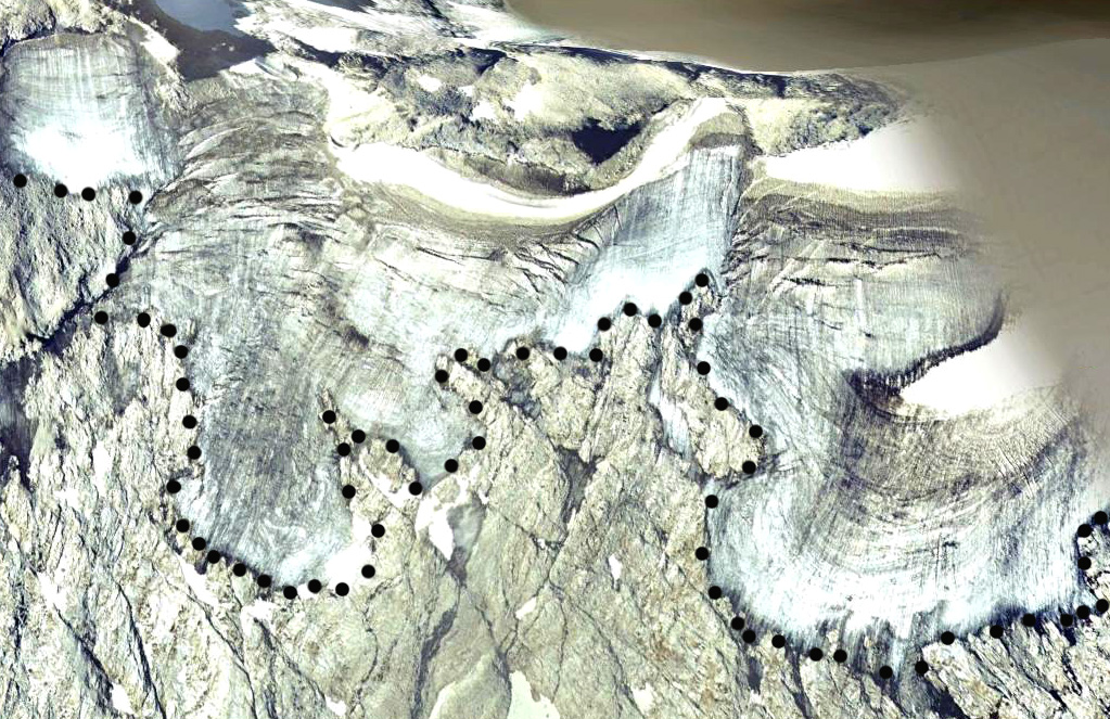
The glacier is too small to rely on our usual Landsat imagery. Here we focus on images from Google Earth and the Digital Globe. The glacier’s maximum top to bottom length by 2005 is no more than 600 meters, black dots indicate glaciers lower margin. The area in 2007 is 0.4 square kilometers by which time the glacier has developed a number of rock outcrops protruding through the thin ice. Snowcover in most images by late summer is minimal. This indicates the lack of a consistent accumulation zone, which a glacier cannot survive without (Pelto, 2010). The glacier has many exposed annual layers extending well upglacier, this is a further indication of the poor preservation of even old glacier ice. In 2005 and 2007 less than 10% of the glacier is snowcovered in the images which are not even at the end of the summer. This glacier is disappearing and like the Careser Glacier, Italy will break into several parts. The thin nature of the glacier is evident by looking up glacier from the terminus, last image from Gus Llobet (llobetgus-on Panaramio)
2005 Google Earth image, limited snowcover evident
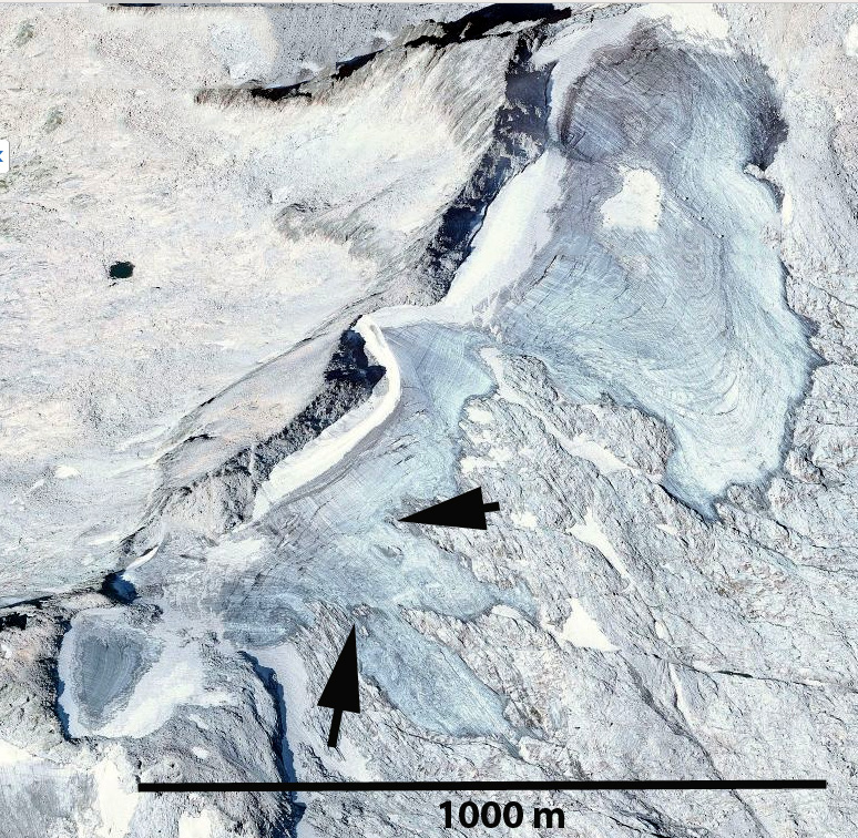
Arrows indicate rock outcrops amidst the glacier.
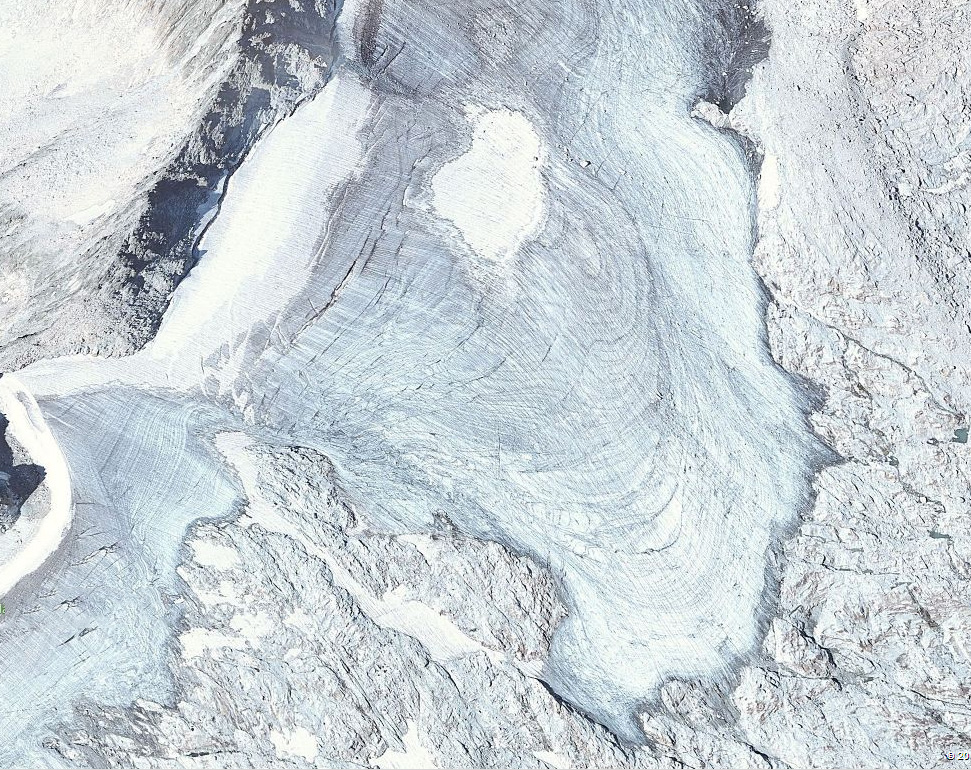
2007 Digital Globe image
Annual layers of main glacier trunk in 2007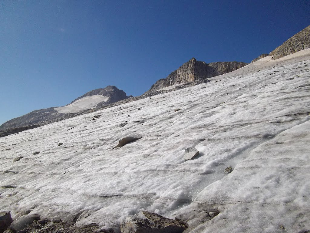
Images from Panaramio user-llobetgus
 Dean of Academic Affairs at Nichols College and Professor of Environmental Science at Nichols College in Massachusetts since 1989. Glaciologist directing the North Cascade Glacier Climate Project since 1984. This project monitors the mass balance and behavior of more glaciers than any other in North America.