
April 10, 2014
Lugge and Thorthormi Glacier Retreat, Bhutan
Posted by Mauri Pelto
Luge and Thorthormi Glacier drain south from the border with China into the Pho Chu River in Bhutan. Both glaciers end in expanding glacier lakes that are prone to outburst floods, which sweep down the Pho Chu. Osti et al (2012) reported in detail on the nature of these floods, noting there are eight dangerous lakes including the two at the terminus of Lugge and Thorthormi Glacier, Thorthormi Cho and Lugge Cho. In 1994 Lugge Cho experienced a glacier lake outburst flood GLOF which incurred huge damage in the Pho Chu basin. The 1994 GLOF event had a peak discharge of about 2539 cubic meters/s and extended 200 km downstream as a flood wave Osti et al (2012) . The GLOF occurred after rapid retreat of Lugge Glacier from 1988-1993 of 160 m/year. 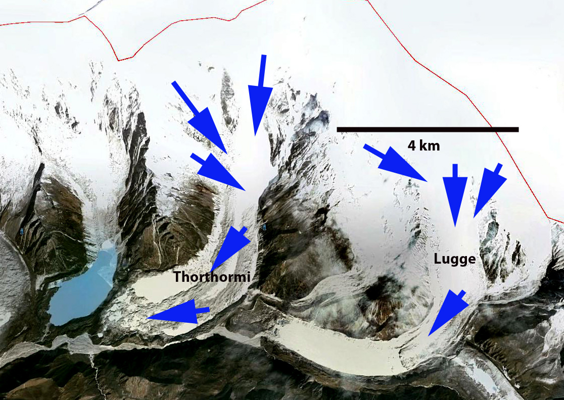
Google Earth Image
Here we examine the retreat of both glaciers in Landsat imagery from 2000-2014. In each image the red arrow indicates the 2000 terminus, the yellow arrow the 2014 terminus, the blue arrow the snowline on Lugge Glacier and the green arrow the center of the Thorthormi Glacier terminus in 2013. In 2000 the Lugge Glacier ends in a 2 km long Lugge Cho. The Thorthormi Glacier has pockets of proglacial lake in 2000, but also a debris covered terminus that extends across the lake basin to the Little Ice Age moraine (M). The two images from 2000 are from the start of October and late December. Note the snowline remains near 5100-5200 m in both images. The glaciers of Bhutan are summer accumulation type glaciers, in which the main accumulation season is during the summer monsoon. The snowline tends to rise from October into December with limited snowfall. By 2013 Lugge Glacier has retreated 1 km from the 2000 position, and Lugge Cho is now 3 km long. The terminus of Lugge Cho is not stagnant and it is not clear how much longer the deep basin extends under the glacier. If the basin does not extend much further retreat will soon be reduced. Thorthormi Glacier debris covered terminus connection to the moraine (M) has melted away and a lake extends across the full width of the glacier basin. The contiguous lake now has an area of over 1 square kilometer. The retreat of Thorthormi has been 700 m since 2000. The lowest 1 km of the glacier is stagnant and melt should be enhanced by calving into the lake, hence the retreat should remain quick in the next decade. The snowline in the Late November 2013 and early February 2014 image indicate the snowline at close to 5300 m in both. The retreat of these glaciers is leading to expansion of proglacial lakes much like the nearby Theri Kang and many other across the region Changsang Glacier, Sikkim, Lumding Glacier, Nepal Matsang Tsanpo, Tibet .
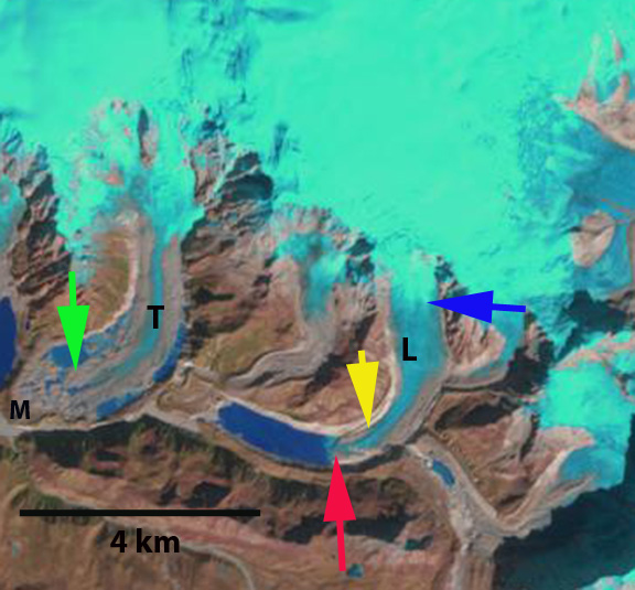
2000 Landsat image
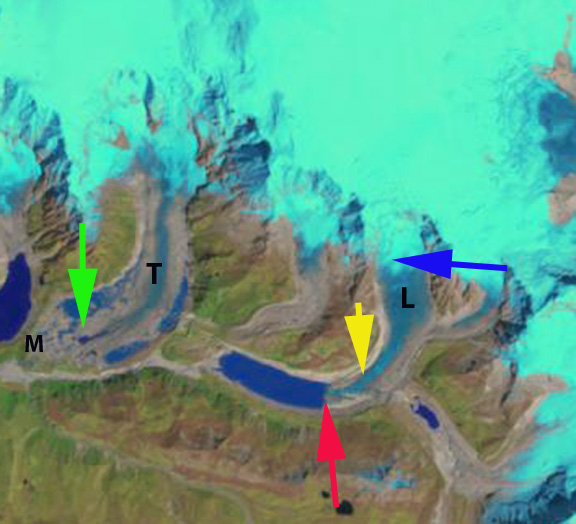
2000 Landsat image
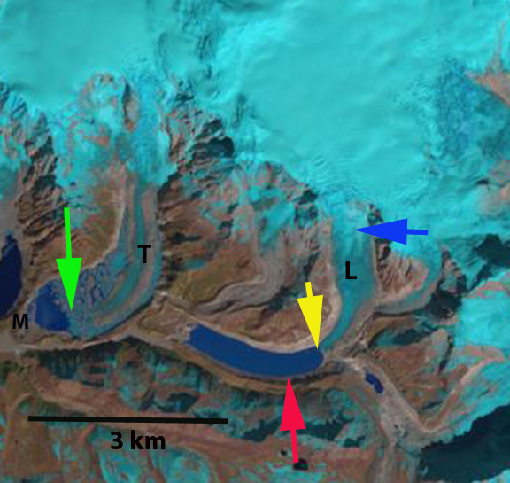
2013 Landsat image
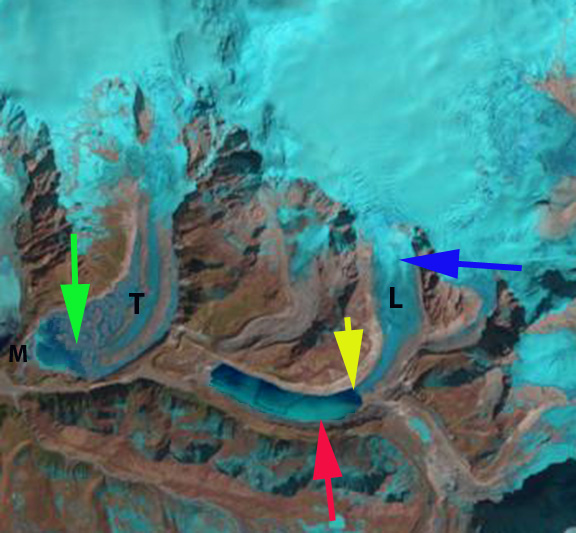
2014 Landsat image
 Dean of Academic Affairs at Nichols College and Professor of Environmental Science at Nichols College in Massachusetts since 1989. Glaciologist directing the North Cascade Glacier Climate Project since 1984. This project monitors the mass balance and behavior of more glaciers than any other in North America.