
March 19, 2014
Verde Glacier Retreat, Chile
Posted by Mauri Pelto
Verde Glacier is adjacent to Reichert Glacier and drains the north side of the Northern Patagonia Icefield. It is a small glacier compare to many outlet glaciers of the icefield that have been examined in previous posts, Reichert Glacier, Steffen Glacier, Nef Glacier, and Colonia Glacier. Here we examine Landsat imagery during the 1998-2014 period to identify the response of the glacier. The glacier flows from a pair of peaks at 1800 m to terminate at the edge of a proglacial lake. There is a significant icefall at 800-1250 m and a significant avalanche fan at the base of this icefall that is spills from a disconnected portion of the glacier west of the terminus and just northwest of the icefall. Davies and Glasser (2012) Figure 2d indicates the glacier nearly filling the entire lake in 1975. In Figure 8a they indicate the fastest retreat for the glacier being from 1998-2014. Rivera et al (2007) indicate the ELA for the glacier at the top of the icefall 1250 m. 
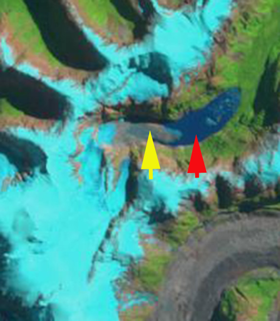
The yellow arrow in each image is the 2014 terminus and the red arrow the 1998 terminus. In 1998 the glacier terminates at the red arrow just beyond the northeast bend in the lake. The lake is 1.6 km long. By 2001 the glacier has retreated 300 m and is at this bend. Notice that the lowest lone kilometer of the glacier is quite debris covered. By 2014 the glacier has retreated to the yellow arrow, this is a further 600 m retreat since 2011. The lake is 2.5 km long measured along its center line. The 900 meter retreat in 16 years is substantial for a glacier that is only 5 km long. A cloe up view of the terminus in a Goggle Earth image indicates that the lowest 300 m is debris coverered ice, notice the wetness of some of the debris, pink arrow. This looks more like ice cored moraine than active glacier ice covered by debris. If this is the case the active terminus is 300 m from the shore of the lake, at the yellow terminus where calving begins. It is certain the lake will expand further as the buried ice melts, but it is nearing its southwestern limit. The steep slope of the icefall and the rock slope to the right of the icefall is evident. This will lead to continued avalanching onto the terminus area, that will make that lowest region above the yellow arrow more difficult to melt out. One observation that is striking is the number of narrow alpine lakes that have formed and expanded as the Northern Patagonia Icefield outlet glaciers have receded. 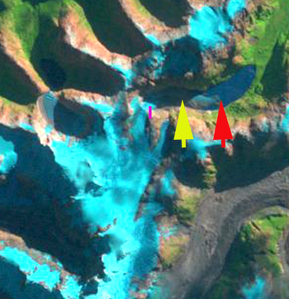
1998 Landsat image
2001 Landsat image

2014 Landsat image
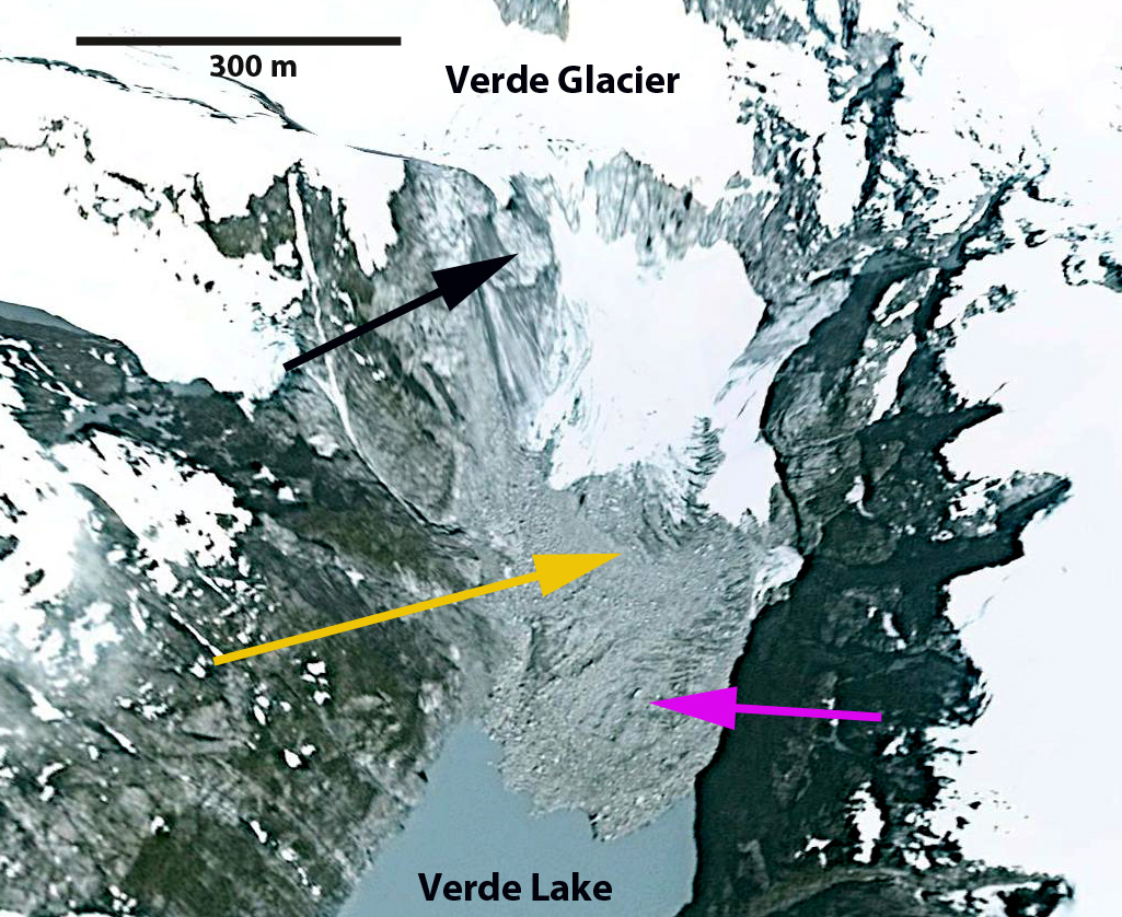
Google Earth image
 Dean of Academic Affairs at Nichols College and Professor of Environmental Science at Nichols College in Massachusetts since 1989. Glaciologist directing the North Cascade Glacier Climate Project since 1984. This project monitors the mass balance and behavior of more glaciers than any other in North America.