
December 10, 2013
Gracey Creek Glacier Retreat and Tributary Loss, Alaska
Posted by Mauri Pelto
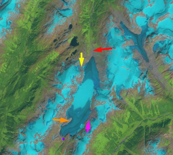
Gracey Creek Glacier is a small glacier in southeast Alaska that terminates near the Canadian border. The glacier’s main terminus is the northern terminus (red arrow), though it has southern terminus as well (purple dot), both drain into Behm Canal via different rivers. Here we examine Landsat images from 1987 to 2013 to identify retreat and tributary separation in the last quarter century.
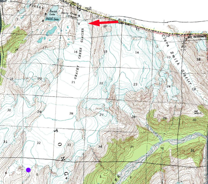
USGS map of Gracey Creek Glacier
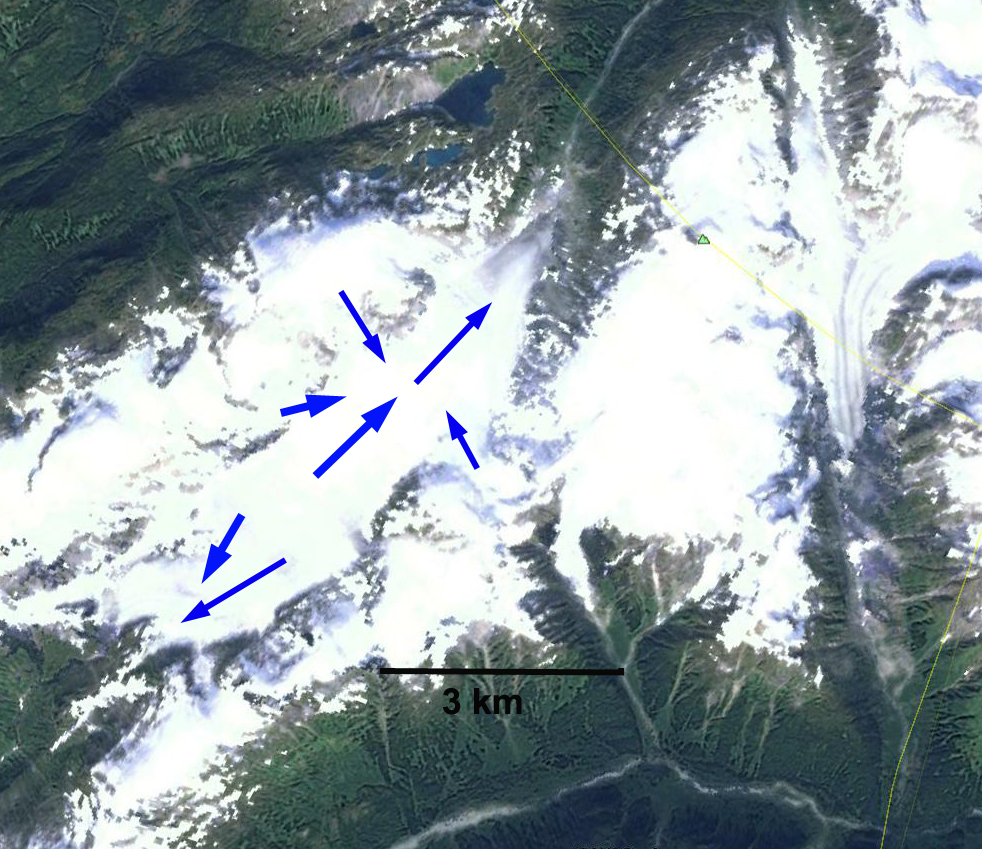
Google Earth image indicating direction of flow.
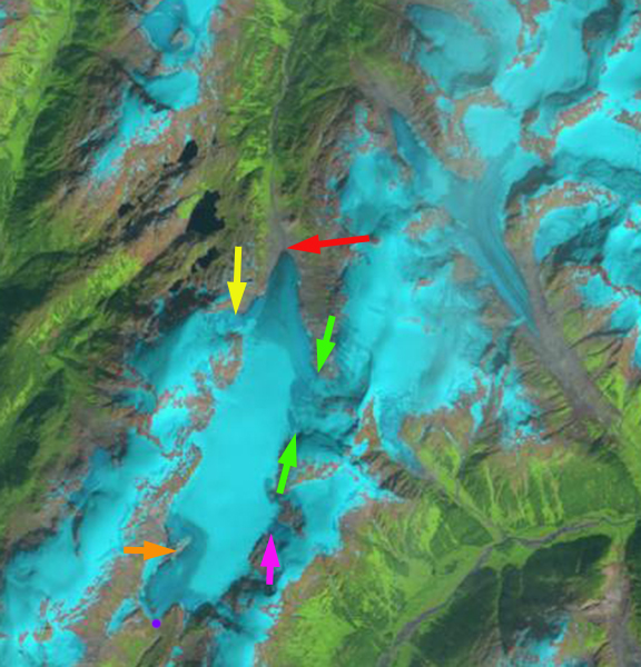
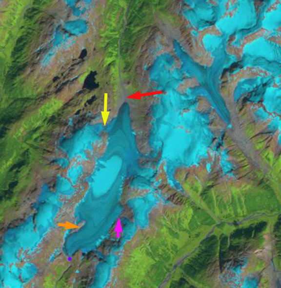
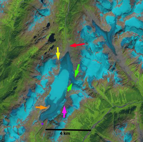
In 1987 Gracey Creek Glacier is fed by several main tributaries yellow, pink and light green arrows. The glacier’s northern terminus is at the red arrow and the southern terminus at the purple dot. By 1997 the pink tributary no longer connects to the main glacier, and the other tributary connections are much narrower. The glacier has retreated 200 m at the northern terminus and 50 m at the southern terminus. Snowcover is quite limited on the glacier. In 2010 the yellow tributary is no longer connected to the main glacier. The area of bedrock at the orange arrow near the southern terminus is greatly expanded. The northern terminus has retreated 400 m and the southern terminus 100 m. Of more importance in 2010 is the limited snowpack that is left, even though this is in mid-August with five weeks left in the melt season. By 2013 the only tributary connection is at the green arrows though this is only 40% of its 1987 width. The northern terminus has retreated 600 m since 1987 and the southern terminus 200 m.
There is limited snowpack in this late August image as was the case in the 1997 and 2009 image, this has become typical not unusual. The bad news is that in 2013 the melt season extended into mid-August and it is likely little snow remained on the glacier. The limited snowcover, loss of connection with higher elevation tributaries and thinning of the glacier even at its higher elevations indicates this glacier cannot survive current climate (Pelto, 2010). This thinning in the accumulation zone is evident from the reduction in width of the glacier at the divide between the southern and northern terminus, this is indicative of retreat of the lateral margins of the upper portion of the glacier, another sign of a glacier that cannot survive. The glacier is still 6.8 km long and it will not disappear quickly. The retreat here is less than on nearby Chickamin Glacier, Bromley Glacier and Nass Peak Glacier, however the changes on the upper glacier are the story. This glacier is similar in size and retreat to Lemon Creek Glacier of the Juneau Icefield.
1987 Landsat image
1997 Landsat image
2010 Landsat image
2013 Landsat image
 Dean of Academic Affairs at Nichols College and Professor of Environmental Science at Nichols College in Massachusetts since 1989. Glaciologist directing the North Cascade Glacier Climate Project since 1984. This project monitors the mass balance and behavior of more glaciers than any other in North America.