
October 27, 2013
Chocolate Glacier Retreat, Glacier Peak, Washington
Posted by Mauri Pelto
From 1994-1997 we ran a four year project to survey the terminus response of all the glaciers on Glacier Peak, Washington to climate change. This was a century after a climb in the region by C.E. Rusk. Chocolate Glacier is the largest of the east side valley glaciers. The average retreat of Glacier Peak glaciers from the LIA to the 1958 positions was 1640 m. Richard Hubley noted that North Cascade glaciers began to advance in the early 1950s, after 30 years of rapid retreat. The advance was in response to a sharp rise in winter precipitation and a decline in summer temperature beginning in 1944 (Hubley, 1956; Pelto and Hedlund, 2001). All ten glaciers on Glacier Peak advanced. Advances of Glacier Peak glaciers ranged from 15 to 480 m and culminated in 1978 (Pelto and Hedlund, 2001). All Glacier Peak glaciers that advanced during the 1950-1979 period emplaced identifiable maximum advance terminal moraines, that were fresh and easy to recognize in the 1990’s. By 1984, all the Glacier Peak glaciers were again retreating, the North Cascade Glacier Climate Project has monitored this retreat since 1984.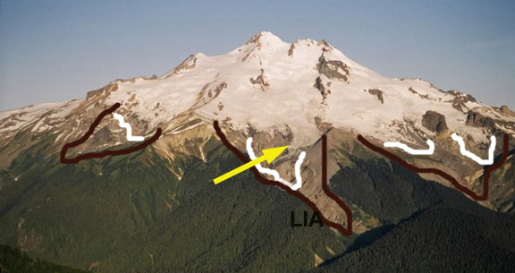
2005 Glacier Peak east side
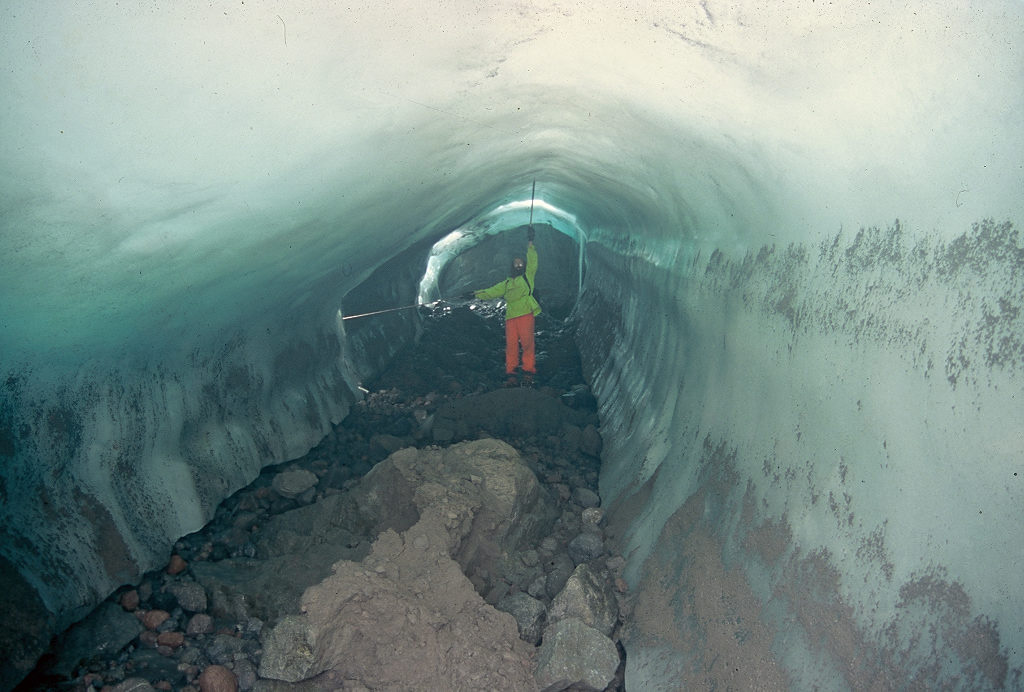
Cliff Hedlund beneath Vista Glacier during 1994 expedition.
Beginning at 3050 m Chocolate Glacier descends to 1800 m today. When Rusk (1924) first saw this glacier he noted that it presented a dramatic sediment covered front. Immediately above the terminus it was heavily crevassed and quite active, indicating a slow retreat. This glacier which he named Cool Glacier had retreated little from the alpine meadows fringing the south side of the glacier. The terminus had already retreated 400 m up the narrow valley by 1906 from its LIA. A retreat of 1380 m occurred between 1906 and 1946. The retreat was noted to be particularly rapid during the 1920-1940 period by Austin Post. Glacier advance had begun by 1950. An advance from 1946-1955 of more than 200 m occurred (Hubley, 1956). The advance continued up until 1975 totaling 450 m. This was the largest advance of the Glacier Peak glaciers, probably due to the nature of the steep, narrow valley down which the glacier flows from 1960 m to the terminus. The glacier was approximately at this maximum position when mapped in 1984. In the next sequence of images the red line is the mapped 1984 terminus, green is 1998 and blue is 2009. During our visit in 1994 the glacier had retreated 210 m from the moraine it had generated. By 1998 the glacier had retreated 275 m, and was at the based of a steeper slope. By 2009 the glacier had retreated 500 m since 1984, ending at 1925 m, this is still the lowest of the east side glaciers. 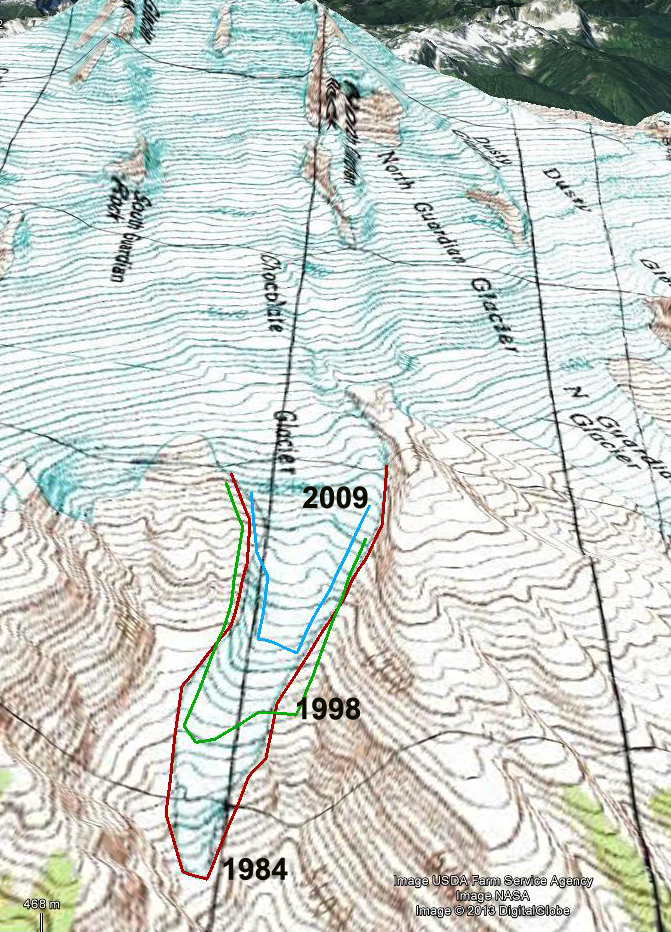
1984 map view
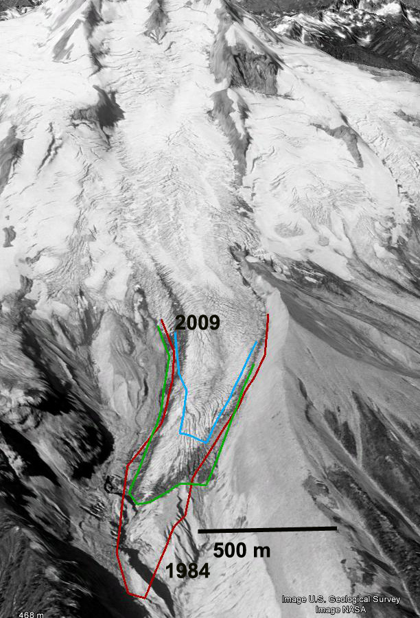
1998 Google earth view

2009 Google Earth
Chocolate Glacier remains crevassed and active, but the degree of crevassing has decline from 1998 to 2009 as evidenced by this closeup of the 2000-2200 m region. It is hard to get a good view of this glacier from up close the best vantage is from across the Suiattle River valley, as seen below. 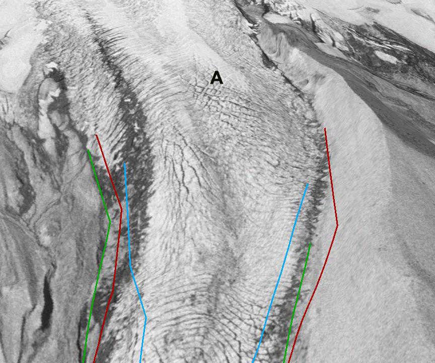
1998 Google Earth view
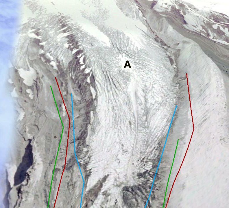
2009 Google earth view
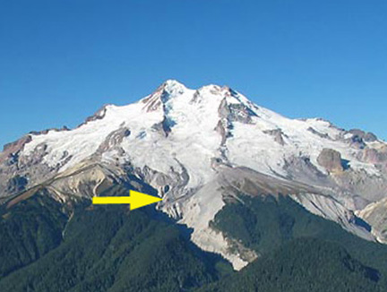
2006 Glacier Peak from the east
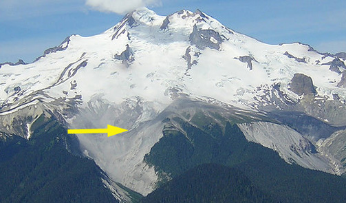
2007 Glacier Peak from the east

 Dean of Academic Affairs at Nichols College and Professor of Environmental Science at Nichols College in Massachusetts since 1989. Glaciologist directing the North Cascade Glacier Climate Project since 1984. This project monitors the mass balance and behavior of more glaciers than any other in North America.