
October 10, 2013
J Glacier Retreat-Impending Loss, Wyoming
Posted by Mauri Pelto
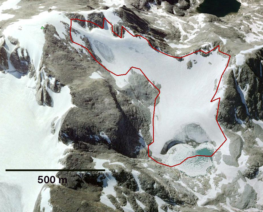
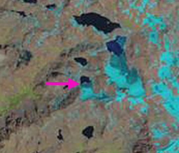
J Glacier is a small Glacier on the northwest side of Klondike Peak in the Wind River Range of Wyoming. In this post we examine changes in this glacier from 1994-2013 using Landsat Imagery and from 2013 and Google Earth imagery from 1994, 2006 and 2009. In 1966 the glacier ended on the far side of the lake basin and no lake was present. The retreat from 1966-1995 was 60 m a rate of 2 m per year. By 1994 a lake had formed at the terminus, the 1994 margin of the glacier is indicated with a burgundy line on each Google Earth image. The main terminus of the glacier retreated 100 m from 1994 to 2009, a rate of 6.6 m/year. More importantly the image from 2006 indicates a significant retreat and rock exposure on the upper portion of the glacier on the west side, pink arrow. In 2009 the glacier terminus is beginning to recede out of the lake as seen by emerging shoreline rock near the glacier center. In 2013 a July and August Landsat images indicate the extent of snowpack loss that occurred in just one month, leaving the glacier without any snowcover by late August. The terminus is indicated with a pink arrow, any change since 2009 cannot be discerned on this image. The complete snowpack loss has led to glacier ice melt and separation of the upper eastern corner of the glacier from the rest of the glacier, yellow arrow. The loss of area and exposure of rock on both the upper west and upper east side of the glacier indicate the lack of an accumulation zone. This indicates a glacier that cannot survive as noted by Pelto (2010). This is the same forecast as for nearby Minor Glacier and Grasshopper Glacier, whereas the neighboring Sourdough Glacier has fared a bit better. 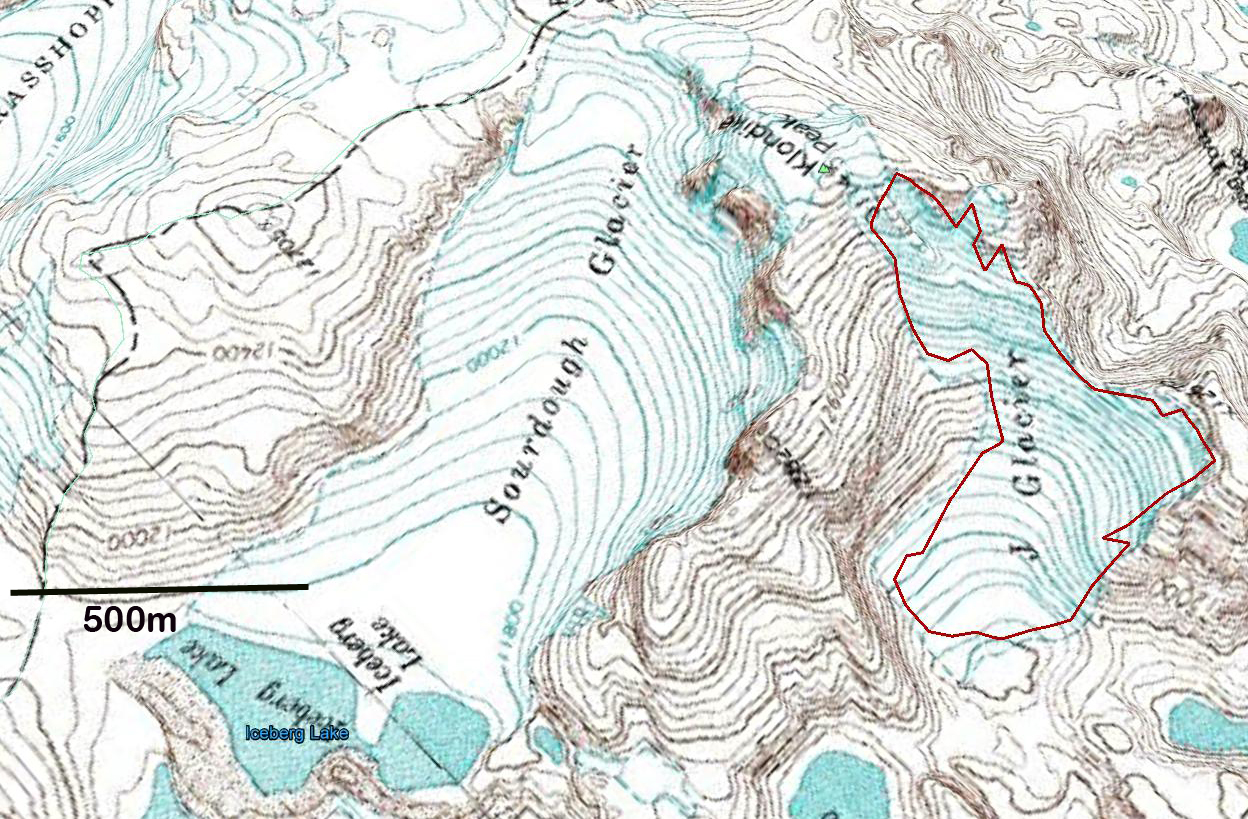
USGS Map of J glacier and Sourdough Glacier, from 1966 aerial photography.
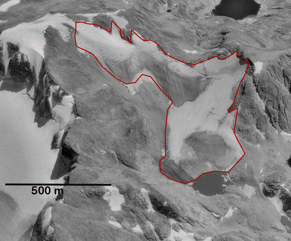
1994 Google Earth image

2006 Google Earth Image
2009 Google Earth image
July 2013 Landsat Image
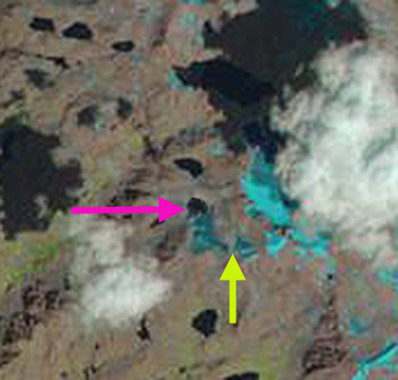
August 2013 Landsat image
 Dean of Academic Affairs at Nichols College and Professor of Environmental Science at Nichols College in Massachusetts since 1989. Glaciologist directing the North Cascade Glacier Climate Project since 1984. This project monitors the mass balance and behavior of more glaciers than any other in North America.