
July 15, 2013
Chernysheva Glacier Retreat, Novaya Zemlya
Posted by Mauri Pelto
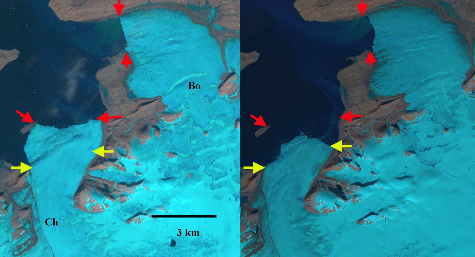
Chernysheva and Borozova comparison in 1990 and 2015 Landsat images. Red arrows indicates 1990 terminus and yellow arrow 2015 terminus position.
Chernysheva Glacier is on the northwest coast of Novaya Zemlya. The glacier terminates in the Barents Sea and has been retreating like all tidewater glaciers in northern Novaya Zemlya (LEGOS, 2006) This glaciers retreat follows the pattern of Krivosheina, Roze and Sredniy and Taisija Glacier. In this post we examine the changes using Landsat imagery from 1988, 2006, 2011 and 2013. The flow of the glacier from the main ice cap is indicated by blue arrows. The yellow arrow in each image indicates an island, the red arrow a bedrock ridge that extends under the ice, and the pink arrow the east margin of the terminus in 1988.
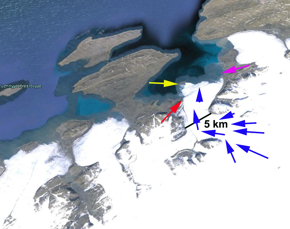
Google Earth image
In 1988 the glacier ended on the island which is a pinning point that would limit calving at the time. The 1988 image is very clear and the ridge with the bulge in the ice over it seems to extend 70% of the way across the glacier. In 2006 the glacier has pulled back from the island, there is however sea ice between the glacier front and the island, which has several icebergs embedded in it. By 2011 the glacier retreat from this island is 3100 m. The retreat from the east margin is 2600 m. The bedrock ridge at the red arrow should provide some stability and slow the retreat rate on the west side, it does not appear to extend to the eastern margin and this may continue to retreat apace. Interestingly the embayment here is very similar to that of Nizkiy and Glasova Glacier, which must be due to the similar geology. The reduction in duration of Barents Sea ice cover ice in front of the glacier has certainly helped to increase recent retreat.
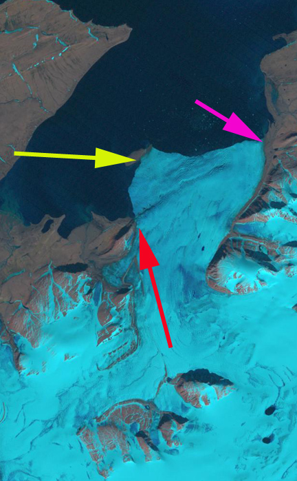
1988 Landsat image

2006 Landsat image

2011 Landsat image

2013 Landsat image
 Dean of Academic Affairs at Nichols College and Professor of Environmental Science at Nichols College in Massachusetts since 1989. Glaciologist directing the North Cascade Glacier Climate Project since 1984. This project monitors the mass balance and behavior of more glaciers than any other in North America.