
May 30, 2013
Hkakabo Razi Glacier Retreat, Myanmar and China Border
Posted by Mauri Pelto
Hkakabo Razi is the highest peak in Myanmar and straddles the border with China. The Myanmar side (east) of the mountain drains into the Irrawaddy River and on the China side (west) to the Brahmaputra River. First of all how many people thought Myanmar had glaciers? Secondly this is a remote peak that only one party has managed to climb. However, a North Face Party attempted the peak, and though did not reach the summit, succeeded in documenting an exceptional adventure “Down to Nothing“. In the Google Earth image the blue arrows indicate icefall regions and the direction of flow into these areas. 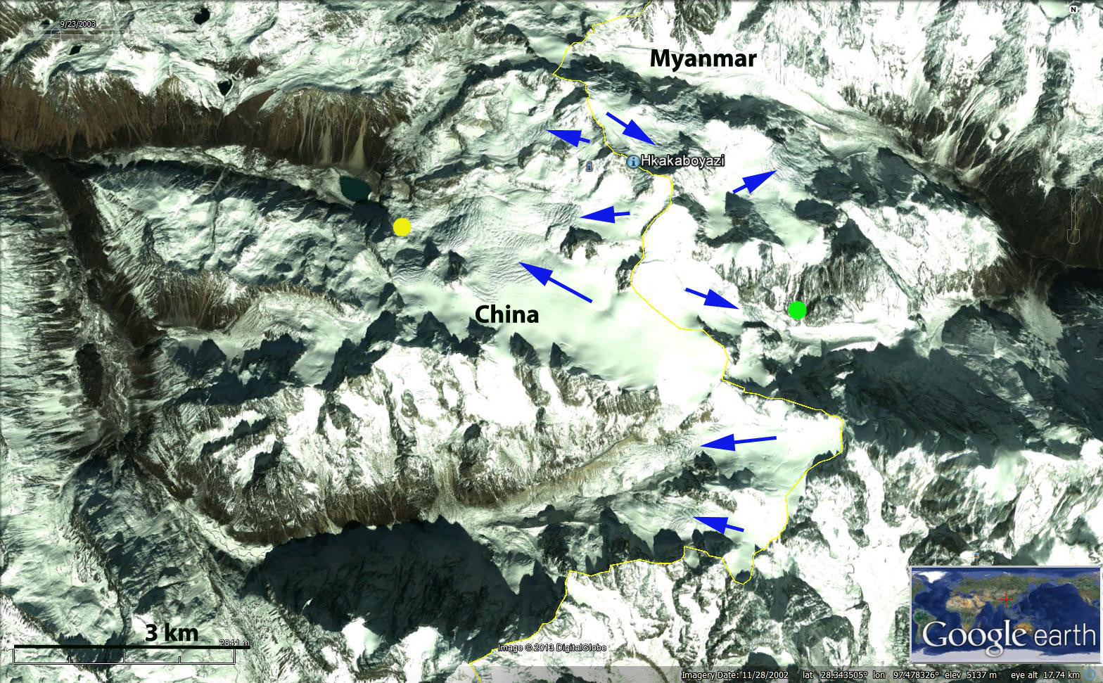 Here we examine the changes in several glaciers using Landsat imagery from 1987, 1996 and 2009. The red arrows indicate several locations in each image where in 1987 and 1996 sections of a each glacier coalesce. By 2009 in each of the red arrow locations the sections of the glacier have separated. The change in terminus position of three glaciers is also noted, the yellow dot indicates the terminus of the main west flowing glacier. The retreat from 1996 to 2009 is 250 m. The green dot indicates a location at the terminus of an east side glacier. In 1996 the terminus is at the down slope side of the dot and in 2009 the terminus barely reaches the up slope side of the green dot a retreat of 200 m. The pink arrow indicates the terminus of a steep east side glacier. In 1996 the glacier ended at a prominent cleft in the rock, pink arrow and by 2009 had retreated 200 m from this feature. These glaciers have behaved in a similar fashion to Hailuogou Glacier and the glaciers at the headwater of the Bode Zangbo.
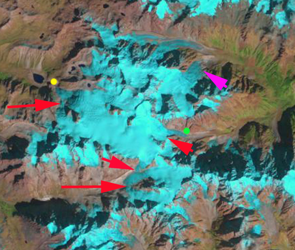
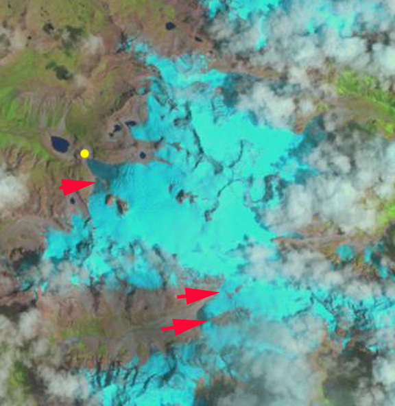
1987 Landsat image
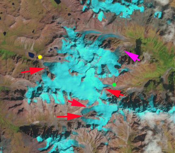
1996 Landsat image
2009 Landsat image
 Dean of Academic Affairs at Nichols College and Professor of Environmental Science at Nichols College in Massachusetts since 1989. Glaciologist directing the North Cascade Glacier Climate Project since 1984. This project monitors the mass balance and behavior of more glaciers than any other in North America.