
May 27, 2013
Bode Zangbo Headwaters Glacier Retreat, Tibet, China
Posted by Mauri Pelto
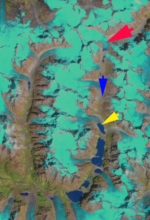
In the eastern portion of the Nyainqêntanglha Shan, there is a raindrop shaped group of mountains encircled by the Bode Zangbo to the west and Yu Chu Zangbo (maps indicate several names here) to the the east. At the headwater of the Bode Zangbo are a series of glaciers ending in valley occupied by several new lakes formed by glacier retreat. The Bode Zangbo is the site of a proposed new 9600 kW hydropower project financed by Datang Power International. The Bode Tsangbo than joins the Parlung Zangbo and then Yarlung Tsangpo that becomes the Brahmaputra River in India. Both of the latter rivers are the focus of ongoing intensive hydropower development as indicated by the map from Tashi Tsering, with most existing dams being upstream on the Yarlung, red arrow indicates glacier site. Here we focus on two glaciers in particular indicated by a red and yellow arrow in each Landsat or Google Earth image. Both glaciers are unnamed. In fact the first image is the area in general from Google Earth with all the layers activate to show names, and there are none in this mountain region. In the lower left of the image China National Road 318 is visible that in this region connects Bomê County and Nyingchi.


The red arrow indicates a glacier that was 3 km long in 1986 beginning at 5500 m and ending at a moraine at 4900 m. The red arrow points to the low lying terminus piedmont lobe. The second glacier ends in a lake, with the yellow arrow indicating a peninsula on the northeast side of the lake where the glacier ends in 1986. The blue arrow simply indicates the drainage direction of the stream. In 1986 the Bode Zangbo Headwaters Glaciers at the red arrow has no lake at its terminus, the terminus has a toe that turns south down the main valley to end at a series of moraines. By 1999 a tiny lake is evident. In 2000 and the 2001 Google Earth image the lake is still barely detectable. By 2011 a full fledged deep blue lake has developed, where the terminus of the glacier had been. The lake is 600 m long and 400 m long, indicating a 550-600 m retreat in the last decade of the glacier. At the yellow arrow there is limited change from 1986 to 2000, with the glacier still ending in proximity to the peninsula. By 2011 the glacier has retreated 350 m from the 1986 position. The other glaciers in the valley have also been in retreat, but given the location of the scan line errors and clouds it is harder to point out the specific retreat. The yellow dots in the late summer 2011 image indicates the snowline at 5150 m. This is the same snowline and terminus behavior as noted for Jiongla Glacier 110 km west northwest. The glacier follows the pattern of many other glaciers retreating in the region leading to lake expansion, Longbasba Glacier.

1986 Landsat Image
1999 Landsat Image
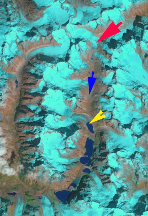
2000 Landsat Image

2001 Google Earth Image
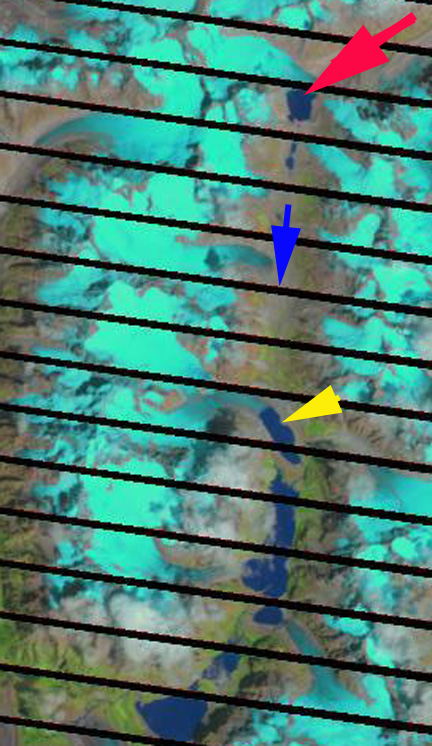
2011 Landsat Image
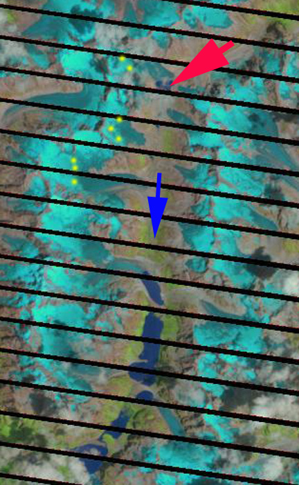
2011 Landsat Image
 Dean of Academic Affairs at Nichols College and Professor of Environmental Science at Nichols College in Massachusetts since 1989. Glaciologist directing the North Cascade Glacier Climate Project since 1984. This project monitors the mass balance and behavior of more glaciers than any other in North America.