
May 19, 2013
Malavalle Glacier Retreat, Italy
Posted by Mauri Pelto
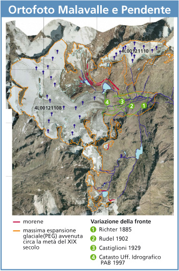
Malavalle Glacier is an Italian glacier draining south from the Austrian border. The glacier has an interesting cartographic history with maps spanning several centuries indicating its evolution. The Italian Glaciological Committee indicates the retreat of this glacier from 1938 to 2004, from 1938 to 1958 the glacier retreated 500 m. A map from 1937 provided by Nicholas Fisher indicates the terminus of the glacier, with the orange arrow indicating the location of a lake that the glacier ended in 1985, the yellow arrow the 1937 terminus and a purple arrow the location of a prominent ridge. Below the indicated lake in 1937 the glacier descended a steep icefall and then had a gentle terminus. The rapid retreat to 1958 removed the entire section of the glacier on and below this icefall. The second image is a 2002 view of the glacier from Google Earth, the red arrow indicate two small proglacial lakes that formed. From 1958 to 1978 the retreat essentially ended, with just 30 m of retreat. From 1978 to 2004 recession accelerated with 180 m of retreat. 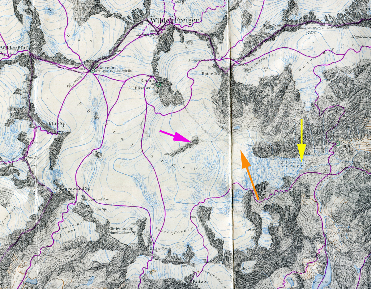
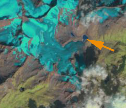
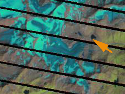
 Here we examine Landsat imagery from 1985, 1990, 2000, 2010 and 2011 to identify a retreat of 540 meters from 1985 to 2011. In each image the orange arrow indicates the location of the lake where the glacier terminated in 1985, and in 2011 the purple arrow indicates the 2011 terminus. In 1990 there is a narrow strip of rock between the glacier and the lake. By 2000 the glacier has further retreated from the lake, and the majority of the glacier is bare ice. In 2010 snowpack on the glacier is again limited. In 2011 the terminus has not only retreated 540 m from the lake, but the current terminus is also quite narrow. The last image is from the Italian Glaciological Committee of the glacier showing the terminus position from 1885 to 1997. The retreat is similar to that of Lobbia Glacier and Sabbione Glacier. However, Malavalle has a higher elevation accumulation zone above 3100 meters below the summit of Wilder Freiger that continues to retain snowpack.
1985 Landsat

1990 Landsat
2000 Landsat
2010 Landsat

2011 Landsat
 Dean of Academic Affairs at Nichols College and Professor of Environmental Science at Nichols College in Massachusetts since 1989. Glaciologist directing the North Cascade Glacier Climate Project since 1984. This project monitors the mass balance and behavior of more glaciers than any other in North America.