
February 28, 2013
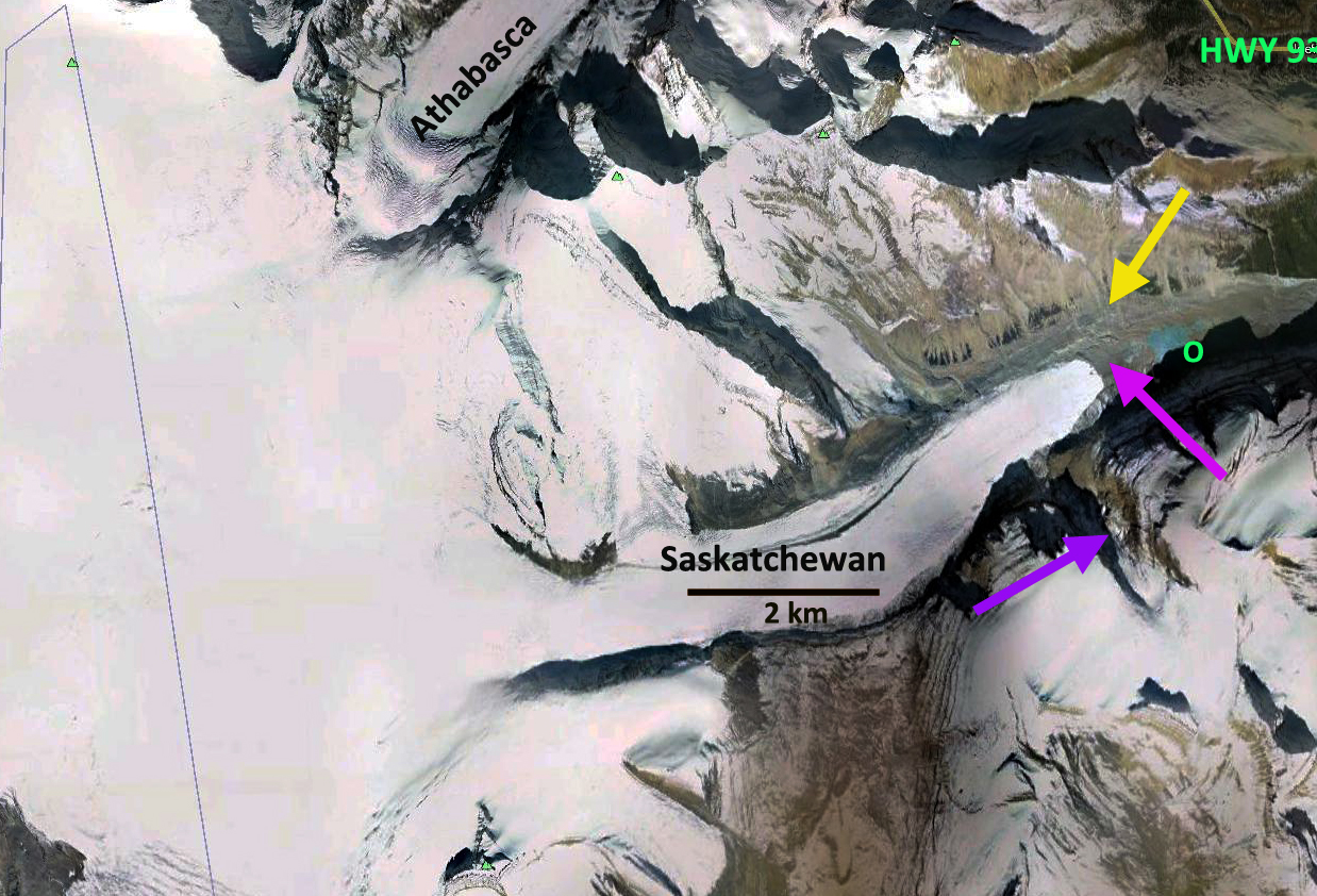
Saskatchewan Glacier Retreat, Alberta
Posted by Mauri Pelto
The Saskatchewan Glacier is a major outlet glacier of the Columbia Icefield in Alberta. The glacier is a 12 km long valley glacier draining east from the icefield that ends within 6 km of Highway 93. This accessibility has led to numerous examinations of this glacier. The glacier is not as famous as its neighbor to the north Athabasca Glacier which the same highway brings a visitor to a parking lot at the margin of the glacier. I visited the glacier twice in the 1980’s, this post is mainly an examination of its retreat since then. A series of photographs from Parker’s Ridge in 1924, 1985, 2011 and 2014 provide a good view of the change in the glacier and the development of a lake that was at the margin and is now separated from the glacier. The first two images are from a report from Dan Smith, Univ. of Victoria BC on the dendrochronology of this glacier, the last image is from Ben Pelto in September of 2014. Interestingly Dan Smith found after a channel erosion event a buried forest that dated to 2800 to 3200 years ago. Indicating that the glacier is now shorter than in had been for at least that long. The lake has expanded in width and length even since 2011. 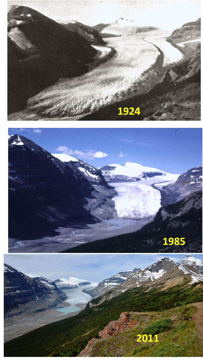
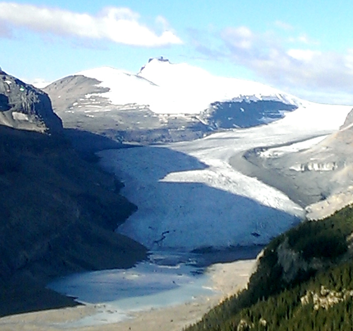
Ben Pelto image 2014
The terminus when I first visited the glacier in 1983 was just at the western margin of the lake that had developed at the glaciers terminus, first image below. The recession of the glacier since the late 19th century is similar to that of other glaciers in the area and was greater than 2 km. middle image from USGS. Bolch et al (2010) identified a 25% loss in glacier area in Alberta from 1985 to 2005, indicating the retreat goes on regionally. The third image is of the trimline above the glacier marking the height of the glacier a century before. 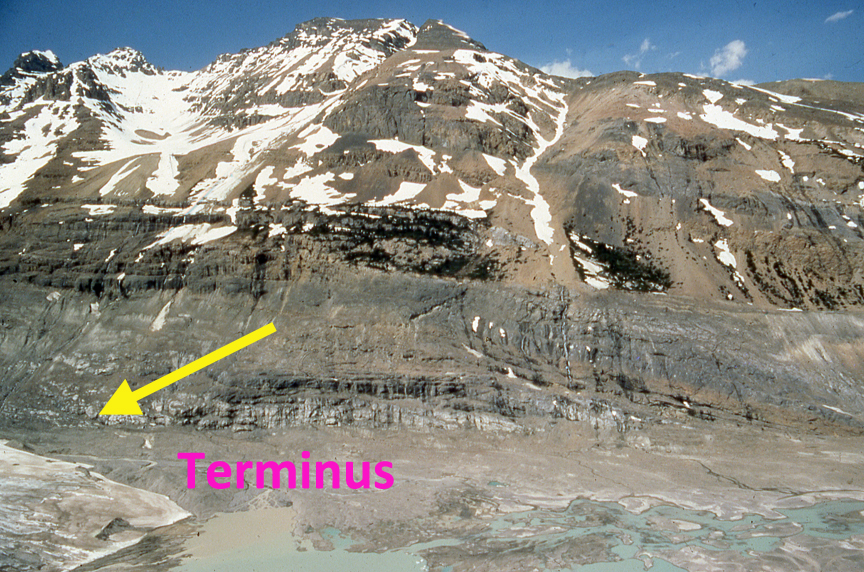


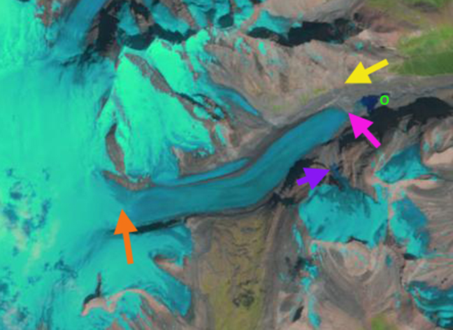
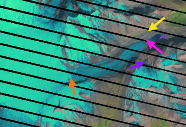
Below is a series of Landsat and Google Earth images from 1986, 2001, 2004 and 2012 in that order. The position of the terminus in the Landsat and Google Earth images rely on a few specific locations for reference. The outlet of the lake has remained the same over the last 25 years and is marked by an O. A ravine angled to the terminus in the 1980s from the north, yellow arrow. There is a pair of deep ravines on the south side that a pink arrow is between. The purple image indicates a tributary and the orange arrow the snowline. The glacier has retreated 700 meters from 1983 to 2012. The change in terminus position with respect to the lake is particularly evident. The tributary from the south has also retreated, purple arrow. The snowline in these images which are not at the end of the summer are at 2500 m, with the snowline rising to 2600 to 2700 m m by summer’s end. This is a higher snowline than reported for the glacier in the 1950’s, (Ommaney, 2002). 
A close up view of the terminus in Google Earth indicates a series of recessional moraines that have formed during the retreat, green arrows, these typically form during the winter when the terminus can advance a few meters due to the lack of ablation. The lower portion of the glacier lacks crevassing and has numerous incised streams which suggests the retreat of 25-30 meters/year will continue. This is a slower rate than on the Columbia Glacier that drains east from the icefield.
 Dean of Academic Affairs at Nichols College and Professor of Environmental Science at Nichols College in Massachusetts since 1989. Glaciologist directing the North Cascade Glacier Climate Project since 1984. This project monitors the mass balance and behavior of more glaciers than any other in North America.
do you have any photos from before 1924 and how about 1940 and 1960 from a similar viewpoint as a way of comparing its retreat?
I do not have other images though I am aware of 1960 images of the glacier that I have seen in books.
I have seen earlier images than 1924 from this point. There are images from the 1950’s.
I have a picture from 1981 that resembles the one from 1985
Would you mind sharing?
Only if I can find my slide and copy it