November 8, 2012
Lapperent Outlet Thinning and Retreat, Kerguelen Island
Posted by Mauri Pelto
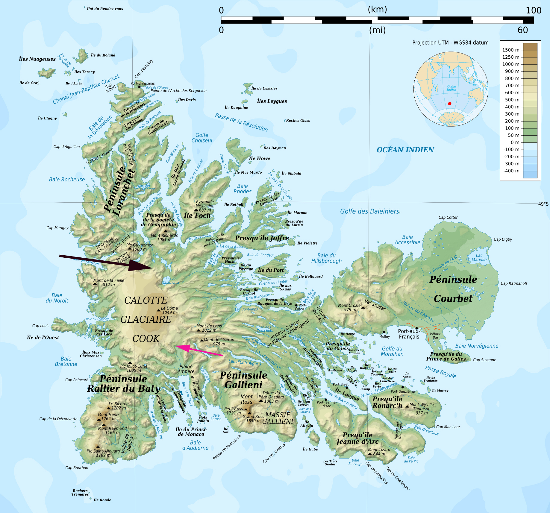
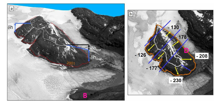
Kerguelen Island sits alone at the edge of the furious fifties in the southern Indian Ocean. The island features numerous glaciers, the largest being the Cook Ice Cap at 400 square kilometers. A comparison of aerial images from 1963 and 2001 by Berthier et al (2009) indicated the ice cap had lost 21 % of its area in the 38 year period. In this paper they focused particular attention on the Ampere Glacier, pink arrow in first image, draining the southeast side of the ice cap, that had retreated 2800 meters from 1963 to 2006. Berthier et al (2009) had a second focus on the Lapparent Nunatak due north of the main terminus and close to the east terminus, referred to hear as the Lapparent Outlet. A nunatak is a ridge or mountain surrounded by a glacier, really an island in a sea of ice. The nunatak expanded from 1963-2001, in the second image below from Berthier et al (2009), but it was still surrounded by ice. 
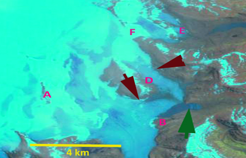
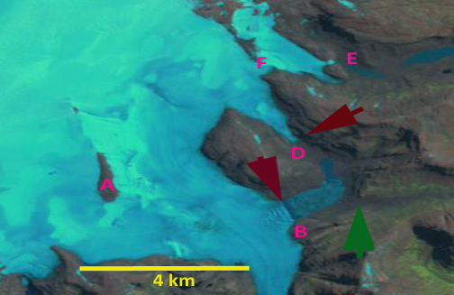
 . In this post we examine changes at the terminus and at several points upglacier in 2001 and 2011 Landsat imagery that indicate widespread thinning and deglaciation. In each image the letters are in the same location as are the colored arrows. The green arrow indicates the 2001 terminus of the outlet and the burgundy arrow the 2011 terminus, indicating a 2 km retreat in a single decade for the southern calving terminus and for the northern terminus above point D 2200 meters of retreat. In 2001 the region around letter D is a filled by the northern arm encircling the Lapparent Nunatak, by 2011 D is in a deglaciated valley. B marks the southern end of the 2011 terminus. F in 2011 marks a location where the Lapparent Outlet spills over a ridge into another valley, by 2011 the overflow has narrowed from 1100 meters to just 500 meters in ten years. The result is less ice flow into the secondary basin, including down a bedrock step to point E. Point E in 2001 is in the midst of the lower reach of the glacier. By 2011 there is no ice near point E as the glacier no longer descends to this lower step. Point A in a nunatak 4 km inland from the Ampere and Lapperent Outlet terminus, this nuntak has expanded from a long axis of 1100 meters to 1500 meters. Berthier et al (2009) had noted thinning around the Lapprent Nunatak of 150 to 250 m. This continued thinning since 2001 is leading to further expansion of the nunatak at A and to reduced ice spillover at point F.
 This island and glacier is experiencing the same climatic warming that is causing retreat of other glaciers in this circum-Antarctic latitude belt, Stephenson Glacier on Heard Island, Neumayer Glacieror Ross Hindle Glacier on South Georgia and on the north side of Cook Ice Cap, Kerguelen Ice Cap.


 Dean of Academic Affairs at Nichols College and Professor of Environmental Science at Nichols College in Massachusetts since 1989. Glaciologist directing the North Cascade Glacier Climate Project since 1984. This project monitors the mass balance and behavior of more glaciers than any other in North America.