October 20, 2012
Glacier Noroeste Retreat, Gran Campo Nevado, Chile
Posted by Mauri Pelto
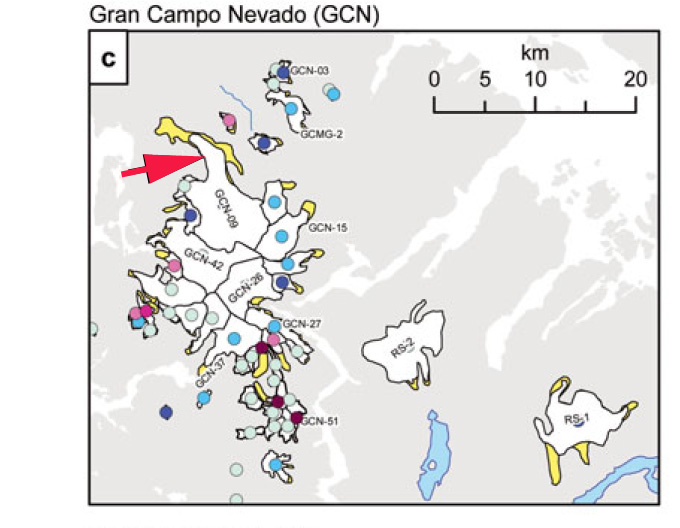
The Gran Campo Nevado (GCN) is the smallest of the four primary Patagonian Icefields. It is on the Península Muñoz Gamero 200 km to the south of the Southern Patagonia Icefield. The major outlet of this icefield is the Noroeste Glacier. In a recent paper examining the changes in Patagonia glacier from 1870-2010 (Davies and Glasser, 2012), observed that the Gran Campo Nevado icefield lost of its area from 1870-2010, and 14% of its area from 1986-2011. Davies and Glasser (2012), Aberystwyth University, also documented that 21 of the 31 glaciers of the icefield experienced their most rapid retreat of the last 140 years during the 1986-2010 period. Nororeste Glacier has been a focus in two papers Scheider et al,(2007) and Moller and Schenider (2010). These papers document a retreat of 1100 m from 1986-2002 first image below, they further identify that the glacier area has declined by 4 square kilometer from 1986-2007, and in 2007 was just under 50 square kilometers. Moller and Schenider (2010) develop an areal extent model for the glacier that indicates the glacier will lose a further 15 square kilometers by 2100. The second image is showing the areal extent change from Davies and Glasser (2012), with the red arrow indicating Nororeste Glacier and the yellow the deglaciated area since 1870. 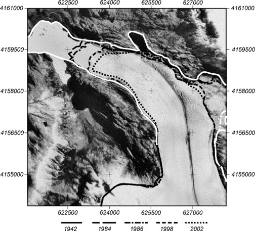
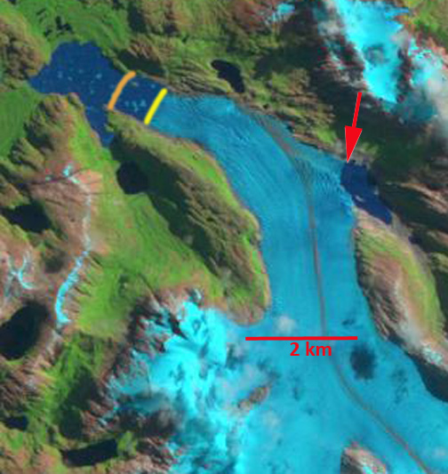
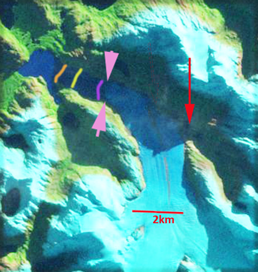
 Here we examine Landsat imagery from 1999, 2007 and 2012. The 1986 terminus is noted by the orange line, the 2002 margin is a yellow line, the 2007 terminus a purple line and the the 2012 terminus indicated by pink arrows. The retreat from 1986-1999 was 600 meters, from 1999-2007 1050 meters and 2007-2012 250 meters. The overall retreat of 1900 meters from 1986-2012, is 73 meters/year and from 1999-2012 the 1300 meter retreat is 100 meters/year. One other noteworthy change is the thinning and retreat at the northern margin that has led to the drainage of an. ice dammed lake that is present in 1999, red arrow and gone in 2012. The lake had drained by 2007 but that is not evident in the deep shadows of the Landsat image. This glaciers retreat fits the regional patter of glaciers to the north, Joerg Montt Glacier, Colonia Glacier, Glacier Gualas and Alemania Glacier to the south. This also fits the overall pattern of area loss that increased after 1986 and has remained high (Davies and Glasser, 2012) and the ongoing detailed studies of the Chilean Laboratorio de Glaciologia
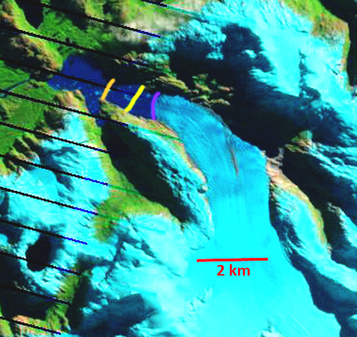
 The retreat is partly due to calving of icebergs into the lake the glacier terminates in, as evident by the icebergs visible in each satellite image above and in the Google Earth image below of icebergs in the lake in 2004.


 Dean of Academic Affairs at Nichols College and Professor of Environmental Science at Nichols College in Massachusetts since 1989. Glaciologist directing the North Cascade Glacier Climate Project since 1984. This project monitors the mass balance and behavior of more glaciers than any other in North America.